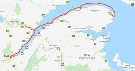
Hi all, it has been a busy week and here is where we have been in the last 11 days:
Tadoussac, Quebec – Canada (Wednesday, 7/10):
Finally today we were able to leave Quebec City and head to Tadoussac; a town at the intersection of the Saguenay River and the St. Lawrence. It would be a long run and the weather in Quebec City was forecasted to be overcast with a very slight northeast wind. Denise was very nervous about making this leg of the trip as the currents can work against the wind and/or the tides to make it a bumpy ride. Because of that we had a “bailout” location identified at Cap L’engle about 50 miles from Quebec City, and a location most trawlers stop at for the night.
We left Quebec City just after 8:00 am and along with a sailboat had to wait on the lock to open. Our new friend Anton took this picture of our boat as we left, and Sabre/Back Cove have now asked to use it in their social media platforms.

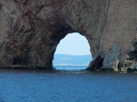
After getting through the lock we turned east and took the north channel along the coast, passing Orleans Island (Ile d’Orleans) to our right, and going under the Ile d’ Orleans Bridge. Orleans Island is large and about 16 miles long. There are several parks, historical sites and homes all throughout the island, and a great place to go explore if spending any amount of time in Quebec City. Just past the bridge we were treated to the magnificent Montmorency Falls.

Orleans Island

Approaching Ile d’Orleans Bridge

Montmorency Falls

Leaving Ile d’Orleans Bridge behind
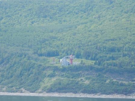
Just as we were at the eastern-most tip of Orleans Island, we passed by the town of Saint Anne- De-Beaupre. Here is where Denise’s two great aunts who were nuns had lived, and where she visited in 1977. The church here is magnificent both inside and out. For this trip we would not be able to visit here, or any of the other locations where Denise’s ancestry lived as we just didn’t have enough time. This begs for a return trip when we can do such things when we have a car.
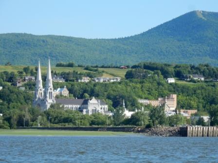
St Anne de Beaupre from the St. Lawrence River
We continued cruising along the north (nord) channel of the St. Lawrence River, passing a long shoaled area called Banc Du Cap Brule, with the most interesting set of channel/navigational aids we have ever seen. On our left the Laurentian Mountains were covered with trees and rocks, and periodically we would see a small town and lighthouses along the capes (called “cap”). Eventually we came to a ski (beach in summer) resort town of Le Mastif and soon thereafter the Island “Ile aux Coudres” with its ferry service to the mainland town of St Joseph de la River.

Shoal marker near Banc Du Cap Brule

North Shore Laurentian Mountains

Le Mastif Ski Resort

Baie-Saint-Paul

Passing ferry at Ile aux Coudres

Ferry Terminal at St Joseph de la Rive
As you can probably guess by now this area (known as the Charlevoix area of Quebec) is very Catholic and there are magnanimous churches in even the smallest of towns. You can almost always spot the church spires before you can see anything else in the town. Additionally, all these towns are usually in some area of the coast that form a bay and here is where the currents get really squirrely. Our Looper friend Anton had warned us about this and we found it to be true. We would be cruising along and all would be great, then we would be in 1’ – 2’ seas and choppy, and 5 minutes later it would be calm as can be. Several times we thought we would pull in at Cape L’Engle as many trawlers do, but we really did not want to if we didn’t have to as we were already a day behind where we wanted to be, and some incoming weather would make tomorrow not as comfortable a ride.
As expected we passed several container ships and freighters, but these were nothing compared to what we have faced when crossing the Savannah River (tighter quarters) or from our years boating on the St. Johns River in Jacksonville, FL. Nevertheless, it is always a time to be cautious as they all produce a terrific wake from bow and/or stern that can rock our boat.

2nd Freighter of day
Just after the town of Saint-Siméon we noticed a boat that we thought might be a pilot boat coming out to meet the oncoming freighter. But it ended up being a Canadian Coast Guard and there is some kind of comfort knowing they are right there should you need them. We ended up following them the rest of the way down the St. Lawrence River to the mouth of the Saguenay River and the town of Tadoussac.
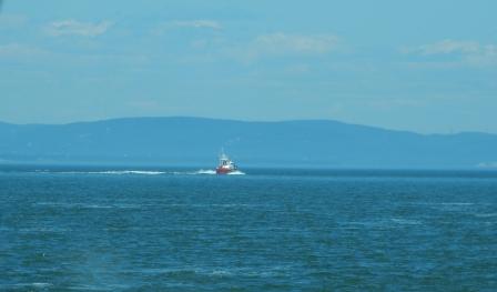
Coast Guard out of Saint-Siméon
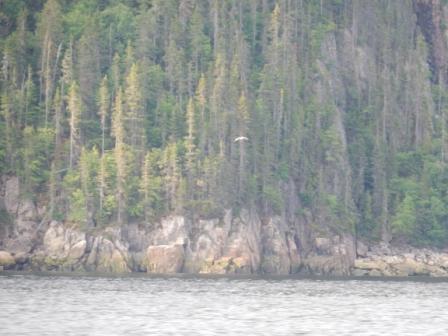
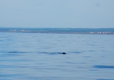
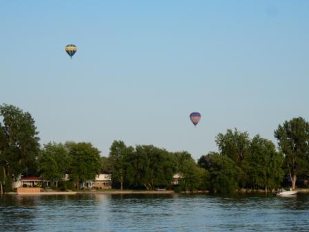
And just when we thought the day could not have gone any better, we saw our first pod of Beluga whales. They are hard to spot, but even harder to photograph. And then we spotted a few darker whales, but could not see them sufficiently enough to know if they were blue whales, minkes, or the North American Right whale. It was thrilling and we were so excited.

Whale in water near Saguenay entrance

Whale in water near Saguenay entrance
Just before the Prince Shoal Lighthouse we turned north up the entrance to the Saguenay River. We had been forewarned about the cross currents, wind against currents, and currents against tides here. However, we seemed to time it all perfectly and entered without issue. Our only concern was dodging the whale watching boats that were all coming out to spot the whales riding the incoming tide.

Prince Shoal Lighthouse

Whale watching boat going out

Whale watching boat
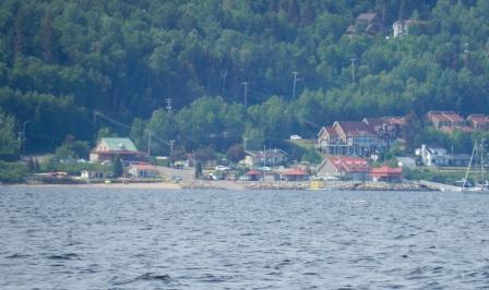
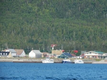
You can line up the entrance to the harbor by looking for the Tadoussac hotel on the shoreline. It is an impressive landmark and makes navigating this area easy, as long as there is no fog. We were directed to our slip and pulled into it without issue. It had been a great day on the water and the sights were spectacular. But the best part was that it was only 2:00 and we still had hours to explore the area.

Entering Tadoussac

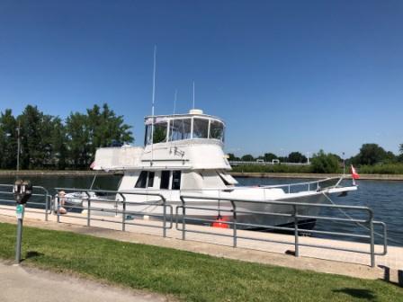
IO at Tadoussac marina
Once the boat was settled, we checked into the marina office and got a map of the area, along with suggestions for dining options. We then headed out to explore the town but got distracted by the Marine Mammal Interpretation Centre. Here we learned all about the whales and their habitats, as well as all the research that has been going on, and why it is so important to protect them. We were able to climb out onto the rocks by the center and take some shots of the Saguenay River to its west.

At Marine Mammal Interpretation Centre

At Marine Mammal Interpretation Centre

at Marine Mammal Interpretation Centre
We then proceeded along the boardwalk that follows the bay and up the hill into downtown. We passed by the Tadoussac Hotel, the oldest church in North America, and the town’s “new” church. We were trying to decide what to do for dinner and investigated several of the dining options, but settled on the restaurant back at the marina.

Tadoussac harbor at low tide

Chapelle de Tadoussac

Graveyard in town

Presbyterian church in town

Downtown Tadoussac

Covered walkway around harbor

Flowers of area – covered bridge

At Tadoussac boardwalk

Tadoussac marina & restaurant
Tadoussac beach and harbor
The Saguenay River and the town of Tadoussac are part of a national park and are environmentally protected areas. Whales migrate here because of the 900 foot trench in the river, and the cold temperatures even in the summer. As a result, we were in long pants and jackets once again.
Tadoussac, Quebec – Canada (Thursday, 7/11):
Denise was up early and was able to go for a walk to the footbridge behind the Coast Guard station. The path takes you around the peninsula that has the harbor on one side and the Saguenay River on the other. She only walked down to the rocks by the point to see what the St. Lawrence and bay looked like. Hoping to see seals or even some whales, this morning she would be disappointed, but the sight was still spectacular.

Tadoussac Hotel

Tadoussac from CG area

Entrance to Saguenay River

Morning over the St. Lawrence
Not wanting to waste a day in our schedule, but still wanting to see the major attractions on the Saguenay River, we decided to go up and back the river in the same day. This means we would be cruising for 4 – 5 hours, but would allow us to still see this beautiful fjord and come back to Tadoussac for the night, before the forecasted bad weather would show up.
At 8:00 we headed out of the marina and up the Saguenay, dodging the ferries as they crossed the river between Tadoussac and Baie-Sainte-Catherine. We then were able to speed up the boat to our normal cruising speed of 20 kts. As this area is all a national park and is protected areas for whales, there are limits to our speed. However, you can go fast unless whales are spotted and then you must slow down to idle. The exception is when you cruise past Baie Sainte-Marguerite where the belugas go to give birth to their young. Here this is a restricted zone and you must slow down as they often venture out into the river.

Ferry Crossing on the Saguenay

Marine Mammal Interpretation Centre
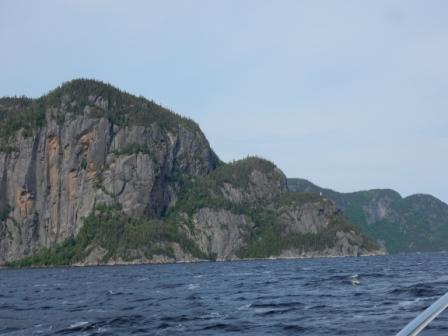
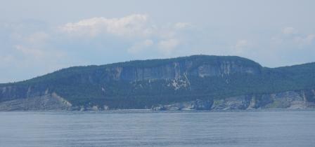
We cruised up the Saguenay passing some amazing cliffs and beautiful scenery.
Western cliffs on the Saguenay River
We approached the Baie Sainte-Marguerite and were amazed at how many belugas were here. We saw so many and tried to photograph these very elusive small whales, especially when they are at least 400 yards away. It was thrilling to see them and we stayed for a while watching them frolic in the water.
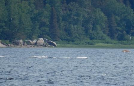
Belugas in Baie Sainte-Marguerite
We then cruised north to the Ile Saint-Louis where we saw a US-flagged sailboat at anchor.

Ile Saint-Louis
We continued up the river and passed by Club De Yacht De Sacre Coeur on the eastern shore, and a little further north we noticed a handful of small buildings perched on the cliffs. Come to find out this is a resort of sorts and these can be rented for a “Saguenay experience” like none other at Alfred le voison d’Oscar. Click here for more info.

Alfred le voison d’Oscar

Club De Yacht De Sacre Coeur on the Saguenay River
Further up the river on the western side there is a small town and marina (L’Anse- St.-Jean) where we had considered staying. Some cruising friends stayed there and recommended it, but due to losing a day in Quebec City we pressed on with our trip.
Anse Saint-Jean
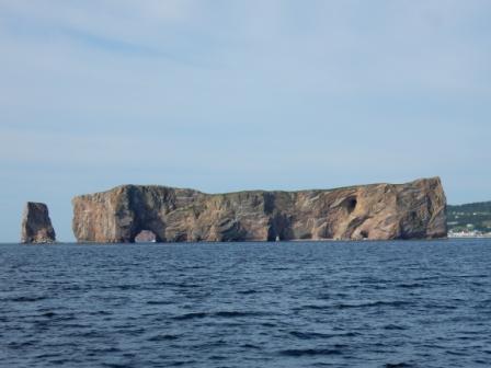
Our destination was to go to Bay Eternité, the most beautiful spot in the fjord. The entrance to this bay is bookended by two capes “Cap Trinité” and “Cap Eternité”. Cap Trinité is called this as there are three distinct ledges, and on the first step there is 9.75 meter (approx. 32’) tall statue of the Virgin Mary. It was carved from wood, then coated with lead and hoisted into its present position in 1881. On the second step there was supposed to be a large cross, but we could not see it. On the 3rd step is the overlook of the entire fjord, but requires a hike up a steep cliff (not for the faint of heart).
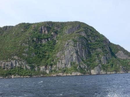
Cap Eternite
Cap Trinite

Statue of Mary on Cap Trinite
After taking a few pictures and cruising a bit around the bay, we headed back down the river. The wind was out of the south and had created a bit of a fetch making it bumpy by Cap Eternité. However, by the time we got back down towards the Ile Saint-Louis it was calm and we cruised by the Baie Sainte-Marguerite again to look for more belugas. We were not disappointed, nor were the people in the park observatory. Just after this point is where we realized our Island Office was in some of the deepest waters it has ever been.

Beluga lookout at Baie St Margarite

Very Deep water
We returned to the Tadoussac Marina in time for lunch as it was only 12:00. We spent the early afternoon doing some work for clients and working on the business. We also watched the handful of different whale-watching boats go out of the marina with their customers. At one end of the spectrum was a smaller boat that was enclosed with glass all around it protecting the customers from the cold and wetness. At the other end of the spectrum were the two larger cruise-ships that would go up the Saguenay River and out to the St. Lawrence. But our favorites to watch were the center console rib boats that were open to the elements, and whose customers had to wear bright orange foul-weather gear. They had a whole spiel they would go through before launching and we could hear it from our boat. But the funniest part was they would start the tour at their facility up the hill, then they would all walk down the hill (in the orange gear) to the boat in the marina. All day we could see the parade of about 10 or 12 people per group, and off they would go in search of the whales.

Whale watchers coming from boat

Whale watching start
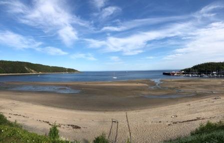
Periodically the fog would come in and hand around the harbor, but would then dissipate. In the meantime we watched the low tide turn to high tide and then back to low tide. Families would be on the nearby beach playing in the sand (or was it really mud).

Very low tide at Tadoussac Beach

Fog in marina
We stayed near the boat for the rest of the day. Denise continued cataloging pictures and writing the last blog and Mark did some work for clients. We ate dinner aboard and in the evening we checked in with our families and a few friends.
Tadoussac, Quebec – Canada (Friday, 7/12):
As expected it was a rainy and foggy day and a great day to hunker down and get some things done. First we did a few loads of laundry before most of the marina was even awake. Then we hunkered down into finishing the last blog, doing some work for clients, communicating with business associates and planning our next stops.
During the afternoon the rain had let up, but the fog came in. Initially, it was light, then it lifted for a while. During the break we went for a walk into town to get some Canadian cash from an ATM at the bank, and to get some milk at the market. It was in the market that we got the idea to have a simple dinner of bread, wine, cheese and sliced meats for dinner. We picked up the few things to supplement the food we already had on board, including a freshly baked loaf of French bread.

Cruise and tour boat dock

Tadoussac hotel
Along the way back to the boat we stopped to see what the “Chauvin Trading Post” was all about, and here we learned a little bit of history and the importance of trade in this area in the 1700’s. However, we did not go into the building as it was close to closing and not worth it for us to pay the museum fee for such a short amount of time.

Chauvin Trading Post

Tadoussac signs
When we got back to the marina, we ran into dockmaster Robert and chatted with him for a while. He was only here for the summer and would be going back to Montreal when the season was over. He told us that there are roughly 800 people that live in the town year-round. Unfortunately, only one of the many restaurants stays open year round and for this reason he does not live here year-round.
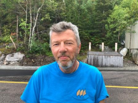
Robert the dockmaster
And as we went down the very steep (because of low tide) gangplank to the floating docks, Denise took a tumble near the bottom and skinned her knee. Fortunately her pants were not torn, but her knee was a bit bloody and required some Band-Aids once back on the boat. It was time to call it a day and enjoy our light dinner.

Steep gangplank at low tide

Slipped on gangplank at low tide
By 7:30 pm the fog rolled in again, only now it was so thick we could only see just beyond our dock. Hopefully, it would burn off in the morning so we could leave without issue.
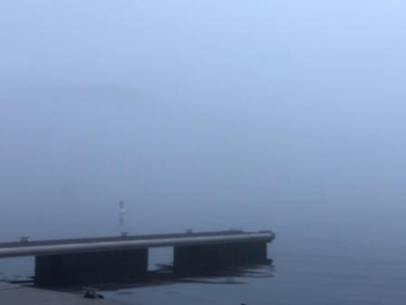
Really foggy now – end of dock
Matane, Quebec – Canada (Saturday, 7/13):
We left Tadoussac with some fog, but we had over a mile visibility so it was not an issue. We had a mostly diagonal course to make a crossing to the south shore of the St. Lawrence River. The water was a bit bumpy but not intolerable. We were less than half an hour out when we saw our first ship, and about the same time saw some seals in the water.

Ship & seal in water
Soon thereafter it got very foggy and for the next hour it required us to blow the horn every minute, and be constantly on the lookout for other boats. Of course having radar helped and with our AIS we could identify any boats that also have AIS. Once across the big shipping lanes, it got easier and soon we came up to and hugged the south shore of Ile du Bic; part of Canada’s National Parks. About half way past this low-lying island the fog lifted and we had a much better visibility.

Foggy day on water

Ile du Bic – low lying island
Our original intention was to stop in Rimouski for the night. It is a big city and the best place to provision or shop for any needed items. Capt. Mark had also determined this would be the best place to buy fuel until Rivieré au Renard, but we couldn’t go that far without at least some fuel. However, the seas were very comfortable and we decided that we would stop only for the fuel and continue on to Matane or possibly even St. Anne des Monts if everything stayed stable. The weather forecast called for rain and high winds on Sunday, so wherever we would end up we knew we would sit for a day or two.
We pulled to the fuel dock at Rimouski marina and had to wait for the sailboat there to finish up before we could take on our fuel. While Mark worked with the attendant (“Charl”), Denise watched a few locals play with their remote controlled boats near the docks. It was quite a set-up with tugs, tugs pulling containers, and they even had a marina. Everything on these tiny boats worked, including the horns; which at one point Denise thought there was an alarm going off on our boat until she realized it was the remote tug.

Charl at Rimouski Marina

Remote control boats

Remote control boats
We left Rimouski and immediately passed by the Point au Pere Lighthouse and Maritime museum; which is dedicated to the history of the St. Lawrence River, and where they have a submarine dry-docked that you can see from the water.

Point au Pere and Maritime museum
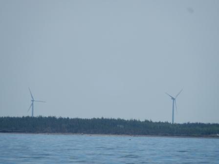
The seas were mostly flat, but there was still a slight fog. We cruised past several small towns (all with churches) and past lighthouses that are certainly contenders for postcard photography. The mountains in this area are smaller than those one north shore, but are still impressive in size. Along the way many are littered with power-generating windmills.

LIghthouse at Pointe Aux Cenelles

Windmills on southern shore of St. L river
We continued along the shoreline until the sea swells started to build and decided to pull into Matane. We had gone 101 miles and felt like pressing on to St. Anne des Monts (48 more miles) would be pushing our luck. While cruising along we called the marina to make sure they had space. They spoke little English, but we were able to communicate sufficiently enough to secure dockage for the evening. We entered the harbor through the rocky jetty and pulled into the slip right near the marina office. It could not have been more convenient.
IO at Matane Marina
Once we had the boat secure, Brian (“Lazuli”) came over to ask if we saw his boat on AIS. He was in a sailboat that we had passed just before the entering into to the harbor, and he pulled into a slip not far from us. He had recently installed the AIS system but was not sure if he was broadcasting well enough; we assured him he was.
During the afternoon we watched the clouds and wind build and knew that we had made the right decision. Additionally, we knew Matane had a Catholic church and we could attend mass on Sunday. We were unsure about the church in St. Anne des Monts as there is little information on the diocesan-shared website and it is all in French. Many of the old churches here have closed or have only one mass and the schedule changes depending on the time of year. The church in Matane also had little information on their website and despite assistance from the dockmaster we were unable to confirm their mass times; he was pretty sure it was at 11:00.
We had a chance to briefly meet Brian’s wife Sharon and to walk around the marina grounds, which also are part of a local park that has a beach facing the St. Lawrence River. There is a big model ship for kids to climb on, as well as picnic tables, restrooms, and a community center where they host many events.

Inside marina clubhouse

Front of marina office

Park area at marina

Looking out at St. Lawrence from marina

Matane Community Center

Park area at marina
The weather continued to deteriorate so we hunkered down and ate dinner on the boat. We were not interested in even walking the half a mile up the street to the restaurant that came highly recommended. We took to reading and planning our next stops along the southern shore of the St. Lawrence.
Matane, Quebec – Canada (Sunday, 7/14):We woke up to pouring rain and gusty winds; thankful that we were not moving the boat today. Although it was only 1+ miles to the church, we decided to take a taxi to mass because it was raining, and because we had to cross a big highway to get there. With the assistance of the dockmaster, he called and scheduled it for us for a 10:30 am pickup. It was a good thing he was early and it only took us 5 minutes to get there, as we discovered the mass actually started at 10:30. Saint-Rédempteur Catholic Church was the more modern smaller church in town; sadly, St. Jerome on the other side of the river was no longer open.

Saint-Rédempteur Catholic Church

Saint-Rédempteur Catholic Church

Saint-Rédempteur Catholic Church
By the time mass was over the rain had subsided and we were able to walk to downtown. To do so we walked through a residential area, then across the bridge that goes over the Matane River and up the main street where all the restaurants are.

Matane River

Dam on the Matane River
Finding most of them closed on Sunday (not unexpected) we ended up at “La Fabriqué”; a restaurant with an adjacent microbrewery next door. The food was excellent and we arrived just before the big rush. By the time we left the place was packed and we were glad we had chosen to have an early lunch.

La Fabrique lunch spot

La Fabrique lunch spot

Fish & Chips at La Fabrique

Lunch
From there we walked through town to the boulangerie for some French bread, then on to the fish market (Poissonnerie Matanaise) for some fresh mussels and salmon.
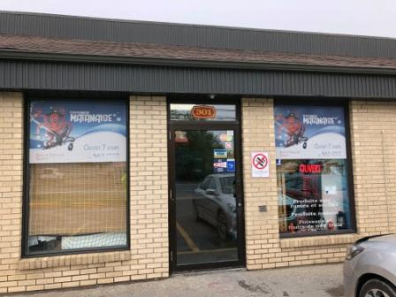
Fish market
On the way back to the boat we passed by the Metro supermarket and the strip mall that had other local businesses and shops, but we didn’t stop. We stopped at the park on the west side of the river to take a few pictures and to see the marina from a different perspective, then walked across the highway bridge back over the Matane River and back to the boat.
")
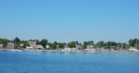
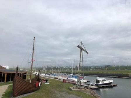
Matane Yachtclub (Marina)

Park at Matane River

Riotel hotel
Just as we were coming up the street to the marina it began to sprinkle, and by the time we got our purchases stowed away in the refrigerator it began to rain hard. We made it just in time. Unfortunately, it was not soon enough for two Tiara powerboats (“Moving on” & “Manitou”) from the US who pulled into the marina and tried to dock in the gusting winds. The awesome dockhands worked so hard in the pouring rain to get them secured in their slips and hooked up with appropriate power adapters. We noticed one boat was from South Haven, MI and the other from Indiana; obviously they were traveling together. Eventually, when the weather broke Mark got to talk with them and learned they were planning to leave tomorrow and head to St. Anne des Monts. They are also doing the Downeast Loop together, but only hoping to get their boats to New York for winter storage.
We spent the rest of the day reading and doing emails. It was a day to catch up on things and for some needed relaxation. In the evening we cooked up the muscles in some garlic and white wine sauce, and along with the French bread had an awesome dinner on a this cold and rainy night. The weather for tomorrow was still changing and we were not sure if we would stay or move the boat. We agreed to look at it in the morning and decide then.

mussels & french bread for dinner
St. Anne des Monts, Quebec – Canada (Monday, 7/15):
With the improving weather situation, Brian and Sharon (“Lazuli”) left at dawn. We also watched “Moving On” and “Manitou” pull out mid-morning. We then looked at the weather forecast and saw that we did have a window of time that we could make our way up the coast for the 50 miles, so we checked out of the marina and at 11:00 went on our way.
Denise was very nervous about the coming days as the St. Lawrence River widens and turns into the St. Lawrence Seaway at St. Anne des Monts. Here the weather can be unpredictable and can change rapidly. We had identified several “bailout” spots should we need to pull into a safe harbor, but most are very small ports with walled wharfs that are geared for the fishing boats. In some cases you can raft to a fishing boat for the night.
About halfway into our journey an engine alarm went off signifying we had water in our fuel (not a good thing). We slowed the boat and Mark went in the engine room to investigate and found water in the engine drain pan. After some deduction and troubleshooting, he was able to pump it dry and felt secure enough to continue on our way. He also investigated and could not find anything indicating where a leak could be coming from (i.e. a hose clamp, etc.), so we continued on. As we came upon the town of Les Méchins another alarm went off and so we pulled into the harbor. It is a small fishing/commercial port with a shipyard and dry dock and there was nowhere for us to tie up. We ended up anchoring in the harbor so Mark could do some troubleshooting. After about an hour he determined what he thought was the cause and we were able to clear that warning message. We pulled up anchor and continued along our way, with Mark periodically checking that everything was ok and that we could safely get to St. Anne des Monts. Denise was so anxious and nervous, she forgot to take pictures at Les Méchins.
We continued heading east (and north) until just before the town of Cap-Chat (another possible bailout location). Here there is Le Nordais Windmill Park; a park that has over 130 power-generating windmills, including the world’s tallest (110m) vertical-axis windmill. And just before the town is the Cap-Chat lighthouse – another postcard worthy scene.

Windmills before Cap-Chat

Interesting windmill before Cap-Chat

Lighthouse before Cap-Chat

Cap-Chat
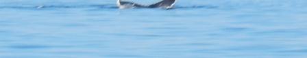
Along the way we were also were graced by a seals and small porpoise (not at all like our bottlenose dolphins), but they are so difficult to photograph when there are waves so we have no pictures.
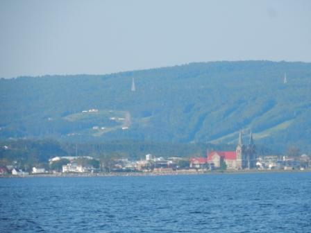
Finally, we arrived at the harbor entrance to St. Anne des Monts, with the church’s twin spires acting as a beacon for how to line up and enter the very narrow breakwater. We had called ahead to the marina before leaving Matane and so they were expecting us, and showed us to our end-tie up. Already tied up to their slips were fellow cruisers on “Moving On” and “Manitou”, as well as Brian & Sharon (“Lazuli”).

Approaching St. Anne Des Monts Harbor
We checked into the marina with the assistance of Roland & Sylva, and had them make reservations for us for tomorrow night at Rivieré au Renard marina – some 90 miles further east. After that, Mark went to work on further troubleshooting the source of our “water in fuel” issue, and Denise went for a walk around town. She needed some terra firma under her feet as it had been a quite stressful day.

Roland & Sylva

Signage for marina office
Her first stop was the church of St. Anne des Monts to give a prayer of thanksgiving for safe passage and for continued blessings until we are home in November. Here are some pictures of this beautiful church.

St. Anne Des Monts

Inside Eglise St. Anne Des Monts

Pipe organ at Eglise St. Anne Des Monts

Alter at Eglise St. Anne Des Monts

Back of Eglise St. Anne Des Monts
She continued with her walk around town, taking pictures of all the driftwood carvings. This area became famous for all the pieces of driftwood that washes up on its shore and therefore they have plenty of large pieces to carve from. Each year this town hosts an art festival (“Feast of Driftwood”) where driftwood is carved into amazing sculptures. The winning sculpture is then placed around the town for all to see. You can learn more about this festival (which takes place in August) here.

Driftwood sculpture

Driftwood sculpture

Driftwood sculpture

Driftwood sculpture

Driftwood sculpture

Driftwood sculpture
Many of the carvings are located in the property near the marina and the Exploramer Center; a museum and educational center about all things related to living off the sea.

Exploramer Centre

Yellow Sub at Exploramer Centre
Another area of carvings are in a park near the shoreline, and some are made into birdhouses that are located behind a hotel that overlooks the bay. It is fascinating and uniquely authentic; a terrific find!

Birdhouse overlooking St. L

Birdhouse overlooking St. L

Birdhouse overlooking St. L

Birdhouse overlooking St. L

Birdhouse overlooking St. L

Driftwood beach

Driftwood park
On the return trip to the marina, Denise went to investigate a fish display located across the street from the church. Here was a very huge mackerel fish that was on display to celebrate the catch during a fishing tournament that took place from July 19 – 22, 2018. The fish weighed in at 327 pounds and will go in the record books for the team that caught it.

Holy Mackerel

Holy Mackerel Story
Heading back to the boat she walked down the docks past the very fishing boat that was in the picture above. Aboard was a man that she stopped to ask if he was the one who caught the fish (albeit in terrible French). Fortunately, Yvan Theriault spoke enough English that he was able to confirm he was the owner of the boat and the one who caught this terrific fish. They chatted for a while and she wished him congratulations, then went back to tell Mark about this terrific fish story!
Yvan Theriault – Mackerel catcher
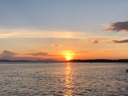
In the meantime, Mark and was able to work on our engine warnings and believes it will be a non-issue. He also met the owner of the sailboat who was docked right off our bow and had a chance to chat with him. Later, Denise went out to take pictures of the terrific sunset and met Terry (“Orca”) and his wife (can’t remember her name). They had just purchased their boat and were taking it home to Nova Scotia where they live and have a huge piece of land overlooking a bay. They invited us to come visit them when we reach that part of NS. Since they just took delivery of the boat they have not had a chance to get boat cards, but Denise gave them one of ours and they promised to email their contact information to us.

Sunset at St. Anne Des Monts

Moon rise at St. Anne Des Monts
Finally, we ended the day with a dinner of fish tacos, courtesy of the leftover salmon from the fish market in Matane. We then looked at the weather and decided that tomorrow would be a good day for cruising and we should have no trouble going all the way to Rivieré au Renard. Mark had even suggested that we may want to go the additional 30 miles into Gaspe, should the weather and seas prove acceptable. Based on that, we made plans to leave early in the morning when the winds would be the lightest.
Here are some other pictures from the area:

East of marina

St. Anne des Monts marina

Seagull at Sunset at St. Anne Des Monts
Gaspe, Quebec – Canada (Tuesday, 7/16):
At the crack of dawn we watched “Lazuli” and “Orca” take off and make their way out of St. Anne des Mont marina and we pulled away at 6:45. It looked like a good day to be on the water with less than 1’ seas and a beautiful sky free from fog. We passed our sailing friends and wished them well; we all have different speeds and destination so it is unlikely we will cross paths before Nova Scotia.
Leaving St. Anne des Monts
Within an hour we passed the town La Martre; identified by the of Lighthouse & Church spires. We passed by the town and cliffs of Mont-Saint-Pierre (known as a paragliding hangout) and then the fishing town of Mont-Louis.

Lighthouse & Church at La Martre

Cliffs near Mont-Saint-Pierre
The cliffs off of L’Anse-Pleureuse were also spectacular and we inched our way to Gros-Morne, the northern-most latitude on our trip. From here we would be heading a little further south (mostly) every day.
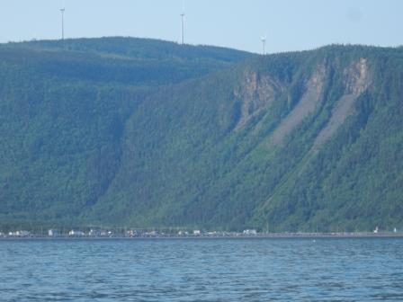
Cliffs at L’Anse-Pleureuse

Highest Latitude

Cliffs near Gros-Morne
We creeped up on the town of Rivieré la Madeleine and it was only 9:00. But we only had 40 miles to go to Rivieré au Renard and now we are considering pressing on to Gaspe. About this time we were also passed by “Moving On” and “Manitou” who we had seen coming up from behind us for a while. They were cruising at about 25 – 30 kts and we were able to see them for a long time thereafter.

Cap de la Madeleine Lighthouse

Riviere la Madeleine
To say the day was nearly perfect is an understatement. The scenery could not have been more spectacular and the seas could not have been any flatter. We had a spectacular view when cruising past the lighthouse and museum at Pointe á la Renommeé where this beacon was the first maritime radio station in North America, established in 1904 by Marconi (physicist who developed the first effective system of radio communication).
Pointe-à-la-Renommée Lighthouse, & Marconi museum
We were making good time thanks to the flat seas and outgoing tide, so by 11:00 we had reached Rivieré au Renard. We decided to push on, figuring we could be in Gaspe in the next 2 hours and before any serious winds would kick up. So we cruised on, past the cliffs at Cap-Bon-Ami where we were now seeing flocks of the beautiful gannets.
Cliffs at Cap-Bon-Ami

Gannets near cliffs at Cap-Bon-Ami
Finally, we were able to round the Forillon Peninsula with its Cap-des-Rosier Lighthouse sitting atop the rocky cliffs. It is the tallest in Canada and marks where the mouth of the St. Lawrence River that dumps into the St. Lawrence Seaway.

Forillon Peninsula Lighthouse
And now we were in the Baie of Gaspe where there were two noticeable changes: the hills were now green with trees again, and the wind was now on our bow. It was a little bouncy, but nothing we couldn’t handle for the last 50 minutes of travel. We saw a small pod of whales but were too far away to photograph them. We even picked up a jet skier who loved the wake behind our boat.

RV park overlooking Baie de Gaspe

Jet skier in our wake

Cottages Park – Chalets du Parc Gaspé Forillon

Paddleboarders near Sandy Beach Point
We made our way around Sandy Beach Point and into the harbor where the marina is located just east of the very visible highway bridge. When we arrived “Moving On” and “Manitou” were at the fuel dock and we had to tie up and wait for them to get fuel before us. To make matters worse, they arrived right at the lunch hour and had to wait for the dockmaster to come back. Finally, 3 hours later we got assigned to our dockage for the few days we would be here; a nice side-tie near the marina office and restrooms (and the microbrewery marina bar).

Downtown Gaspe

Gaspe Marina Breakwater

Friends docked in Gaspe

IO at Gaspe Marina
We took showers made a much-deserved cocktail and walked to town for dinner. We arrived at “Brise Bise” and had to wait about 30 minutes for a table, but the food was worth it. Denise loved the bouillabaisse and Mark got a rack of ribs (with some for leftovers). We walked back over the bridge to the marina and called it a very long, but successful day.

Welcoming signage

Rack of ribs for Capt

Seafood Bouillebase

Brise Bise restaurant
Periodically throughout our journey, the “water in fuel” warning would come on and Mark would go inspect the engine. He made it a habit of checking it every hour and found nothing to be of concern. Once we arrived in Gaspe he noticed the fuel filters did have a small bit of water in the bottom, despite having checked them before. So now he believes we may have picked up some water in the fuel at Rimouski and will have to treat it when we can.
Gaspe, Quebec – Canada (Wednesday, 7/17):
Today would be a work day aboard Island Office. The weather forecasted rain and the rising temperatures meant it would include thunderstorms. Not wanting to take our chances on the Bay of Chaleur, we had planned to stay here a few days and get some work done. “Moving On” and “Manitou” had advised us late in the evening that they would be leaving in the morning and so we don’t expect to see them again.
When not doing work, Denise worked on cataloging pictures and trying to get the blog updated. Periodically we would watch the comings and goings in the marina, including how they splash the boats that have been on the hard, using a front-end loader, a trailer and a long line. It was amazing to watch as they man-handled these items like toys.

Splashing sailboat
The rain never came so in the late afternoon we walked up the hill to the shopping plaza that had a grocery store and a Canadian Tire. First we went to Canadian tire which is like a small Walmart (sans food) and where Mark was looking for a fuel treatment. He also purchased a pair of gloves to wear when working on the engine as it is hot and he doesn’t want to get burned. Then we walked to the grocery store to buy a few items we will need for the coming week.
On the way home we stopped by the “train” station, which is also the tourist office for the town of Gaspe. Here we talked to the woman about some of the buildings in town and about the area. We also learned that the train was shut down due to damage to the tracks during the 2013 flooding and how the cruise ships no longer come to Gaspe due to the newly-imposed speed limits to protect the whales. She advised us of the concert along the water tonight, and answered our question about where to order a pizza for delivery.

Train station, tourist office and observation building

Train at Station
Armed with lots of information and a new t-shirt for Denise, we headed back to the boat. We ordered the pizza and while waiting on the delivery we decided not to go to the concert and instead spoke with some of our family members. Before going to bed we checked the weather forecast once again to see if had improved. While it looked like it was going to be a sunny day, the wind was forecasted to be really strong with gusts to 40 kts and seas expected at 3′-4’; we are not going anywhere tomorrow and will use it as another down day.
Gaspe, Quebec – Canada (Thursday, 7/18):
It is hard to imagine that we could be waking up even earlier than when we were in Quebec City. However, the farther east we move, the closer we come to the Atlantic Time Zone and now sunrise is at 4:30 in the morning. So naturally just before sunrise the sky is bright and Denise was wide awake. The crazy thing is that we are so far north the sun does not set until 8:30 pm which makes for long days and short (almost sleepless nights).
For Denise, today was another day to work on the (very delinquent blog) and finish cataloging the pictures taken so far. She also did some research into future stopping points and where we could be that would enable us to go to church on Sunday. Meanwhile, Mark washed the outside of the boat and continued to investigate a solution to the “fuel in water” issue.
We also spent time looking at weather over the next week and at the possibility of leaving tomorrow morning for Shippagan, New Brunswick. Our plan is to head out of Gaspe, stop at Perce Rock and ile Bonaventure, and then cross the Bay of Chaleur to Shippagan, hopefully before the serious winds kicked up the seas. Mark made marina reservations for several nights as the weather will not be good enough for us to leave Shippagan right away, and then we will most likely need 2 more days to get to Prince Edward Island (PEI) – weather-depending, of course.
In the afternoon Mark went to the store with “Doris”, the (male) dockmaster here who helped him identify the product he would need to treat water in the fuel. Mark was able to learn that Doris has worked at this marina for 40 years and lives upstairs of the round building that houses the marina restrooms and laundry facilities.
Mark returned with a fuel treatment that should help eliminate water in the boat fuel and immediately put it in our tanks. Hopefully this combined with running out the existing fuel will eliminate the problem once and for all. We still have lots of big water to cross and need things to be in working order.
We ate a low key dinner aboard the boat and watched a group of locals enjoy some fellowship at the marina bar. Then we watched a huge moon rise over the mountain near the marina before turning in for the night.
Here are some other pictures of our time in Gaspe:

Sculpture in nearby park

Yacht club and activity tent

Sculpture at Train station

Marina and Gaspe Bay

Yacht Club floats at channel
Stay tuned for more of our adventures on Island Office


")


")


")