Posted onApril 28, 2021|Comments Off on New Things in New Bern!
New Bern, NC – Monday, 4/26
It was a comfortable 52 degrees when Denise woke up this morning; perfect running weather. So she took off for a jaunt through downtown Beaufort, taking in some of the usual sites and a few new ones along the way. Here are a few pictures:
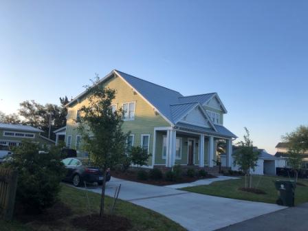
Beaufort house
Neighborhood near water
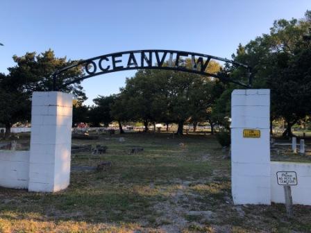
Ocean View Cemetery
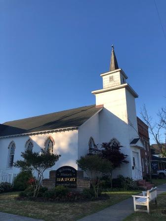
Welcome to Beaufort
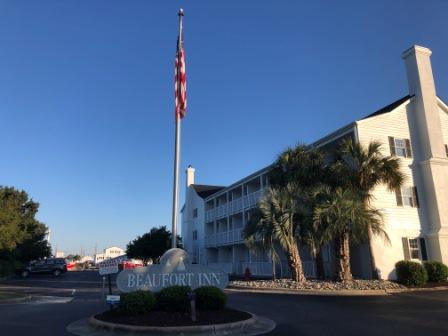
Beaufort Inn
Beaufort Grocery Company
Artwork at house
We were in no hurry to leave today to head to New Bern. It was going only going to take us between 2.5 – 3 hours to get there and the wind was forecasted to get weaker throughout the day. So we did a little bit of work, answered some emails, and took care of a few other chores on the boat.
Historically, one of the perks of this marina was you would get a free pound of fresh shrimp. However, with the processing plant closed, sadly this benefit is no more. Another perk is the free ice that is always available. Since we have an ice maker on board, this is normally not something we have taken advantage of in the past. However, our ice maker has been acting up and doesn’t make ice the way it used it. We have had it cleaned and serviced, but it may be on its last leg. So, Mark decided to fill our Yeti cooler and anything else we could possibly keep ice in (our freezer is already full up) before we left.
Ice House at Homer Smith
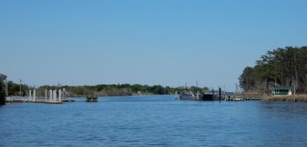
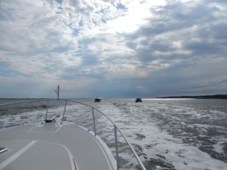
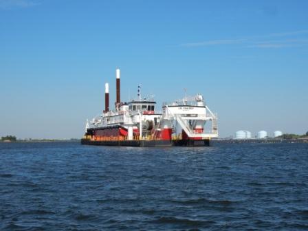
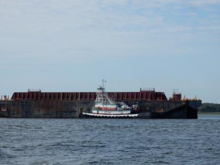
Once all this was done, we prepped the boat and left the dock at 10:40, a little earlier than planned but we were ready to move on. Going north from this marina is easy as there a separate channel that prevents us from having to go by the port and the large ships and barges that are frequently operating there. Whether they are loading potash or some other raw material, it is interesting to watch but can be a bit nerve wrecking when they are moving.
We moved up this channel through shoals and fish farms, and met up with the ICW as we entered Core Creek. Here the creek turns narrow and we passed by Jarrett Bay Marina and boat repair facility, where we saw “Corporate Approved” at the dock. We wish them luck on their repair and hopefully they will soon be on their way home.
Jarrett Bay Marina & Boatyard
“Corporate Approved” at Jarrett Bay
Soon thereafter we went under the Core Creek Bridge (Highway 101) and where it turns into Core Creek Canal, then the Adams Creek Canal, and eventually Adams Creek. In this area there are lots of things lining the shores: several marinas, an RV park, a small community including a Methodist Church, more housing developments and a sunken shrimp boat. We had to pass a few boats along the way, but thankful we were not doing this on a weekend when it would have been so much worse. Soon the creek opened up a bit making it easier to maintain a decent speed.
Derilick shrimp boat – still there
New homes on Core Creek
More development on Adams Creek
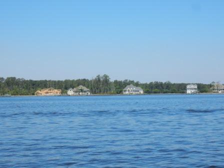
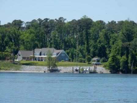
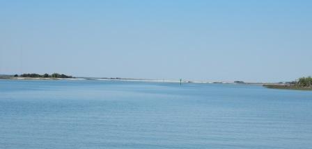
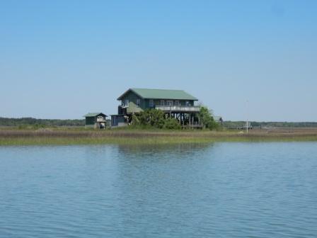
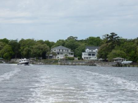
Finally, at 11:55 we entered the Neuse River, on our way once again to New Bern. It was a beautiful day and the water was not bad at all, despite a bit of wind at first. The Neuse is a wide open body of water and today we could clearly see both the south and north shorelines. We passed by some lovely houses and Cherry Point Marine base, as well as Loopers Ken & Karen on “Island Girl”; whom we met in Beaufort and knew they were headed to New Bern as well. We hope to catch up with them while there.
Homes on Neuse River
“Island Girl”
Home on the Neuse River
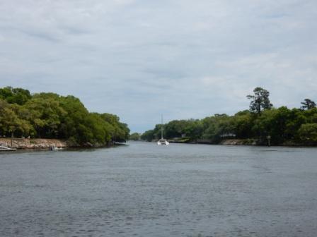
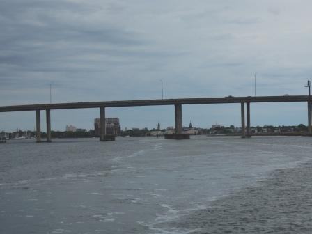
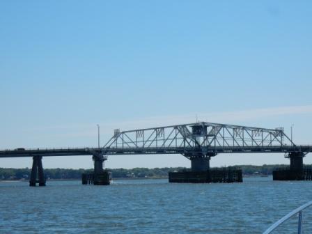
Before long the water got even calmer and soon we entered the narrow channel that took us under the Neuse River Bridge. We made a left turn up the Trent River, went under the Cunningham Bridge and entered the harbor at New Bern Grand Marina.
Neuse River Bridge
As with the marina in Beaufort, we had a pre-assigned slip and had the layout of the marina, so docking help was not needed. It is a good thing as the Dockmaster doesn’t work on Sundays, and when we went to check in, there was no one in the marina office as well. Walking back to our boat, we met a few boaters who are full-time cruisers and they gave us the gate codes, rest room codes and Wi-Fi passwords. Later one of them, Peter (“Puffin”) came by our boat to drop his boat card (we had already given him ours) and to discuss cruising Maine, which he has done extensively. He knew many of the great places we also have stayed and it was fun to compare notes.
Shortly after 4:00 Mark mentioned he hated to break up the party, but he needed to leave to go to the airport and get his rental car for the week; remember he was going to spend Tuesday through Friday going to our nearby client and needed transportation to do so. Peter was generous enough to take him to the airport, sparing him the need to get an Uber, and allowing for more conversation. This is the thing about cruising we love; people are incredibly generous and hospitable.
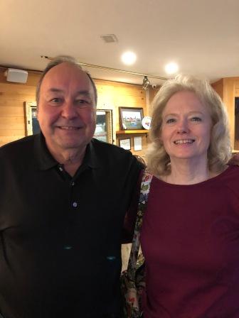
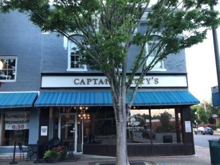
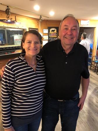
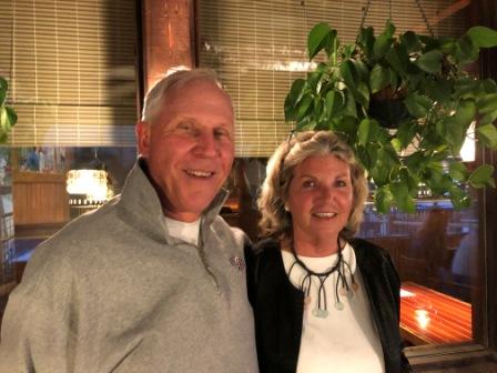
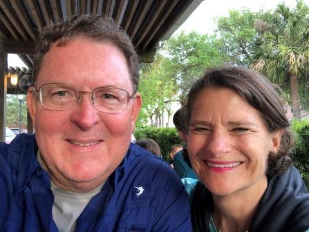
Once Mark had returned, we proceeded to meet up with Bob & Mary Griswold. Bob is one of our associates who used to be a client before he retired. He still periodically does work for us, but he and Mary are heavily involved in local NC politics, so his time is more limited these days. We met up at Captain Ratty’s seafood & steakhouse, a place we had visited before and is only a block away from the marina. We arrived at the same time and were glad we were a bit early as the place filled up fast; we still had to wait 15 minutes for a table. The food was great and having a hamburger was on our minds, so we all indulged in a delicious burger.
Bob & Mary
Captain Ratty’s
Denise & Bob
Although we did not venture far from the marina, we immediately noticed some great changes in New Bern. Many of the restaurants have reopened since the great flood, the Doubletree is back in business, and the marina has made arrangements for restrooms, showers, and laundry facilities again. However, these are still a block away and not super convenient like they used to be when they were actually in the Doubletree hotel.
Over the next several days we will explore more, then Denise will fly home on Thursday for a memorial service for a friend, and then back to the boat on Saturday. Then on Sunday we will head to our next stop; where that will be and how far we get will depend on weather.
IO at New Bern Grand Marina
New Bern, NC – Tuesday, 4/27
This morning was a work day for Mark, and because of that he was up early for a change. Off he went to the client site to help them make more money.
Meanwhile, Denise spent the entire day working on the last two blog updates, cataloging pictures, preparing for an on-line meeting on Friday, and getting caught up on some work-related items. She did not venture off the boat the entire day as it was mostly peaceful, except in the afternoon when the wind picked up. Then it started to really blow from the south and the boat across the dock from us was pinned up against the dock. Their under-inflated fenders barely protected the hull of the boat from being marred by the edge of the dock, and it made a squeaking noise that was quite irritating. The only other excitement for the day was watching TowBoatUS come into the marina and tow a sailboat out of its slip to some unknown destination, most likely for engine repairs.
Since Mark had a rental car (courtesy of the client) we decided to venture out past the downtown for dinner. When he came “home” we took the car and drove to the nearby Panera as we wanted a light and somewhat healthy dinner. We had already decided to dine out at a new local (and highly recommended) restaurant tomorrow night, and Denise had made reservations. So tonight was about a quick meal so we could get back to the boat; Mark had work to do and we didn’t want to be gone long.
Panera dinner (soup & salad)
Tomorrow Mark will go to the client and Denise will venture out in New Bern. She will update the blog and prepare for the trip home on Thursday morning.
Posted onApril 27, 2021|Comments Off on Besties in Beaufort!
Beaufort, NC – Sunday, 4/25
It was a cool morning with overcast skies, but the rain had come and gone. Fortunately, the severe storms and gale-force winds did not materialize as forecasted. It did rain and we did get strong winds from the south, but not nearly as bad as expected and we were thankful we were on the north side of Beaufort.
Denise got up early and managed to get a load of laundry washed and dried with no wait. We then borrowed the marina loaner car (one of two available); a fairly new van and used it to go to Church at St. Egberts. We were last here for the Easter vigil two years ago when it was crowded and mass lasted 2 hours. However, today it was only 45 minutes long as they were anxious to get everyone out of this socially distanced, temperature taking, mask-wearing, super-spreader environment (sarcasm intended).
St. Egberts Catholic Church
Inside St. Egberts Catholic Church
We then took advantage of the loaner vehicle and drove out to the Super Walmart for a few things. Mark found their RV section to be great, so we bought an extra package of toilet paper (we have been Covid-trained), as well as a new short hose for the external water filter system as ours had a small leak. We don’t like to have water dripping on the docks at a marina and wasting their water. Denise purchased a few fresh produce items and then we made our way back to the marina.
Denise spent the entire day completing more loads of laundry and cataloging pictures. Mark finally got a chance to wash all the salt off the boat, including the roof. There were a few people on the water and they would cruise past our boat from either the marina next door (Beaufort Yacht Basin), or from across the one across the way (Town Creek Marina). It is fun to see all the different boats that pass by, some of which you wonder how they even float, and others you know the people on them are drinking.
Town Creek Marina – across the water
Tiki bar on the water
The skies had cleared, but the wind picked up and about the time both of us finished our chores, the boat was bouncing around a bit. The wind was now out of the northwest and north, and we were quite exposed. So we got our showers and grabbed a quick cocktail and then headed into downtown Beaufort, about a half-mile away.
We had made arrangement with Brian (“Corporate Approved”) to meet up at 5:00 on his boat at the Beaufort Docks to share a pizza dinner. He had two of his friends aboard (Tom & Jimmy) that were helping him get his boat home to New Baltimore, NY; home of Shady Harbor Marina – host of the AGLCA Pig Roast in June. When we arrived, Brian was taking a nap after an afternoon of margarita drinking. But he was so excited to see us and gave us the warmest welcome. This was day two of being held in Beaufort as he damaged a prop in the ICW in Myrtle Beach, and required a haul-out and repair before continuing north. The boat was scheduled for Monday at Jarrett Boat Works just north of Beaufort on the ICW.
Brian (sitting) & Tom (bartending)
Jimmy
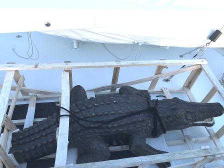
Brian is known for transporting interesting things back home to NY. When we first met him in 2015 in Coinjock, VA, he had a marina power pedestal on the back deck of his boat. This year he had a life-size fake alligator he picked up at the Ft. Lauderdale boat show, and a stuffed sea turtle. Both will be put on display at his marina and we can’t wait to see it there.
Alligator for marina
Mark and Brian’s turtle
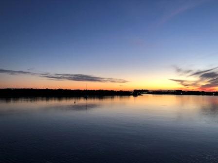
We spent a fun evening with these guys having drinks, socializing, eating pizza, and watching other boats go by. Eventually we got to see a killer sunset.
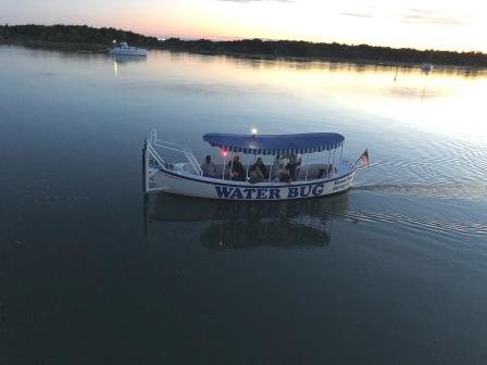
Tour boat on creek
Sunset from Corporate Approved
Finally, we had to say good-bye and look forward to our reunion at the Pig Roast in June. We got back to the boat just before 9:00 pm and found the wind had died down enough that the boat was no longer rocking. This was good news as we were tired and wanted to get some sleep, which is exactly what we did.
Posted onApril 27, 2021|Comments Off on Tedious Travels!
Figure 8 Island Anchorage – Friday, 4/23
Before getting underway today, Denise went for a short run through downtown Georgetown. The old homes and quiet streets offer a nice place to run when there is no traffic. Here are some pictures of the town during the early hours of the morning:
Downtown Georgetown at dawn
Purple house downtown
Beautiful home downtown
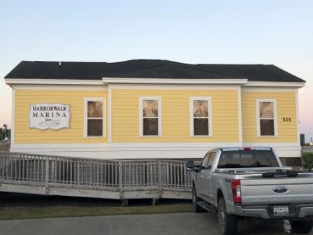
Harborwalk Marina
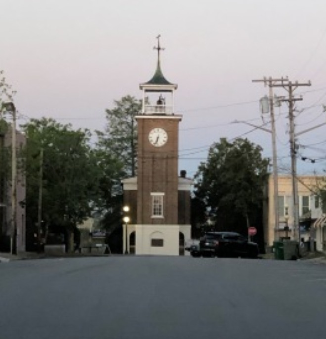
Rice museum clock tower
We wanted to leave early today and get as far north as possible. There was incoming wind and rain expected on Saturday afternoon, which could hamper our attempts to get to Beaufort, NC where we had reservations for a 2-night stay. We did not want to get caught in this storm on the water, nor did we want to be coming into a marina in high windy conditions. We cannot make it that far in one day, so it would force an overnight somewhere. Our preferred choices were Carolina Beach, Wrightsville Beach, or an anchorage north of there.
In a normal year we would go the approximately 70 miles to Southport, NC and stay a few days in this very cool town. However, the Southport Marina has been closed since hurricane Isaias and a tornado took out this large and very well run place in August of 2020. They have reopened the fuel docks, but they are not yet ready for transients, let alone their permanent boats. Therefore, we knew we were going to have to stop somewhere else, and we wanted to put in more miles today, then tomorrow.
Another consideration was to go offshore on Saturday from Masonboro Inlet (near Carolina Beach or Wrightsville Beach), or stay in the ICW. Given the unpredictable nature of weather in these parts, and not wanting to get beat up, we decided to make the final call on this as the day wore on. Sunset wasn’t until near 6:30, which means we had plenty of daylight and could get far if we choose to.
What we didn’t know was how long it was going to take us to get anywhere. We had to get through South Carolina with two bridges that required opening for us to pass, and the many homes that line the ICW, forcing no-wake zones. This is particularly true around Myrtle Beach, and it gets even worse in North Carolina (thus the desire to go offshore).
Denise was sad to leave Georgetown, but hopeful we will be able to spend more time here on the return trip south in the fall. From Georgetown Harbor we turned into the ICW and onto the Waccamaw River. This is one of her favorite parts of SC ICW as it is remote, but beautiful. We pass by forested areas on our left, and several marinas and golf communities on the barrier islands to our right. But it’s the area through the Waccamaw National Wildlife Refuge and the Wacca Wache Marina (stayed in 2017) in Murrells Inlet that is the prettiest. We wound our way along the ICW passing several Looper boats, including new friends David & Lisa (“She’s the One”), and “Cenyth” that we have not met.
Waccama River
Wacca Wache Marina
“She’s The One” – Dave & Lisa
Looper “Cenyth”
We also passed by the small community of Bucksport where there is a marina, and some new construction for a marine repair or manufacturing business.
New construction at Bucksport Marina
Bucksport Marina
Soon we approached the Socastee Swing Bridge where we had to wait a little while for it to open. We had now approached Myrtle Beach where there was nothing but houses on both sides of the ICW, and the channel was very narrow making the passing of oncoming barges and other boaters a challenge. Needless to say we saw some large houses and some interesting sites along the way:
Socaste Swing Bridge
Houses for Sale
As we travelled further north we passed through areas that continue to be developed (or should we say over-developed). One such area is Barefoot Landing. This marina, condo and country club area now has newly constructed houses overlooking the marina. We have been told they no longer accept transients, and since the Barefoot Landing across the ICW is still being renovated, there is nowhere to stay in this area, even if we wanted to – which we don’t; there are better options.
New homes at Barefoot Landing
Barefoot Landing Marina
Reparing docks at BL
Next up was the infamous “rock pile” area. Here the ICW literally has granite rocks on both sides, so you must stay in the channel. It can be nerve wracking during high water times when you cannot see the rocks; it is better in low water as they do stick out. Unfortunately, now north of this area there is more new development on the mainland side. On the eastern shore there is an airport and which we cannot see, but know it by the antennae visible from the water.
Antennae at MB Airport
Right after this is when we encountered a flotilla of four slow trawlers that were all traveling together. Because of the narrowness of the channel and other on-coming boat traffic we were not able to get around them easily. It wasn’t until we came up on the Captain McLauchlin (Little River) Bridge (aka the Captain “Poo” Bridge) that we were able to maneuver between the #2 and #3 boats. But we all had to wait on the opening and by the time it was ready there were six boats all stacked up trying to head north.
LR Swing Bridge – waiting
LR Swing Bridge – stacked up behind us
Unfortunately, even though we were able to get past two of them, we soon turned left down the channel to take us to Myrtle Beach Yacht Club where we stopped for the lowest price fuel in the area. We had hoped to get all the way to the New River Marina outside of Swansboro, NC before needing fuel, but we didn’t have enough diesel left in the tank. So, we pulled into the Yacht Club and got some petro to keep us moving.
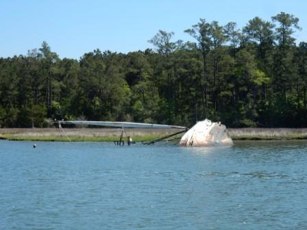
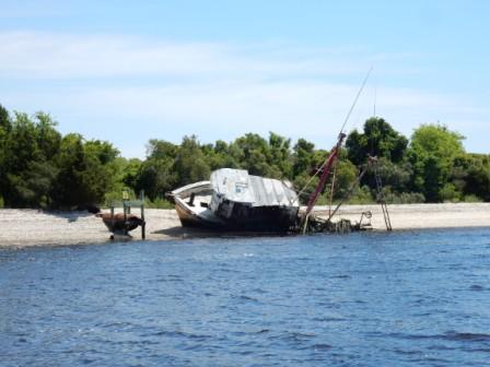
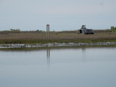
Within 30 minutes we were back on the ICW and making our way passed the Little River Inlet and all the wrecks that have washed up on her shores; one of them has been there ever since we made our first trip this way in 2015.
Little River Inlet
Long time wreck at Little River Inlet
And around 12:30 we entered the state of North Carolina; you know the one where we go east, then southeast, then east for miles before we get to head north! It wasn’t long before we came up on the four-boat flotilla again, and had to negotiate around them. However, here we had to also deal with a small fishing boat, jet skiers and many houses with boat docks and no-wake zones again. This was slow-going.
Once past the Shallotte Inlet (an area known for shoaling but thank goodness had been recently dredged) we were able to break free from the group. It was still slow going until we got through Holden Beach and endless houses with boats in the water and kayakers. Then we made our way through Lockwood’s Folly; another inlet notoriously known for its shoaling and also recently dredged. Here the beaches are pretty and there are always lots of recreational boats on the water. All of this makes for slow travel time, a high level of concentration, and why Captain Mark prefers to go offshore.
Passing the 4 boats again – Shallotte Inlet
House after house – north of Holden Beach
Just past Oak Island to our right, the ICW turns more rural and we were finally able to speed up and got away from the slower moving boats. The ICW turns north (FINALLY!), and we passed the marina and town of Southport. Clearly the waterfront bars and restaurants have recovered, but the marina is still a work-in-progress.
Southport Marina – still rebuilding
Southport Waterfront
Once past the town of Southport, the ICW turns onto the Cape Fear River which is a large body of water. Twenty miles north on this river is the town of Wilmington and we hope to get there on our way home in the fall. The channel here is much wider, but outside the channel it is shallow and there are small barrier islands, some sandy, others with trees and bushes.
North of Southport is MOTSU (Military Ocean Terminal Sunny Point), one of the largest military terminals in the world. It serves as a transfer point between rail, trucks, and ships for the import and export of weapons, ammunition, explosives and military equipment for the United States Army. The 596th Transportation Brigade operates the terminal which is not open to the public or used for commercial purposes.
It was from here that a large container ship (“Cape Sound”) had left and was headed south to the Atlantic Ocean. As we passed it we were hugging the far right side of the channel giving the ship plenty of room and trying to avoid its wake. The ship was not going fast, but it was not going slow either and so it created a good size wake. But the wake bounced off the barrier islands and shoals and came back at us in a series of waves, the largest of which was 6’. Our vessel went vertical on the 3rd wave, and the 4th wave went right over the top of our boat and dowsed the cockpit. Water seeped into the slightly open hatch all over the galley and helm. Fortunately, Mark saw it coming, warned Denise who was in the cockpit snapping pictures, and she was able to get seated inside before the big waves hit. It was over in a few seconds, but was quite scary. Then we had to clean up all the salty water inside and wipe down everything. What a mess! Miraculously we did not break anything and nothing spilled out of cabinets.
Cape Sound Container Ship
Smallest of 4 waves to hit – barrier island just off bow
By the time we got things back together it was time to turn off the Cape Fear River, following the ICW through Snow’s Cut and to Carolina Beach. It was still early enough and given the latest weather for tomorrow it did not look good for going offshore from Masonboro Inlet. We decided to continue north passing the inlet and Wrightsville Beach, choosing an anchorage north of the Figure Eight Island Bridge.
Carolina Beach
North of Wrightsville Beach Bridge
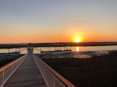
We arrived at the anchorage just before 5 pm and had time to take in the beauty of the surrounding area. To our east there was a yacht club about a half a mile up the creek and before the homes on the barrier island. Probably because of the weather there was almost no boat traffic from there; unheard of on a Friday afternoon. There is nothing but estuary to our north, and a spit of land for the highway to our south with a boat ramp that wasn’t in use. This provided a great barrier for the breezy wind that evening. It was far enough off the ICW to our west, that the passing boats did not bother us and after sunset it was quite peaceful. This proved to be a very good location as it was quiet and we had the whole place to ourselves. After a celebratory adult beverage, and a quick dinner of leftovers we crashed; exhausted from a long tedious day on the water. We had covered 112 nautical miles in a long 9 hours.
Looking east – to Figure Eight Island Yacht Club
Looking North
Looking west towards ICW
Looking South – boat ramp
Sunset over ICW
Beaufort, NC – Saturday, 4/24
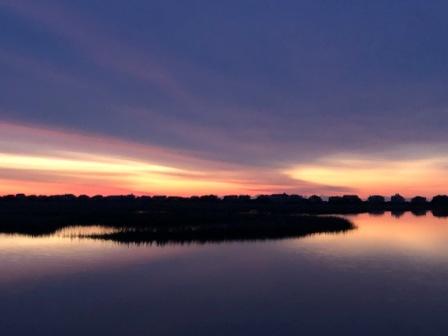
A boater learns to tell the weather by the color of the sky and there is truth to the saying “Red sky at night, sailors delight. Red sky in morning, sailors take warning”. Today the sunrise was spectacular, but told of pending bad weather. It was overcast and remained so all day long.
Sunrise…red sky in morning
Sunrise
We heard the reports as the front moved through Alabama, Georgia, the North FL panhandle and South Carolina. It was chasing us and we were anxious to get to Beaufort before it hit. We were ready to go early and pulled up the anchor by 7 am. Probably because of the weather, we had little boat traffic to contend with, making the early hours of cruising quite easy, near Top Sail Beach and Surf City. Our biggest challenge at this point was passing a dredge that come to find out was not operating, so it only required us to slow down.
No more houses for awhile
We continued cruising well until we came to the New River Marina in Sneads Ferry where we stopped to get fuel. This is the cheapest around and by topping off the tank here we would not have to fill up again until we are on the Albemarle Loop next week, where it is considerably cheaper. While fueling Mark struck up a conversation with “Daniel”, the young man who helped us. He wants to eventually get his Captain’s License so they discussed his future post-graduation (high school) this spring, as well as other options open to him. We did not require much fuel so in no time we were on our way.
Daniel at New River Marina
We navigated around the ever-shoaling but currently being dredged New River Inlet and made our way to Onslow Beach. Here begins the point where the ICW cuts through Camp Lejeune Marine Corp base, for which there are two challenges: the Onslow Beach Bridge with a restricted opening, and potential live fire exercises on the base which shuts down the ICW to boats for up to 4 hours at a time. Denise had called the base’s scheduling office on Friday afternoon to confirm no exercises were scheduled and that passage was not restricted (hooray!). The bridge itself is undergoing planned maintenance and was supposed to be in an open position during this time. However, as we approached the bridge it was in a down position. Fortunately, we had arrived just before 9:30 and would get in on the scheduled half-hour opening. For the first time ever we were the only boat waiting on this bridge.
Onslow Beach, Camp Lejeune
Onslow Beach Bridge
Camp Lejeune Live Fire range
Once through the bridge and the live-fire exercise area, we came into the town of Swansboro.
Swansboro
And here is where the Coast Guard (CG) was on patrol and approached our vessel for a potential boarding. Once they discovered we had been boarded in 2019 (DE Loop trip), all they were interested in was our life jackets. We showed them what we had and they were satisfied, so they left us alone. At that time we had been preparing to pass a sailboat, who was now still in front of us. As soon as the CG left us they approached the sailboat. We had to chuckle as they boarded the sailboat and the “Coastie” was met by a very friendly golden retriever who greeted him with a million licks and attempted hugs. We love our “Coasties” and apparently their dog did too!
Coasties approaching
Coasties board the sailboat
Here we also passed this property on a small barrier island that had been for sale when we first saw it 2015. We were happy to see that someone purchased it and they were now getting some enjoyment from it.
House still for sale – 2015-2019
Finally sold!
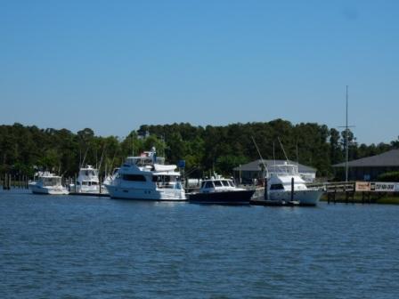
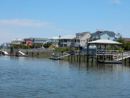
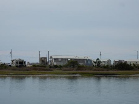
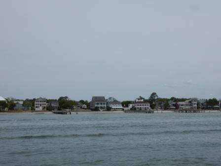
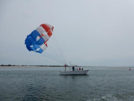
It wasn’t long thereafter that we entered Bogue Sound. Here the ICW again opens up pretty wide, although the channel itself is somewhat narrow. But the houses that line this area are set back far enough from the ICW that there is no need to slow down for boats in the water or at their docks. The only slowing was to pass a few other cruising boats, until we hit the No-Wake zone around the NC port in Morehead City. We rounded Goat Island and made our way through the inlet at Beaufort, just outside what appeared to be a smaller boat fishing tournament. We entered the channel and made our way into Homer Smith marina dodging a parasail boat and a few crazy recreational boaters as well.
Houses on Bogue Sound
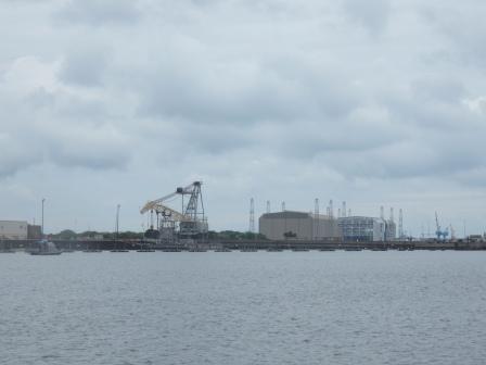
NC Port at Morehead City
Parasailer getting ready
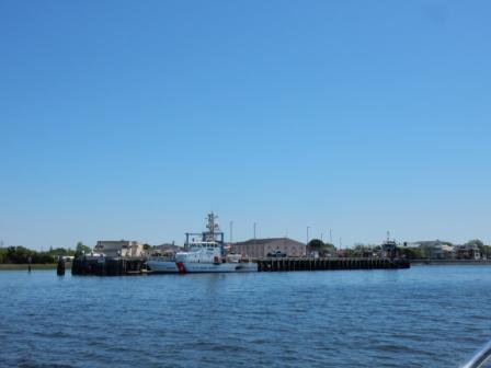
Approaching Homer Smith Marina
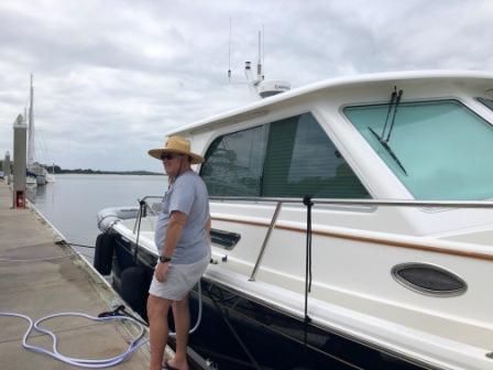
We had a preassigned slip and knew the layout of the marina, so we docked the boat without assistance from dockhands. Eventually, the dockmaster came down when he saw that we had arrived, but by then we had the boat settled, and had hooked up the power and water. We had arrived right at noon, so we made lunch first, then went to the office to check in.
IO at Homer Smith
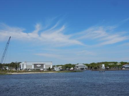
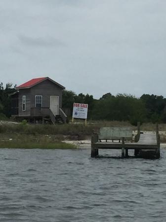
And here is where we were totally surprised but what we saw. Gone was the shrimp processing facility that we had to walk through to get to the marina office. They had put up a wall, sold off the equipment and tore down the rest of the building that butted up to the dock where the shrimp boats would land. Now there was a parcel of green grass and obvious construction equipment working on the bulkhead. We learned that processing business had been hit hard by Covid. With the shuttering of restaurants up and down the east coast (their main customer), they no longer wanted to keep this declining-in-profits part of the business. The marina is more profitable and was funding the shrimp processing business for the last few years, in part due to high costs (fuel) for shrimpers and the ever-increasing regulation on fisheries. They are going to build a new clubhouse with better laundry and restroom facilities and a new marina office.
Shrimp processing plant no more
New wall – no more shrimp processing
We also learned that just next door they are going to put in a Margaritaville (aka Jimmy Buffet) resort. Apparently this has been in the works for a while, and was recently approved in order to attract visitors to this north side of the town of Beaufort. We were disheartened to learn of all these changes as this area was truly an authentic fishing village, and now it will be forever changed to look like every other coastal town in the US.
We spent the afternoon getting caught up on some emails, talking to family, and planning our next few day’s adventures. We had secured the marina rental car for mass tomorrow, and Denise managed to get a load of laundry done before there was a queue in line for the single washer and single dryer. With free laundry here and only one set of appliances, it is a challenge to get it all done. Plus, the wind had picked up and the overcast skies turned to dark clouds threatening rain. She did not want to wash and dry laundry only to have it get soaked on the way back to the boat.
Small washer & dryer
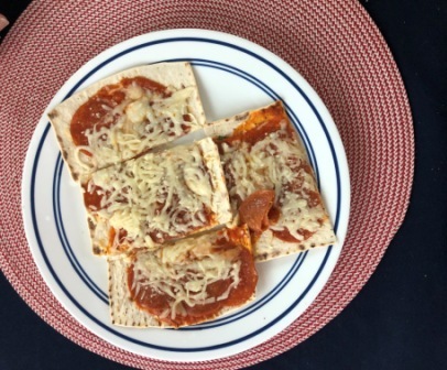
We had been in communication with our friend Brian Donovan (“Corporate Approved”) who was also in Beaufort on his boat (ahem – yacht). We were trying to meet up for dinner which became a scheduling issue, and we had started to receive intermittent rain. It was not going to be fun walking into town, so we agreed to reschedule to tomorrow when the weather would be better and our schedules more flexible. We stayed in for the rest of the night, making flatbread pizzas and even watching a little TV.
Posted onApril 23, 2021|Comments Off on Gathering in Georgetown
Georgetown, SC – Thursday, 4/22
The wind of yesterday ushered in a cold front, and when Denise woke up it was 46 degrees. She went for a run in the neighborhood around the marina and near The Citadel. She has run here several times before, but still snapped a few pictures along the way:
Brittlebank Park sign
house near the Citadel entrance
Neighborhood street near the Citadel
Harold’s Cabin Restaurant
Altman Athletic Center The Citadel
Once back on the boat she worked on emails and the blog post a bit while Mark dealt with some work issues and prepping for the part. Finally he received a text that the package had arrived, walked up to the marina office, then returned and began the install. He had predicted it would take approximately 30 minutes, and he met his goal (a first in the history of boat repairs). He tested the thrusters and all was right with the world again on our Island Office.
So we left the Bristol Marina right at noon and headed out into the Ashley River. We passed the City marina and the Coast Guard station, and eventually the downtown.
Passing city marina
Coast Guard Charleston
It was a beautiful, but cold day on the water and we got to see Ft. Sumter on the horizon with a dredging operation going on in Charleston Harbor blocking part of the view. We also passed a large ship that was just getting under way from an anchorage and the “Spirit of Charleston” tour boat.
Passing ship in Charleston Harbor
Ft Sumpter (dredge in front)
Passing “Spirit of Charleston”
We re-entered the ICW near Sullivan’s Island and cruised slowly through the no-wake zone; another area where the waterway is bordered by homes with boats on their docks.
We continued through this part of the ICW with no real issues. Eventually we came up to Isle of Palms and the marina we have had friends stay at. The area is always filled with people on jet skis, paddle boards, kayaks and other personal watercraft. We were thankful it was not a Saturday or Sunday as it would have been crazy and a pain to navigate around. We did see a few brave souls out on jet skis, despite the still-cool temperatures.
Jet Skiers near Isle of Palms
In passing the Isle of Palms Marina, Mark spotted a “Chesapeake Buy Boat” at the docks. This is one of those types of boats that Denise is fascinated with (along with the Trumpy yachts, and the Sabre/Back Cove family of boats, of course). You can read about these cool vessels here.
Buy Boat at Isle of Palms Marina
Within minutes of passing the Isle of Palms we were the ICW turns very remote and beautifully scenic. This is definitely South Carolina Low Country with its marshes, small creeks and impassable inlets that feed into the waters.
Just north of Isle of Palms
For most of our journey we would pass by these unspoiled waters. And then we came across the lone house in the middle of nowhere and got to see both dolphins in the water and a bald eagle at perch.
House in middle of nowhere
Dolphin in water
Bald eagle on structure
As we cruised further north we wound our way through more remote areas, with some houses interspersed throughout. To our west was the Francis Marion National Forrest with hiking trails, an RV park, and camp sites. It is so great that this pristine area is part of the National Parks and will not be developed. Unfortunately, right along the ICW border there are several houses that back up to the park’s eastern-most boundaries. However, these are far fewer than the rest of the SC ICW. On the eastern side of the ICW, most of it is uninhabitable and is made up of Cape Romain National Wildlife Refuge.
The bad part about this part of the ICW is the constant shoaling that is created by the currents as the tide changes make their way through the numerous curs and tributaries. We follow Bob Sherer on the “ICW Cruising Guide by Bob423” Facebook Page and we use his routes through these areas in AquaMaps (navigation app) to assist us. Bob (aka “Poughkeepsie Bob”) used to do this as a volunteer, but now does it for Waterway Guide. This has become the go-to replacement for Active Captain since Garmin bought that peer-review application and people quit posting to it. The problem for us this year is that we are ahead of Bob and his tracks are 6 months old. The good news is that many of the usual problem areas have recently been dredged and we had plenty of depth. However, ones that have not recently been dredged required diligence on the part of Captain Mark.
Once such area that has recently been dredged but is always a challenge is McClellanville; a small town just off US 17 and sandwiched in the middle of these natural areas. We have heard good things about this little place, including usually good fuel prices. However, we have yet to visit.
Continuing further north the ICW crosses the South and then the North Santee Rivers and then turns into something like a canal in that it is narrow and a pretty straight shot. To our east is the Tom Yawkee Wildlife Center and its Welcome Center. Here there is a barge (Miss Ellie) that acts like a ferry to transport vehicles across the ICW.
Approaching Ferry Swing Bridge
“Miss Ellie” floating swing bridge
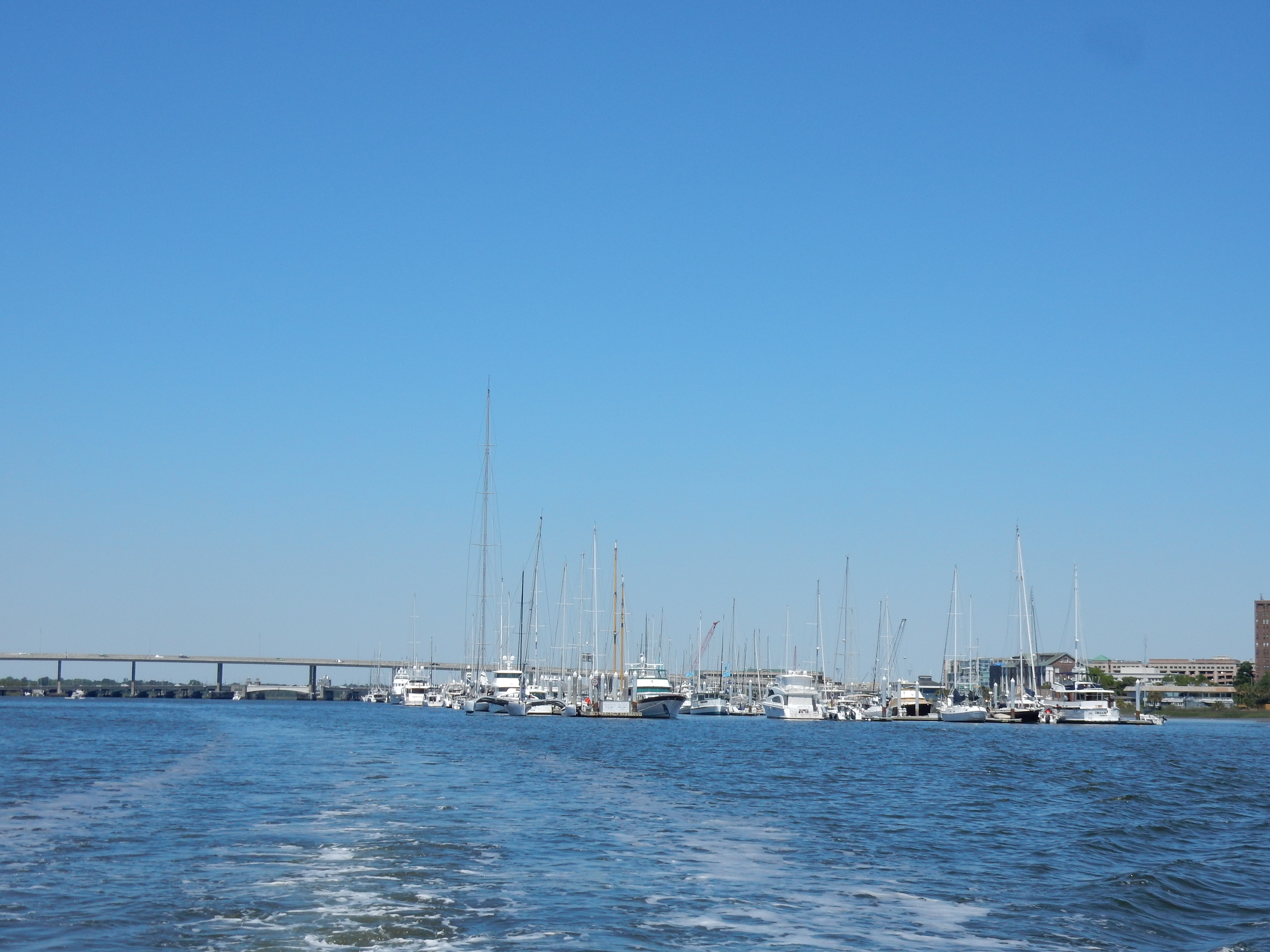
We use this as a landmark when heading north knowing we don’t have much further to go to Georgetown. Within 15 minutes the ICW takes a left turn into the Winyah Bay, and here we entered the channel to take us into Harborwalk Marina at Georgetown; our spot for the night and right on our predicted time of 4:00 pm.
We had been in communication with “Cathy Ann” via the Back Cove/Sabre’s FB group and knew they were in Georgetown; we were anxious to meet face-to-face for the first time. As luck would have it our slip was right next to theirs. After settling the boat, checking into the office, getting showers, and a quick conference call for Denise, we joined them on their boat for happy hour. Jeff & Cathy were very gracious hosts and had also invited another Looper couple Dave & Lisa (“She’s the One”). We had a chance to talk about our mutual looping experiences, friends we have in common (“Donna Pacem” and “Balahula”) and our Back Cove boats.
David & Lisa had to leave, but we went to dinner with Jeff & Cathy at the River Room Restaurant. This was a new restaurant in town and was quite popular. We had to wait a bit for a table, but our time was spent getting to know each other better. We had a delicious seafood dinner and really enjoyed the company of our new found friends.
IO and Cathy Ann
Jeff & Cathy (Cathy Ann)
River Room Restaurant
After dinner we went back to the boat and made plans for tomorrow. Mark looked at the weather over the next two days, and looked at fuel stops along the way to determine the best (cheapest) place to stop. Denise published the last blog and then we retired for the night.
Over the next two days we are going to push hard and cover a lot of miles. We need to be in Beaufort, NC on Saturday night and the weather Sat. afternoon is going to deteriorate. So, our plans are to get as far north tomorrow as possible, and then get up early on Saturday to arrive before the rain. Of course we will adjust accordingly on Friday if in fact this changes.
Posted onApril 22, 2021|Comments Off on Congenial Charleston
Charleston, SC – Tuesday, 4/20
Before leaving Lady’s Island Marina Denise went for an out-and-back run down Sea Island Parkway; the road that runs by the street entrance to the marina. Along the way she passed the Publix, Dollar Tree, Dollar General, several banks, a strip center and the future site of “Harris Teeter”. Eventually she found the Walmart that Mark had visited yesterday and used it as a turn-around point, knowing she could get end up with approximately 4 miles. Along the way she saw a beautiful sky at sunrise, and a few quirky ornaments in front of the strip center and garden center.
Sunrise over the marshes
Sidewalk along Sea Island Pkwy
Statuary along run
Marina and office
Statuary along run
Once back from the run and with our breakfasts done, we shoved off from Lady’s Island Marina and headed back on to the ICW. We immediately saw a Sabre (“Stella”) ahead of us and once out of the no wake area picked up speed to follow this sister ship. Before long we caught up to the Back Cove “Cathy Ann” whom we had seen yesterday near Daufuskie Island. Together all 3 of us passed by the Marine Corps Air Station Beaufort (Merritt Field) to our west; the base that was flying jets all day yesterday, buzzing our marina at Lady’s Island.
Before long we were headed out of the protected waters of the marshes and made our way into the St. Helena’s Sound. Here Denise snapped a picture of the other two boats over the bow of our boat:
Cathy Ann & Stella – St. Helena’s Sound
St. Helena’s Sound is one of the largest of all the inlets, and was going to take a while for us to cross. It is shallow in parts, but really wide so there was plenty of cruising ground to go around the handful of slower boats making their way north. The wind started to pick up a bit and the waters developed a light chop by the time we got to the other side of the Sound and re-entered the protective marshes of the ICW. We were glad we had left when we did and that our boats cruising at 20 knots made it a non-event. “Cathy Ann” had decided to take a slower path and did not keep up with us and “Stella”.
We entered the Ashepoo-Coosaw Cutoff winding our way to first through the Ashepoo River, then the South Edisto River, and then the Edisto River. Although our intended direction is north, periodically we actually were heading southeast. This is what it is like in the ICW in South Carolina and this is why Mark hates to take this “inside” route north. If we were offshore we could have cut our time in half, but today’s weather did not warrant it. So while Mark drove the boat through these winding rivers, Denise made the best of the time and polished the stainless steel refrigerator and the sink in the head. By the time we got to the wider North Edisto River the entire galley had been cleaned and everything looked great. But once again we were in areas where many houses line the shores and they all have docks, some with boats in the water causing us to have to slow down.
SC homes – Stella following
Finally we came to the Elliot Cut; a house-lined canal that signifies we are getting close to Charleston. Our voyage was almost done for the day. We continued along until finally the ICW met with the Ashley River, just near the Charleston City marina.
Entering the Elliot Cut off the Stono River
Entering Ashley River in Charleston
We made a left turn and negotiated around several boats all attempting to go into that marina at the same time. But we headed up the Ashley River, went under the dual Ashley Memorial Bridges (US 17), and prepared to dock at the Safe Harbor Bristol marina; original home of our wonderful Island Office. But as we were preparing to dock the boat with the wicked current running through this area, the paddle on the helm deck for our bow thruster broke. Mark had no control of the thruster and limited control of the boat. So he backed us out of the marina fairway back into the river until we could figure out what to do. In the meantime, two other boats were coming into the marina and didn’t understand why we were backing out, so they tried to move around us. It made for a harrowing few moments but we all managed to keep from colliding.
Once back out in the river, Denise drove while Mark tried to fix the plastic handle that had broken completely off. He managed to get it to a point that it was usable, so we once again attempted to dock. This time we were more successful, thanks to the helping dockhands at Bristol, and Maria (pronounced Mariah) our favorite contact at Coastal Carolina Yacht Sales. Once the boat was settled we were able to explain to them what happened and thank them for their assistance.
After spending some time trying to fix the broken paddle unsuccessfully, Mark began the process of locating a new one. Unfortunately, once he talked to the manufacturer he learned the whole unit had to be replaced, and it wasn’t going to be cheap. (BOAT – bring on another thousand)! Mark was able to talk to find the unit at Defender (online marine supply store), but Maria was also able to get a favorable dealer pricing and (hopefully) get it shipped here in the next two days. We intended to spend 2 nights here anyway, so this should not delay our plans too much.
Broken bow thruster paddle (top)
Once all of this was investigated and the part was ordered, we got down to other issues that needed to be addressed. Denise had been advised that the memorial service for her friend Leslie (who unexpectedly died last year) would finally be held on Friday, April 30th. The pandemic had kept the family from traveling and it was now scheduled. Having been informed of this and contemplating Denise going home for the service, Mark contacted his NC client and sold them on a few consulting days while we would be in the area. With this secured, we altered our plans slightly and secured a marina slip in New Bern, NC for a week. Denise then made travel arrangements to fly out of New Bern on Thursday, and return to the boat on Saturday 5/1. She will be home less than 48 hours, but it will also afford her the opportunity to bring things home that we don’t need on the boat, and pick up a few things we have decided we should have brought with us this trip.
It was late when we finished up all that we had to do and we really didn’t feel like going downtown for a dining out option. One of the best things about this marina is that it is located directly across the street from a new Publix. It could not be more convenient! So, we walked across the street, picked up a few grocery items, a rotisserie chicken (Denise), and fried chicken (Mark) and came back to the boat for dinner and a quiet evening.
Charleston, SC – Wednesday, 4/21
Today was going to be a windy day and we were so glad that we were not going anywhere. Although it was sunny and the temperature was perfect, the wind started early and we were thankful to be tied to a dock.
In the morning we waited to hear word about bow thruster paddle, and its arrival. Unfortunately, we learned that it was not going to arrive today, but it was guaranteed for 10:30 am tomorrow.
We did not want to be captive to the boat all day, but we were not really up for going into the downtown area; we’ve been here many times and unless you are going out to dinner, it’s a bit touristy. We were up for a different adventure. Mark suggested going out to lunch and located a spot about a mile away near the city marina. There is sidewalk and crosswalks the entire way, so it makes it easy to walk in this area.
The restaurant “Marina Variety Store Restaurant” overlooks part of the city marina, as well as the marshes and the Ashley River. It was beautiful day and we arrived just before the lunch crowd, but it got busy fast. It is definitely a locals place filled with marina contractors and construction crews from the nearby site as well as a few boaters from the nearby marinas. And there is a reason: the food was very good. Between the smoked fish dip appetizer, the she-crab soup, and the crab cake salad, we really enjoyed our meal and thought we made a good choice.
Marina Variety Store Restaurant
Once back at the boat, we spent some time talking with a few other boaters, as well as Craig, the owner of Coastal Carolina Yacht Sales and the broker who sold us our boat. He had taken a customer out on a boat (a previously owned Grand Banks Eastbay 46’) for a sea trial and survey. It was a good day for this as the owner got to see how she handled in the now very choppy and windy waters around Charleston. The new owner was gracious enough to let us tour the boat as it had a similar layout to what we like. However, after looking at the features and design, we decided we still like the 45’ Sabre better…not that we are shopping for a new boat!
Mark also was able to talk to Jeff, the electronics contractor who was outfitting a new 48’ Sabre in the slip next to ours. Mark wants to eventually replace our chart plotter and discussed options for placement and rearrangement of the electronics on the helm, as well as other such related items.
In the late afternoon, Kim Russo (executive director of the AGLCA – the Looper organization which is based in Charleston) came by the boat for a short visit. We discussed our trip plans and her efforts to fight all the pending restrictive anchoring laws in the SC and FL legislatures; something our organization has been fighting against. Due to the number of derelict boats that are a nuisance to others, as well as an increasing number of houses being built along the waterways, these states are trying to make it more difficult for boaters to anchor in the rivers, tributaries and finger creeks off the ICW. This forces boaters into marinas which can be expensive and there are few of these in number than the number of transient cruisers during the seasonal migrations. The waters should be free for all to enjoy.
Kim Russo – AGLCA Exec Director
After Kim left, the local owner of a 32’ Back Cove in the slip on the other side of us came by to check on the boat. We had a chance to talk with him about doing the Great Loop. He wants to do it, but his wife is reluctant, so we told him to bring her down tomorrow morning and Denise can help change her mind.
IO at Safe Harbor Bristol Marina
Sabre and Back Cove family at Bristol
Finally after 6 pm everyone had left and the docks got quiet, but the wind was stronger than ever. We opted for a light dinner of flatbread pizzas and some TV watching; we actually put on the news for the first time in almost a full week. Mark spoke to his mom and sister while Denise worked on and published the last blog. We did get to see this great sunset over the Ashley River before we turned in for the evening.
Sunset over Ashley River
Here are some other pictures from the area around the marina:
Posted onApril 21, 2021|Comments Off on Lovely Lady’s Island
Lady’s Island, SC – Monday, 4/19
It was a beautiful morning at Possum Point anchorage, but we knew the weather would be catching up to us. The beautiful sunrise revealed the impending rain and we were hoping to stay north of it today.
Sunrise over the Sound
We left the anchorage just before 8:00 and made our way back to the ICW without issue. We entered the Burnside River which divides Burnside Island and Skidaway Island. This river is lined with huge houses along both shorelines; a definite high-rent district.
Homes on Skidaway Is
The Burnside River turns into the Skidaway River where it meanders around more houses and a continuous “no wake zone”. We passed a few crabbers out in the morning checking their pots and then by the Isle of Hope Marina (where we stayed in 2017).
Working the crab pots
Passing Isle of Hope Marina
The Skidaway River turns onto the Wilmington River and shortly thereafter we passed by the Savannah Yacht Club (sorry no good picture due to sun in our face) and the large-boat Thunderbolt Marina and shipyard. From here until we get to the Causton-Bluff-Sam Varnedoe Bridge (still undergoing construction) it is a no-wake zone and slow going. We pass the Hinkley and the Savannah Bend Marinas and the Bonaventure cemetery (made famous in the book “Midnight in the Garden of Good and Evil”) before we could finally go back to our cruising speed.
Thunderbolt Marina
Causton-Bluff-Sam Varnedoe Bridge
Bonaventure Cemetery
It was shortly thereafter that we came to the Savannah River and crossed into South Carolina. Fortunately, there were no large ships making passage up or down the river, but we did have to negotiate around the large dredging operation.
Savannah River dredging operations
Savannah River tugs for dredge
For the next hour we continued north on the ICW, winding our way through the curves until we came to the western side of Daufuskie Island and eventually the Calibogue Sound. We passed by Haig Point, where there is a very nice resort area, and is also where the ferry boats bring people from Hilton Head. In January, Denise and her sister Claire ran a half marathon and they had to take this very ferry to the island for the early morning start.
Haig Point – Daufuskie Island
About this time we caught up to another Looper on a Back Cove ’37 (“Cathy Ann”) and enjoyed cruising past Hilton Head with them until they turned off and we continued on. Normally we would stop at Windmill Harbor marina on the north end of the island, but our plans this year are to stop in the Beaufort (SC) area instead, so we pressed on.
We crossed Port Royal Sound and rounded the famous Marine Corp Recruit Depot at Parris Island and eventually passed the city marina in downtown Beaufort. We went under the Woods Memorial Bridge and turned right up Factory Creek to the Lady’s Island Marina; our home for the night.
Parris Island USMC Base
Beaufort City Marina
Woods Memorial Bridge
After we settled the boat and checked in, Mark used the loaner car to do a quick run to Wal-Mart to pick up a few things. As it was only 2 miles away, he was back in no time. Meanwhile, Denise worked on the last blog, and had some communications with clients and family members.
Condo’s at Lady’s Island Marina
IO at Lady’s Island Marina
We chose this spot as our friends Vicki & Mack (McGahee) from the Down East Loop in 2019 live here. Last year they sold their boat (“Confetti”) and have now moved into a dirt home on Lady’s Island. We had made previous plans to connect with them, and they graciously invited us to their home for dinner. So Mack picked us up at the marina and drove us back to their home where we had a chance to share stories, including Mack’s adventure walking the Appalachian Trail in 2020. After dinner we walked around their neighborhood and out to their community dock for a great view of the low country marshes in this area. Before long the night was coming to a close and we had to leave. We said good bye and Mack drove us back to the marina and we called it a night.
Sunset off of dock over Factory Creek
Overlooking Factory Creek
Vicki & Mack McGahee
McGahee’s House
As Gold Loopers, they now have agreed to be Harbor Hosts for other Loopers coming into the Beaufort area and we know they will do a fantastic job! Thank you Vicki & Mack you are great hosts!
Posted onApril 20, 2021|Comments Off on Perfect at Possum Point!
Near Savannah, GA – Sunday, 4/18
As expected, Denise woke up to the rain coming down hampering her plans for a nice run through Jekyll Island Village and on the trail that parallels the beach. It’s a good thing she is not yet training for any race, as the lack of running would make this a challenge. Instead she spent the time reading a book; a luxury these days with blog posts, navigation and cruise planning, not to mention work responsibilities.
We left Jekyll Island during a sprite between rain showers, getting off the dock just before 8:00 am as planned. Our intended destination was an anchorage off of Ossabaw Island south of Savannah, but we would finalize that as the day went on. The benefit of anchoring out is you can pretty much choose any suitable anchorage along the way; no marina reservations and no fees. Georgia recently passed some very restrictive laws that limit anchoring near oyster beds, marinas, fixed objects and other such things. But in low-country Georgia there are still many favorable spots and our cruising apps provide good information regarding holding, wind conditions, tidal currents and cell phone availability.
Leaving JI Marina
Shortly after leaving Jekyll Island Marina and the Jekyll River, we headed out crossing St. Simons Sound. This is a wide open inlet and it was very calm, but there is quite the attraction still blocking part of the entrance. The South Korean car carrier ship “Golden Ray” went aground in September 2019, and they are still working to take her apart and clear the inlet. More than 4,000 cars were on the ship when it went down. They have built a massive superstructure to support the salvage efforts, and the metal is hauled up to Brunswick where it is prepared and loaded on barges that will take it for recycling in Louisiana.
Salvage of the Golden Ray
The cause of the 2019 incident has not yet been formally established, but in September of 2020, a naval architect with the Coast Guard’s Marine Safety Center testified that unstable loading left the Golden Ray susceptible to capsizing. According to analysis, the ship required an additional 1,500 gallons of water in the ship’s ballast tanks as counterweight. Otherwise, rearranging the cars on the deck might have kept the boat from tipping. The first cut into the Golden Ray’s bow actually began Nov. 6 and took three weeks to complete due to several setbacks, including a broken cutting chain and delays due to tropical storms. They are now working on the 3rd cut and it continues to be a slow effort. Perhaps when we come back through here in the fall it will all be cleared away.
After crossing the Sound we re-entered the ICW and navigated around a few boats. After that it was mostly smooth cruising through the winding waterway, grateful there were not more small fishing boats for which we would have to slow down. And lucky for us, the rain held off and stayed south of us for the rest of the day.
We had several other Sounds to cross including Altamaha, Doboy, Sapelo, and St. Catherine’s before coming to a stopping point. Along the way it was almost all remote except near Doboy Sound where there were several houses on a spit of land in the middle of nowhere.
Remote house near Doboy Sound
Our cruising was uneventful and we easily made our way north to our fuel stop in Richmond Hill, Ga. This was a quite a place and warrants a story.
The Kilkenny Marina is really in the middle of nowhere, just a few miles off the ICW up Kilkenny Creek. This is low-country Georgia and nothing is around here but sawgrass marsh, small rivers and the ICW. However, it is not far off of I-95 and is a popular place with locals for launching their boats. They have a marina store, fuel (cheapest in the area), bait shop (with bait caught by the owners), and a boat launch that is like nothing we have seen.
Kilkenny Marina
Kilkenny marina office
While Mark was fueling the boat, Denise spoke with “Danny” who told her that his dad had built the marina and he and his brother (Robert) have been working at it since they were in their 20’s. They helped to construct the docks and the wood deck, as well as the lift. Since their father passed away in 2012, the two brothers have been running the place ever since. Danny also showed Denise their bait wells full of shrimp; all of which he caught that morning in just 10 minutes, right near the marina.
Fueling up at Kilkenny Marina
Danny – co-owner of Kilkenny marina
At Kilkenny marina
Bait shrimp for sale
About this time a young man came into the marina to launch his boat. We watched as he backed his trailer up to the lift, connect a strap to the bow eye at the front of the boat, then two at the stern and hoist it right off the trailer. Like a mechanism on a garage door opener, the hoist moved along a track positioning the boat out over the water where it was then lowered to the surface. All of this took less than 5 minutes. Danny explained that due to the high tide swings (approx. 8’) in coastal GA waters, these type of boat launches make the most sense. A traditional ramp makes it too difficult to maneuver a trailer down a ramp, especially at low tide. But in Maine with their 14’ tides, and in the Canadian Maritimes with their 20’ ones, they at least put a strap or two under the boat’s hull.
Boat launch at Kilkenny marina
Boat launch at Kilkenny marina
Once fueling was done and we paid the bill, we said good bye to Danny and got on our way. Due to the slowness of the pumps, we lost about 40 minutes trying to put fuel on board, but we didn’t have a long day so it was o.k. We left Kilkenny Marina and in 5 minutes we were back on the ICW heading north and again passing boats we had previously passed earlier in the day.
It was still not yet noon and we were not ready to end our day cruising, even though our originally-planned anchorage was nearby. We decided to press on, taking advantage of a high tide situation at “Hells Gate”; an area that cuts through Ossabaw Sound that is notorious for its chronic shoaling despite frequent dredging. Since it had been dredged recently we felt confident that we didn’t need the high tide, but wanted to take advantage of it. So we continued north through the area without issue, seeing plenty of depth for our 3’6” draft boat. In 2017, before the most recent dredging, we came through here on our way back from Maine and hit it at low tide. We had less than 3’ under our boat and probably left some paint on the sandy bottom of the cut. We vowed never to do that again and now are much more prudent in this area.
Once clear of this area, we cruised north for only a few more miles to our new anchorage for the night at Possum Point. This is just up the Vernon River and right off the ICW where it turns to the east and snakes between Burnside Island and Skidaway Island. We still had plenty of daylight and could have pressed on, but wanted to anchor somewhere new and this spot had a good review.
We easily set the anchor and used a pole in the marsh as a guide to ensure our anchor held and we didn’t drift. The river was wide enough that we were not rocked by too many passing fishing or recreational boaters. A little further up the river we could see several nice large homes that lined the shore. All were big and many had long docks out to their boats. This is really the suburbs of Savannah and obviously it is prime real estate.
Pole on shore
View to the Southeast
View to the Southwest
It was relaxing and the weather was nice with a light breeze. Denise worked on posting the last blog and Mark did some work and read his book. One thing we didn’t like about the anchorage were the bugs. They seemed to come out of nowhere and we soon had them all over the inside of the boat. We put up our makeshift screen and tried a bug/mosquito contraption we had got on the Loop, but we still had a handful that were making us crazy. Finally we gave up and closed up the boat then Mark broke out the vacuum to rid the critters from our floating home.
Screen to keep bugs out
We had a nice dinner of Caesar salads with leftover baked chicken from our freezer stash. We were treated to a nice sunset and even saw a few dolphins playing in the water not far from our boat. Although it was overcast and we didn’t see many stars, it was nice night and we were grateful for the calm winds.
Posted onApril 18, 2021|Comments Off on Changes in Jekyll!
Jekyll Island, FL – Saturday, 4/17
Despite the forecast for lots of rain to come in during the night, it continued to be delayed. We did get a few sprinkles here and there, but not the downpour we were expecting. The wind completely died down and when we awoke there was a coolness in the air. With overcast skies and a slight drop in temperature, heat was required. So Denise cranked up the generator, put on the heat and settled in for a nice cup of coffee and some quiet time before Mark woke up.
Sadly, this morning we needed to leave Cumberland Island and make some progress north, although not too much. Our next destination would be Jekyll Island; a fun and familiar place to stop. It was not going to be a far or a difficult cruise with less than 30 miles to cover. Our biggest challenge would be crossing St. Andrews Sound with its constant shoals and wide exposure to the open Atlantic Ocean.
Shortly after 9:00 we pulled up the anchor and headed out so we could spend more time at Jekyll Island. We left a peaceful and calm anchorage and pulled back into the ICW where it too was peaceful and calm. We made our way past the submarine degaussing station and base at St. Mary’s, and cruised through the low-country marshes of Georgia.
Pulling up anchor
Degaussing station at St. Mary’s
Sub base at St. Mary’s
Horses on CI as we left
Just north of the sub base there is a large patch of land known as Cabin Bluff that is the oldest hunting club in Georgia. The property houses an Orvis®-endorsed fly fishing lodge and Beretta wing shooting lodge. Over the years it has been used as a fishing and hunting club, as well as a location for corporate meetings and retreats. We have always cruised through this area knowing it is in a beautiful but remote spot.
Cabin Bluff
Cabins at Cabin Bluff
Today we discovered it was sold in 2018 by its owner, Westrock (a paper and packaging company). The land was purchased by the Nature Conservatory to protect the site’s endangered, threatened and rare plants and animals, and to ensure long-term conservation of the property. Of the nearly 11,000 acres, 7,000 of it was deeded to the GA Department of Natural Resources. In addition to preservation of the property, the US military had a vested interest in ensuring the land would not be developed into a resort, as it is a strategic location for protecting the submarine base to its south.
In 2020, the Nature Conservatory sold 3200 acres of the camp to a mega-church in Jacksonville, FL (“Church Eleven22“) where they will use it as a retreat center. It will not be open to the public, and the sale makes the creation of a wildlife management area possible. Potential uses include wildlife viewing, fishing, hunting, kayaking and nature photography. The state of GA, and the US Navy co-hold a conservation and restrictive easement over the now privately owned portion of Cabin Bluff, and the state is expected to take owner of the remaining land in 2021.
We meandered up the ICW through the marshlands and got to see some great birds, including a bald eagle (sorry no picture). There was almost no boat traffic and we did not have to worry about passing any of the slower fishing boats, sail boats or cruisers. Eventually we approached St. Andrews Sound and had to make a decision which route to take. There are two ways to get through the sound: the western route that goes around a series of low barrier islands, or the route directly across the sound. Since there was little wind and an incoming tide, we decided to cross the sound and did so without any issue. In fact it was quite calm and in less than 15 minutes we entered the Jekyll River and approached Jekyll Island.
It does not take long to go from St. Andrews Sound to the Jekyll Island marina and soon we were docking on the very long dock they put all transient boaters. Their very knowledgeable dockmaster Chris, and helper Devon, assisted with our tie-up and had power connected in no time. In the process we learned from these guys that the marina had been sold last fall and that a couple had purchased it from the previous owners; a group of men, one of whom we knew (Dave Blue) from our Jacksonville days. He also owned and still owns the marina where we kept our sailboat.
One of the reasons we made the stop in Jekyll was to be able to go to mass. We knew that the church in Brunswick, GA had a mission on the island with a Saturday evening vigil. However, the information we had regarding whether or not this was still available was conflicting. Due to COVID, it appeared services were no longer offered on the island, but other information indicated there was a 7 pm Sat. evening vigil. Denise decided she would go to the location of the church itself and see if there was any information physically posted. So, she grabbed a loaner bike from the marina, rode the 3 miles to the church and 3 miles back, talking to her sister Claire the entire time on the cell phone. It made for an easy ride and some welcomed exercise. From the posting at the church there was a phone number to call for information and once back at the marina, Denise confirmed that there would in fact be a Catholic mass at 7:00 pm.
Church services
Meanwhile, back at the boat, Mark filled the water tanks and washed down the outside that somehow got filthy during our 2 nights at anchor. He met and talked to several people along the docks as this is a very friendly place. We then settled in to eat lunch; all this occurred before noon!
Putting water on the boat
In the afternoon several Looper boats came into the marina and we spoke with them, exchanging boat cards and talking about future destinations. Denise worked on the blog and Mark handled some financial transactions for our business. We wanted to spend more time talking to the other boaters, but the gnats and no-see-ums were so bad we could not stand to be outside the boat. Because of this, and the need to keep the boat sealed up, we ended up putting on the air conditioner despite otherwise a very comfortable temperature. We have encountered the bugs here in the past, but usually only around sunset; it has never been this bad during the day.
IO at Jekyll Island Marina
Later we went on a short outing into the village as we needed milk for breakfast. We knew we could find it at the Jekyll Market so we used the marina golf cart (available for the guests) and drove towards the village. As we were leaving the marina property we were stunned to see a condominium and townhouse complex being built at the edge of the property. This area is very low-lying and the wetland and marshes run right up to the road, causing flooding in some situations already. It is also why the marina has such an abundance of the aforementioned bugs. We could not believe they would actually build something on this piece of land, but they have.
Property sign
New development
New townhomes
Apparently building on this parcel had been part of the plans for the marina when it was originally built, but it was never developed. Prior to the recent marina sale, the land was sold for such development, skirting the “no more development on the island” rules because of its previous pre-approval. We learned this from the new owner whom we met on our way to get milk. We knew immediately that he was the new owner as he was getting off of his boat, a large “Ocean Yacht” that now resides in the #1 slip space on the dock.
Marina owners boat
We took the golf cart into the village and found it difficult to park. The place was swarming with people and they were busier than we have ever seen. We finally secured a parking spot, walked into the market, got our milk and left right away. With all the people all about, and with mask-wearing not required, we did not want hang around very long. We were back at the marina in 15 minutes with the golf cart parked in its shed.
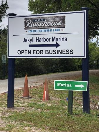
Back at the boat we decided on an early dinner at Zachry’s Riverhouse, the restaurant at the marina. We knew with a 7:00 pm mass we needed to eat early and to allow time to get to church. Mark had arranged for a hired driver as the Uber cars were not available, and it was too far to walk. We could have used the loaner bicycles, but with the coming rain and that it would be dark when we left, we did not think this would be a good idea. So we went to dinner and sat at the bar so we would not have to wait for a table. We had simple salads with tuna (Mark) and grilled shrimp (Denise) and left feeling satisfied with our meal.
Bar at Zachry’s Riverfront
Selfie at dinner
Greek salad with grilled shrimp
Zachry’s Riverfront
Later we met our driver at the marina office and she took us to the church. St. Francis Xavier Catholic church is located in Brunswick; a short 8 miles away. But the parish has services on the island and calls it a mission. Since it does not have its own physical location, it “rents” space at the Methodist church. The Episcopalians do as well. So there are 3 different Christian denominations that hold services in the same building.
It was pouring raining by the time we arrived, and managed to get inside before getting too soaked. We made plans with our driver to pick us up in an hour, figuring the usual mass takes approximately that long. We were greeted by a very nice woman and realized we had forgotten our masks back on the boat. Gratefully, the church had some disposable ones at the entrance and we graciously accepted them. There was a very light crowd in attendance, so social distancing was not an issue. One thing we did not count on was that there was no singing and with a small crowd for communion the mass was only 35 minutes. This meant we would have to wait nearly 25 minutes for our ride to pick us up, and since it was still raining outside we weren’t too thrilled.
While Mark called our driver, Denise spoke with the woman who greeted us when we arrived. She offered to return us to the marina, but we advised that we had someone picking us up. She and her husband were like the “super couple” of the mass: he did the readings and the ushering, she did the greetings, and they both took up the offertory during the mass. They were also responsible for locking everything up and they graciously waited with us until our driver arrived, so as not to put us out in the rain. We asked about the attendance and the shortness of the mass. They advised that they used to have singing, but the women who played the organ and was the cantor was elderly and died of Covid. Many of the usual parishioners have not returned yet, and no one is there to lead them in song. Our driver arrived and we thanked them for their patience and generosity. Truly these were Christians looking to help their neighbor.
Mission church
When we returned to the marina the rain had stopped for a bit. Walking down the dock to the boat we had a chance to meet another cruisier (non-Looper) on a large Endeavor Cat (catamaran) that were full-time live-boards. They were from Annapolis area and we spoke about their boat and cruising areas in the Chesapeake. We exchanged boat cards and agreed to look them up if time permitted when we are up their way. By this time the bugs were eating us alive so we bolted back to our boat and stayed in for the rest of the night. Denise worked on the blog and Mark read a book until finally around 10 pm we crawled into bed with the once again pitter-pattering of the rain.
Posted onApril 16, 2021|Comments Off on National Treasure!
Cumberland Island, GA – Thursday, 4/15
We knew that once we left Fernandina we would have only 6 miles to the anchorage at Cumberland Island, so we were in no big hurry to get off the dock. Because of this, Denise was able to get in a run. It worked out great that it was 2 miles from the marina to the entrance at Ft. Clinch State Park; a straight out-and-back down Center St. all the way. Here she ran through downtown Fernandina, passed through the residential section, took in two parks and a slight hill, before turning around and heading back to the boat.
One of the parks (Egan Park) was full of early morning exercisers. Some had just finished up a yoga class, and others were doing “loops” in the park. Others were using the exercise equipment that is like a “seniors” playground. We had seen a similar park like this in Newport, Rhode Island in 2019, but never knew there was one like this here. One runner told her there are four ¼ mile each loops in the park and that is what the walkers and runners were completing with a coach cheering their progress. What a great find and good information to share with other Loopers who might be interested in some exercise while on their cruising adventure. Here are some pictures from this outing:
Central Street
Egan Creek Park
Exercise toys at park
Egan Creek
Entrance to Ft. Clinch
Neighborhood sign
Central Park
Water Tower
House in downtown
Once back at the boat, and with breakfast and showers done, it was time to leave this cool town. Whether a boater or just a traveler looking for a neat small town, we highly recommend this location. It has been a favorite of ours for years, and continues to delight us every time we come here.
We left the marina and cruised past the industrial area, eventually crossing the St. Mary’s inlet. Here we watch for submarines transiting to and from the Atlantic Ocean. Although we saw none today, we have in the past and it is always thrilling.
We arrived at Cumberland Island and had plenty of options on where to anchor; it is a large area and there were few boats. Once settled in we ate some lunch and then spent the afternoon getting caught up on emails, doing some work, and relaxing. It was overcast and breezy, and when the wind was against the outgoing tide the water slapping the boat’s hull was bit loud.
Cumberland Is Anchorage – South
Cumberland Island is part of the National Parks and is known for its sandy white dunes, long flat beach, and the wild horses that roam all over the island. About half way up the island is the Greyfield Inn where John F. Kennedy Jr. and his wife were married. In 2017 we were able to dine at the inn and tie up to their dock for the night, but the park was closed due to hurricane damage. Now the park is reopened and we are anxious to go explore this island.
Near mid-afternoon Todd & Patty (“Alcyone”) came by in their dinghy to see if we wanted to join them on a walk into the park. They too had anchored, arriving before us that morning. We thanked them but declined as we had things we wanted to get done and are planning to go inside the park tomorrow when we have a full day to enjoy it. These were nice folks and we hope our paths will cross with theirs again sometime.
After that, Mark took a nap and Denise worked on cataloging pictures and writing the last blog until the power on her laptop computer died. Eventually, we powered up the generator to charge all devices (iPads, iPhones, computers), and we microwaved a dinner from leftovers in the freezer. Shortly thereafter we were treated to a couple of wild horses as they foraged along the western shoreline of the island.
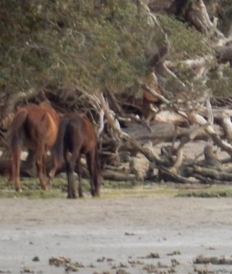
How Mark spent the afternoon
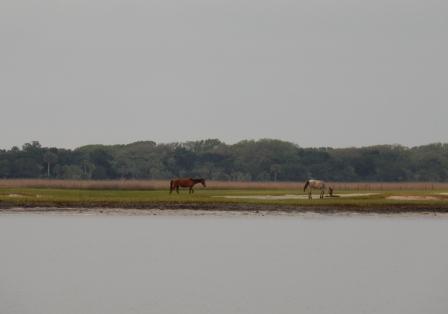
Wild horse on shore
Wild horses on shore
After dishes were done we published the blog, and read until daylight was no more. Despite being overcast all day, we were treated to a delightful sunset over the marsh on the western side of the anchorage.
Sunset at Cumberland Island
There is a saying among the Loopers: “9:00 is Looper Midnight” – and it was true for us. By 9:00 we could no longer keep our eyes open and turned in for the night.
Cumberland Island, GA – Friday, 4/16
As you can probably guess, when you go to bed early, you wake up early. But a 1:30 am wake-up was not what Denise had in mind. The wind had shifted and the boat did too, now pointing a different direction. The water slapping continued and it is quite loud in the master stateroom so she moved to the main salon and curled up on the settee there. Finally sometime after 3:00 am she fell back asleep, waking at 6:30 in the morning to another day of overcast skies.
The weather forecast had the impending rain now delayed until late afternoon, so we took a chance and decided to go inside the park. Mark launched the dinghy and we cruised to the dock where the ferry comes to drop off campers and day-trippers.
Dinghy Dock at Sea Camp entrance
Ferry dock
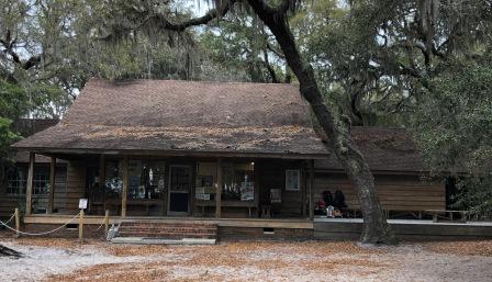
We tied up the dinghy in the authorized spot and then walked up to the Sea Camp welcome area. The entrance fee is $10 per person and you put your money in an envelope and drop it in a collection box. There is a welcome building that all campers must check into when they arrive, and it was manned by a single volunteer ranger. Due to Covid, access inside is limited, but there were very few people around so it was not an issue when we arrived. We got our questions answered about the appropriate trails to take to see what we wanted to see, and then headed out to explore.
Entrance to park – pay fee
Sea Camp Welcome Center
Cumberland Island is a long island and there is so much to see and do, there is no way we could experience it without bikes. You can rent some at the park office, but none were available when we arrived. So, we chose a handful of things we wanted to see, mostly the ruins of the old estate home (“Dungeness”) at the southern end of the island, and the sandy beaches on the Atlantic. We could see both of these if we went to the estate home and then head east to the beach.
From the welcome area it was a bit of hike to the estate, but well worth it. We took the main road hoping to avoid the buggy path along the water. It was tree covered path and since there was no sun, it was not a bad walk. Along the way we encountered a handful of the wild horses, including a new fawn that was being very protected by the others. They literally were within 8 feet of us and this was quite a thrill.
Main Road on CI
Wild horses on main road
We came upon the estate and toured the ruins of the house, originally build by Nathanael Greene (Continental Army General during the Revolutionary War), but later rebuilt by the Carnegies. The entire estate stayed in the Carnegie family until the last of the children died, then it was deeded to a trust who turned it over to the National Park Service. The family wanted to make sure it was never in the hands of developers who could ruin the natural beauty and incredible wildlife on the island. You can learn more about this very cool place here.
Ruins of Dungeness
Overlooking the marsh at Dungeness
Ruins of Dungeness
At one point we stopped to talk to one of the maintenance workers on the island who told us what it was like to work here. He mentioned the wildlife (snakes and gators) he has captured, and we talked about the wild horses. He told us there are around 175, but this year they have lost count because so many have been having babies, as have the eagles on the island. To us it felt like the bugs too had been multiplying and we were getting bitten and swarmed. So we thanked him for his time and pressed on towards the beach. Here we once again encountered the wild horses as they had made a full circle of the grounds and were now following us.
The pathway that led to the beach was long and it felt like a million miles to Mark. It started out ok, then turned into soft sand, and then over the wetlands there was a wooden boardwalk that took you to the dunes and the beach area. Here we found a large driftwood tree, and numerous jelly fish that had washed up on the island. We also saw all kinds of birds along the water and very few people. We also encountered an ATON (aids to navigation) that had to be a remnant from one of the hurricanes. Here are some pictures:
Path to beach
Boardwalk to beach
Denise & driftwood tree
Mark on the beach with dunes
Jellyfish on shore
So many birds
Long flat beach
ATON washed ashore
Knowing we did not want to have to deal with the mass swarms of gnats and bugs around the estate, we chose not to go back the way we came, but to walk north on the beach. We could then pick up the cross trail near the campsites to get back to the Sea Camp Welcome Center. This was the smart decision as the cloud cover kept the temperature amenable, and there were no bugs. Plus, we got to see another group of wild horses, once again protecting yet another young fawn.
Wild horses on beach
The path back to Sea Camp was much easier, but now there were more people in the park. They request social distancing and we did our best to keep away from others, even on the narrow paths. We again encountered a horse, but with all the people about we moved past him quickly to give space; they recommend you do not touch or approach them as they will kick and bite.
We arrived back to the welcome center just at the ferry had showed up with a bunch of weekend campers and all their gear. Likewise there were people waiting to leave on the ferry, so we had to wait until the gangplank was cleared of all before we could get back to our dinghy, and then back to the boat. It was a fun outing and we were really glad that we stopped here.
IO at CI anchorage
Once back on the boat we ate a late lunch and then worked on our travel itinerary for the coming days. We have had a few things to potentially change our original schedule (work, a memorial service for a friend) and now we are putting in contingencies. Denise read a book, and worked on the blog while Mark did some client work, marina scheduling and took a nap.
In the late afternoon it started to rain and it is expected to continue all night and all day tomorrow. We had a delicious dinner of poached salmon and roasted asparagus and some red wine; after all it is Friday!
Calm anchorage
Dinner onboard IO
We are headed to Jekyll Island tomorrow; it is one of our favorite spots along the GA coast and we are looking forward to returning there.
We left St. Augustine at 8:00 am as planned knowing our travel today would only take about 3 hours. Mark had hoped to go offshore to Fernandina Beach (via St. Mary’s Inlet) but the seas did not lay down as expected overnight. So it would be the ICW all the way, winding our way north and slowing for the inevitable fishing boats, slower trawlers, and sailboats along the way.
Morning on the San Sebastian River
The trip was mostly uneventful. We passed by the ever-increasing houses with boat docks in Palm Valley and Ponte Vedra Beach. Denise likes the one on the edge of the state park, particularly their tree fort (not visible in picture).
We passed under all the bridges that are part of Jacksonville, and navigated the shoals of the entrance at the St. John’s River. Here we saw several ships at anchor in the river, and grateful none were moving as can often be the case. This is usually a busy area with large freighters and container ships moving up and down the river as they make their way to the Port of Jacksonville. Fortunately, the crossing was uneventful and we quickly found our way back on the ICW heading north towards Fernandina Beach (Amelia Island).
At anchor in St. John’s River
We continued winding our was north, happy to see that the dredging that had been done in 2019 was holding and we did not encounter any shallow areas along the way, including around Nassau Sound; an area known for chronic shifting of the bottom and the creation of shoals.
White Pelicans in ICW near Amelia Island
We passed under the bridge that takes you to the island and the famous Down Under Restaurant.
Downunder Restaurant
Just past the bridge is the entrance channel to the Amelia Island Marina. Last time we came this way we stayed there because the Fernandina Beach City Marina (located downtown) was still being repaired from hurricane damage suffered in 2016 and 2017. But the marina is now up and running (now part of Oasis Marinas) and we had reservations for the night.
It was just a short time later that we arrived at Fernandina Marina and Captain Mark expertly parallel-parked our Island Office into the slip. Immediately we were met by a knowledgeable young dockhand who assisted with tie-up and our power connection. Within 10 minutes he was back with our Welcome Kit, and all the information we need for our stay. Everything was very efficient and we didn’t have to go up to the office to check-in. Additionally, we were on the inside of the long dock, which meant the big yachts across the dock on the outside would be blocking all the boat traffic passing along the ICW. We were very happy.
We spent the afternoon doing work; Denise had 2 conference calls and Mark had a few issues to handle with clients. Mark then washed all the salt off the boat while Denise did some in-house chores, periodically getting interrupted by passers-by who commented on our boat. In the last few days on the ICW, and at this marina we have seen more Looper burgees on boats then we have ever seen. More and more people are discovering this fun and exciting adventure, and as “Gold Loopers” we are always happy to accommodate.
Because of Covid we were not sure what we would find open for restaurants, but it appears all but one has some form of take-out or dining in options. We were glad to find our favorite “Timoti’s” was open and opted for a quick and delicious bite at this family-friendly outdoor-only dining establishment.
Once our stomachs were full of food we wandered up and down the main street (Center St) of Fernandina and was delighted to see many of the shops were still in business. It must have been a tough few years for this town, but it looks like it is back up and running. There were several new stores and a few old ones, and we were happy to see that the famous Palace Saloon was still operating in its newer post-fire digs. When we lived in Jacksonville and would take our sailboat here, this was a familiar stop at the end of a long day of off-shore sailing up from Mayport.
Palace Saloon
After our walk around downtown, we walked the long dock at the marina, and introduced ourselves to Loopers Todd & Patty on “Alcyone” (like Halcyone without the H). They are from Michigan and have been on the Loop since 2019, interrupted in 2020 due to Covid and some real estate transactions that now have them owning a place in Punta Gorda, FL. We chatted for a while and then completed our walk back to our boat for the night. Tomorrow we will head towards Cumberland Island, GA, leaving the state of Florida in our wake.