
Our days are full and we seem to be moving the boat a lot, so no real time to write these updates. Here is what we have been up to:
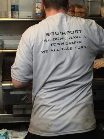
Southport, NC (Friday 5/12)
We left Myrtle Beach at 8:00 in the morning and headed north. Around 11:30 we crossed into North Carolina and eventually reached Southport at 1:30 pm. It was cloudy and overcast, but we enjoyed the 38 miles on the boat, except for when we had to negotiate our way around a dredge that took up the whole channel. This was quite stressful.
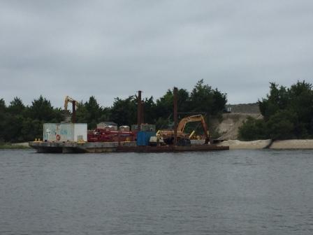
ICW Dredge

Very close pass by dredge

ICW Dredge

Way too close
Along the way we saw the usual houses that line the ICW, the seafood processors that still try to eke out a living, and even a few kayakers negotiating around us in a congested area.
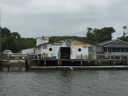
Old Ferry Seafood -Holden Beach,

Holden Beach Seafood
After securing the boat we went to check in at marina office and along the way we encountered David Pike, a guy who is doing the Loop in his 15’ Dinghy (“Journey”). He is an avid Pickleball player and has played in every single state on the Loop. We asked about his sleeping arrangements on this small vessel and he shared stories of Pickleball players who have hosted him in their homes, renting cheap hotel rooms, and even sleeping on the floor of his boat. He is a true adventurer and checks in with his wife every 4 hours when on the loop.
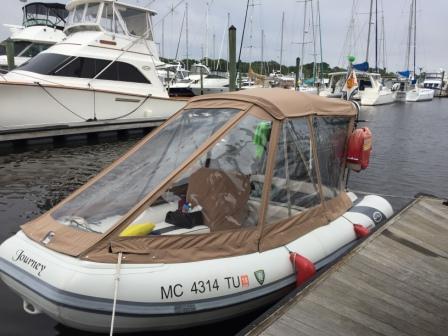
“Journey”

Pickle Ball advocate
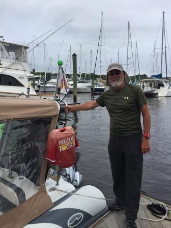
David Pike
Later that afternoon we were visited at the dock by the AGLCA Harbor Host Robert Creech (“C-Life”) who has a house that overlooks Southport Harbor. He and his wife completed their Loop in 2009 and walk the marina docks every day in order to meet all the Loopers who have come into port. It was a very nice gesture and we feel like we will always have a friend when in Southport.
That evening we went to a presentation by Hank Pomeranz (hankd@carolinaYachtCare.com) that was all about navigating the ICW from Southport north all the way to the VA state line. It was incredibly informative and helpful, particularly in areas that have shoaled considerably and for which the navigational charts have not yet caught up. The rule of thumb is pay attention and stay in the marked channel, even if GPS says to navigate differently. It is for this reason that you should never cruise the ICW at night; line of sight is way too important.
After the lecture we walked into the town to get a bite to eat. Originally we wanted to go to a restaurant that had received lots of great reviews, but we arrived to a 45 minute wait and did not feel like eating so late. So we walked back to the waterfront and to our second choice: Provisions Company – a very casual place with very fresh seafood that allows your bar tab to be on the “honor” system. The food was great and very casual, so we called it a success.

Honor beer at Provisions

Inside Provisions
Provisions Shirt
While there we ran into a group of friends who were delivering a Sabre 34’ from Charleston to Hampton, VA, and who had attended the lecture as well. We soon learned that Michelle was the new owner, Kenny was her boyfriend, and Dave & Henry were along for the delivery. They had all been friends for over 15 years and are members and sailing buddies of the same yacht club. We talked about our Back Cove (owned by Sabre) and the Loop, and how we will be in Hampton within a week. We were invited to join them at the yacht club there, and Dave offered to help us with anything when we arrive. See why we love the boating life?!
We meandered back the boat and prepared for an early morning departure. We had a long day ahead of us on Saturday, and needed to head out very early. There was a major storm heading into the area and we wanted to be as far north as possible before we got rained on.
Morehead City, NC (Saturday, 5/13)
We left Southport at 6:40 am and headed north under cloudy skies and cool temperatures (65°). The forecast looked awful for the area, with severe storms coming in. As a result, many cruisers opted to stay sheltered in place and not leave. However, at our cruising speed we were positive we could make it to Morehead City and outrun most of the bad weather. This proved to be true and we didn’t even get any rain; it stayed south of us the whole day.
Because of the pending storms, there were few boaters on the water, so we had to slow down less than we would have if the weather had been great. However, this part of the ICW through NC is one big constant subdivision of houses along the water, many of which have boat docks. Most of these have lifts to keep their boats out of the water, but the occasional one or two have a boat in the water that you have to slow down for (“you are responsible for your wake”). Many of these houses are huge and multi-level and had us wondering what all these people did for a living.
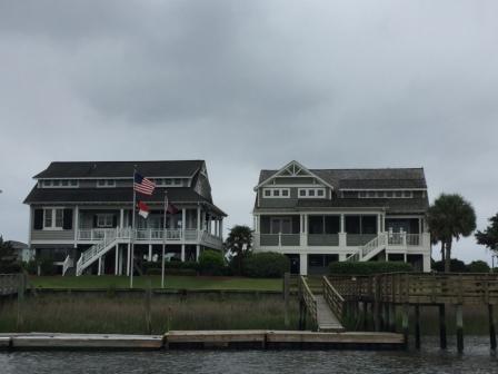
Houses in Holden Beach, NC
We had to wait for two bridges to open along the way; the Surf City swing bridge, and the Onslow Beach Bridge (at Camp LeJune) – both of which have very restricted opening schedules and we timed it badly.

Surf City Swing Bridge
Even so, we were able to make it to Morehead City just after 2:00 pm where we went immediately to the fuel dock and added sufficient fuel (100 gallons) to get us to the next cheap stop in VA.
Here are some other pictures from our sights along the water today:
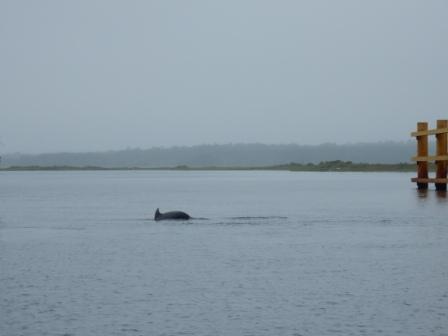
Dolphins near Surf City Bridge

House still for sale – two years later

Kayakers in Holden Beach, NC
From there we were assigned to our slip on C-dock, and we put in right next to a boat we met in Georgetown, SC (“One Eye Dog”). The occupants were not on board, so we proceeded to check in and make arrangements to use the loaner car to go to church for 5:30 mass. Additionally, we had learned that Looper friends Dave and Betsy Frye (“Fryedaze”) were in Beaufort, NC (one mile away) and so we made plans to go by and see them after church for a brief visit.
When we returned back to the boat, April and Larry had returned to “One Eye Dog” and we learned that Kimbob and Ellen had left the boat; they had decided they wanted a different boat and were headed to south FL to buy one. In the meantime they had parted company and Larry and April were continuing on the Loop in their current boat. We chatted for a while before we had to get showers and head to church.
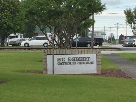
St. Egbert’s
Fortunately this marina has a loaner car, making it easy for us to make the 5:30 mass at St. Egberts; a church we had visited when we were here on the Loop. From there we drove to Beaufort, knowing our time would be short with Betsy and Dave. And it was – way too short. Fortunately, we will see them again in a few weeks and said our goodbyes. We had definitely exceed the 2 hour limit on the loaner car, but since we were the only people requesting it all day and it was after hours, we figured it was better to beg forgiveness then ask permission.
Although we wanted to reconnect with Larry and April that evening, it was much too late when we got back to the boat and we were tired. It had been a very long day, and we were exhausted. The storm did finally did catch up to us and it rained overnight, washing all the salt water off the boat.
Here are some other pictures from Morehead City:
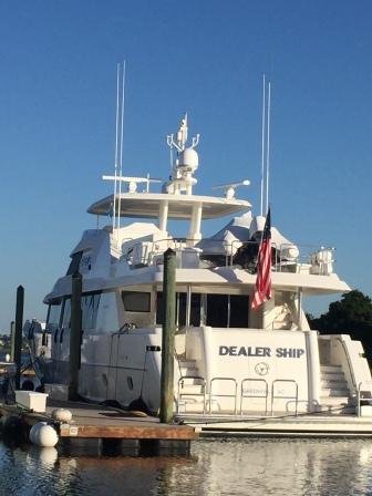
“Dealer Ship” – Boat near us in marina – We loved the name

IO next to “One Eye Dog” and other boats near us
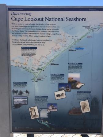
Cape Lookout and Back Creek Anchorage (Sunday, 5/14)
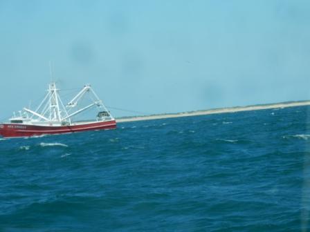
With the passing storm, the weather forecast looked perfect for us to venture into the Atlantic Ocean and cruise outside of Morehead City Inlet to Cape Lookout. Mark has been wanting to go to this area for a long time and it looked like our plans to go there and anchor out overnight were going to come to fruition. We headed out around 9:30 am and found a beautiful calm ocean and a pleasant day to be on the water. There were a few commercial fishing boats that seemed to hug the direct line course to the Cape, but it wasn’t until we hit the entrance to the harbor that we had to negotiate around hundreds of small private fishing boats that were in an obvious tournament. It was a mad house!

Calm Atlantic Ocean
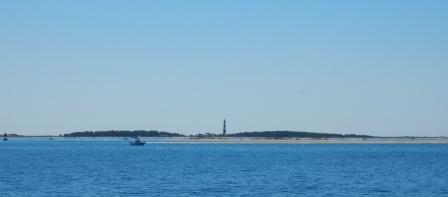
Cape Lookout
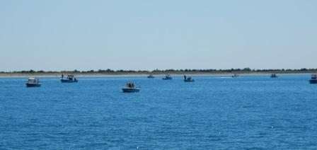
Fishing boats blocking entrance
We cruised around the harbor and located a spot to anchor that would be a good location for the night; buffered by sand dunes to the Southwest and West. Immediately, we were really surprised at how beautiful the water was here; almost tropical in color and very clear. We ate a quick lunch on the boat, then launched the dinghy to take us east to the park and go exploring. It was quite a distance to the eastern side of the harbor, but our dinghy engine (now fixed) worked great and we were there in no time.

Cape Lookout Lighthouse
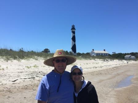
At Cape Lookout Lighthouse

Mark at Cape Welcome Center
Welcome Center Signage

Boardwalk to lighthouse

Boardwalk to beach
Atlantic Ocean from shore
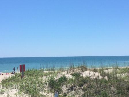
Unfortunately, we were unable to climb to the top of the lighthouse as it is only open during the summer season – and was scheduled to open on 5/16! Go figure we were just two days too early! But that didn’t deter us from exploring the surrounding areas and taking the boardwalk to the beach. There we explored the soft sand, watched surfers tackle the pretty good size waves, and collected some beautiful shells. This spectacular park is located south of Cape Hatteras and the outer banks of NC, and is part of the National Parks Service. You can learn more about it here.
After a while it got hot and a little buggy so we decided to head back to the boat and relax. This time Denise was driving the dinghy and it was a bit of a learning experience; she forgot that it drives with a “tiller” so you push the engine handle in the opposite direction you want to go. At the same time you have to turn the handle to increase or decrease the speed, all the while doing it left-handed. It was a bit challenging when you throw in the fact that the place was getting crowded with boats and we had to navigate around many that were bigger and faster. And on the way back we noticed that it had become a little rougher in the harbor and the wind had picked up a bit.
When we got back to the boat we called some of our family members to wish them “Happy Mother’s Day” and work on the blog post. Mark began looking at the weather, which now was predicted to blow 35 knots during the night. We had already noticed the anchorage was rolling a bit and it was getting uncomfortable. Fearing it would only get worse, we made the decision to leave and head back to Morehead City. Even though it was almost 4:00 pm, we knew we had sufficient daylight to make it back to a marina, or even further up the ICW where there were several anchoring spots we could tuck into that would offer much better protection.
So we pulled up the anchor and headed into the Atlantic Ocean that was now a washing machine of waves. The seas had gone from beautifully calm to 4-foot swells and choppy. Our poor little boat got tossed around, and to make matters worse the commercial fisherman were hogging the most direct (and comfortable) course to Morehead City Inlet. Since they have right-of-way we had to navigate around them, making the 6 miles seem endless. Eventually, we pulled into the inlet where things were much calmer, but not before hearing a small craft hailing the Coast Guard for assistance; it was probably a very busy afternoon for them.
Negotiating around fishing boat
We continued up the ICW until we found a protected anchorage (Adams Creek) as identified by Active Captain – one of the greatest aids to navigation. By 6:00 pm we had put the anchor down and shortly thereafter poured a well-deserved adult beverage. We grilled some freshly caught Mahi we had in the freezer (courtesy of a boater in Charleston) and made fish tacos for dinner. It was delicious and we were happy to be in a beautiful anchorage with no boat traffic, which was fully protected. With no light pollution we were graced with a spectacular sky full of stars and a very bright moon.
South of the anchorage

Denise at Adams Creek
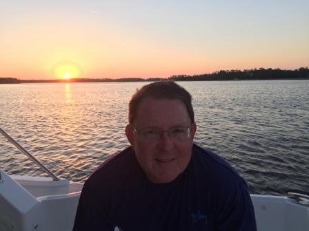
Mark at Sunset
And this is why we do this……
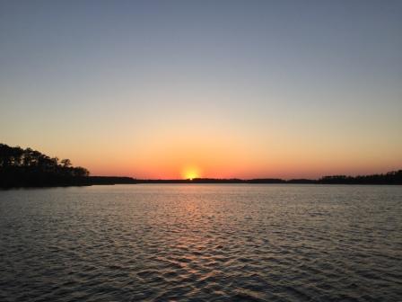
Sunset over ICW at Adams Creek
Oriental, NC (Monday, 5/15)
Since we had anchored so close to the entrance to the Neuse River, we knew it would take us no time to get to Oriental. Although Denise was up before the sun came up, we didn’t leave the anchorage until just after 8:00 am. However, it only took us a little over an hour to pull into Oriental harbor and so we first went to the city dock where they have a free pump-out station. It was not working that great and it took forever, but we finally got our holding tank emptied. We then moved about 50 feet into the Oriental Marina slip we had been assigned and tied up for the day and night. The good thing about getting there so early was that we had a chance to explore the town a little bit, work on this blog post a bit, and get some work done for our clients. Additionally, Mark was able to give the boat a good scrubbing as it was covered in salt from the beating in the Atlantic Ocean on Sunday.
Oriental’s slogan is that it is the “sailing capital of North Carolina”, but you would think it was known for the number of still-operating fishing boats. The small harbor had a handful of these large boats in port and they maneuvered around the recreational boats in the marina with such ease it was amazing to watch.
Although we were the only boat that had a reservation at the start of the day, by afternoon things started to fill up. Several sailboats came in, as did a handful of cruisers, and we got to meet a few of them. On the port (left) side of our boat was George and Caroline (“Lydia B”), loopers who now live in Venice, FL, but who are originally from Maine. In fact, George is a former lobsterman and their boat is a Duffy – a classic down-east design. On the starboard (right) side of our boat was “Stillwater” – the Sabre 34 whose owner and delivery crew met in Southport.
That evening we all met for drinks at the very nice patio deck that the marina inn offers to its guests. After some socializing and getting to know each other a little better, we opted to eat dinner at the onsite restaurant Toucan Grill. George and Caroline opted to eat aboard their boat, so we said good night and wished them luck on the rest of their loop adventure. We hope to see them next winter in Venice, should we decide to take our boat to the west coast.

Michelle, Kenny & Henry

Cruiser Happy Hour
We then went on to dinner with Michelle, Kenny and Henry and heard more of their stories. After dinner we double-checked the weather for the next day and confirmed that we were still good to cross the Pamlico Sound and go to the Outer Banks for a few days.
Here are some pictures from Oriental:
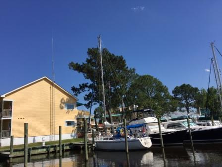
IO at marina
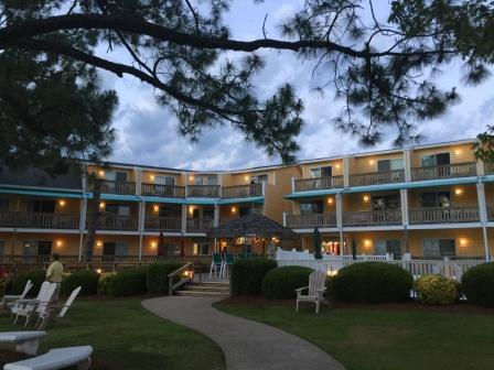
Oriental Marina & Inn
Sign at marina

Marina & Inn sign

Oriental Marina and Inn – Street view
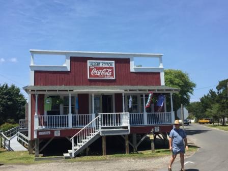
Provision Company
Home mural
No more “Breakfast”?

Porch dragon on home
Ocracoke, NC (Tuesday, 5/16)
It must have been a bit of anxiety about the open water passage on the Pamlico Sound, which caused Denise to be wide awake at 5:00 am. Eventually, she got up and put on her running shoes to relieve that stress. Unfortunately, the historic town of Oriental is so small that an “out and back” run was only two miles. So she continued past the marina and ran through the neighborhood for another 1.5 miles before stopping. Here are some of the sights from her run:

River Neuse Suites

Neuse River
Shop across the street

Morning in the harbor
After cooling down she went across the street to “The Bean” coffee shop and got a terrific cup of coffee, as well as breakfast: a cinnamon bun for Mark and a cinnamon muffin for herself.
“The Bean”
We took one more look at the weather and agreed we would be fine to head to the Outer Banks. So, at 9:00 we left Oriental and headed out on the Neuse River, and eventually on to the Pamlico Sound.
It was a beautiful day on the water and we were not alone. There were sailboats, cruising yachts, sport fishing boats, crab boats and even car ferries. Not a cloud in the sky and the mostly flat seas made it a great day to be on the water. We had an uneventful 40 miles and it took us less than 3 hours to get there.

Crabber working traps
It had been over 20 years since we were on Ocracoke Island and it was hard to remember what it used to look like. So after we secured the boat at the end-tie, we decided to walk around the town. Our little walk ended up being nearly 3 miles once we went out to the lighthouse and then around to the beach side of the island, but we did not go on the beach. We saw all kinds of cute cottages, many souvenir and t-shirt shops, and even some wildlife.
Here are some pictures from the island:

Entering Ocracoke Harbor

Coast Guard Ocracoke

Our dock at Anchorage Inn

IO at Anchorage Inn

Heading out for an adventure
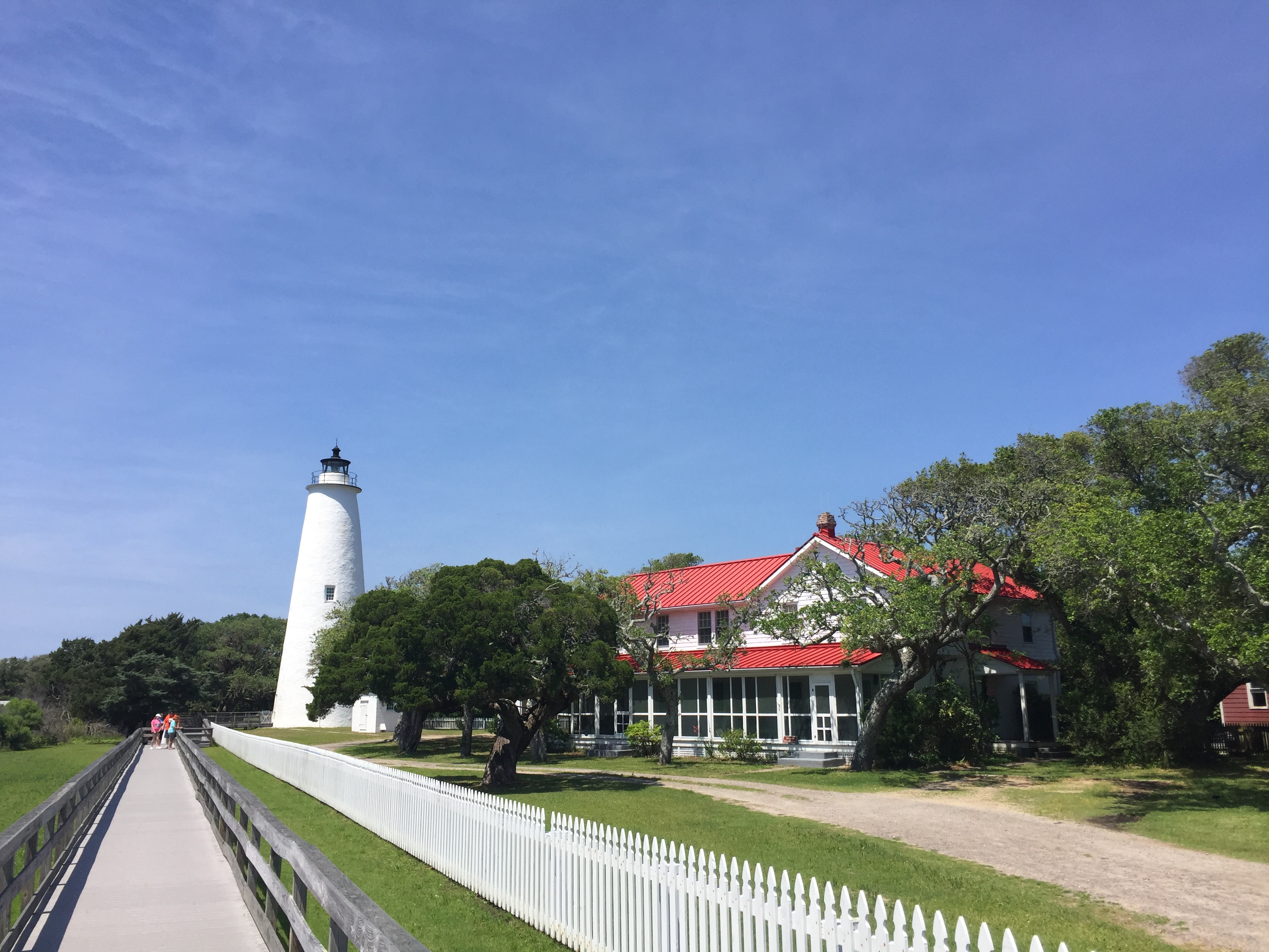
Ocracoke Lighthouse
After we got back to the boat Mark took a nap and then rinsed the salt off the boat while Denise worked on the blog. We decided to stay in for dinner as we had some leftovers in the fridge and didn’t feel like a big meal. In the evening we were entertained by the local sports fishermen who were coming back into the marina with their catch, as well as a few sailboats and kayakers who ventured out for the spectacular sunset. It was a great day and we ended it on a high!
Here are some other pictures from Ocracoke:
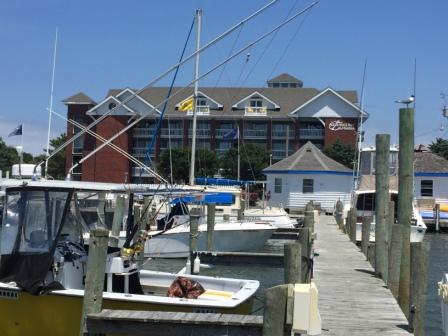
Anchorage Inn & Marina

Community Store

Kids shopping cart at Community Store

Harbor Pano
Turtles in water
Souvenir shop in old general store
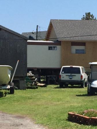
Doublewide or house in the making?

Ocracoke cottage

Ocracoke Harbor homes at sunset

Ferry in early am

Lighthouse at morning
Manteo, NC (Wednesday, 5/17)
It is with God’s grace that we were able to leave Ocracoke and cruise across the Pamlico Sound in near-perfect conditions. It is a very large body of water that is shallow, so the least amount of wind can cause quite a build-up of waves. Fortunately, we had calm winds and seas that were less than 2’. Additionally, since it was blowing out of the southwest so we got a nice little push from those waves. This enabled us to zip through the crossing into the Croatan Sound which is bordered by Roanoke Island and the Outer Banks to the East, and Alligator River National Wildlife Refuge on the west, and therefore offers more protection and even calmer waters.

Bodie Island Lighthouse – on the Outer Banks
As we approached the town of Manteo, we had to go through a very narrow channel that is also incredibly shallow if you go outside it. It was very slow going as there were 3 sailboats arriving into the Anchorage Inn and Marina ahead of us, and they were taking their time getting their slip assignments and getting tied up. While waiting in the harbor for our slip assignment, we got to see someone on a rental jetpak – the last time we saw this was on the Illinois River in 2015.

Water “Jetpak” rental
Eventually, we arrived at the dock and were happy that the entire trip of nearly 60 miles only took 4.5 hours. After securing the boat and checking in, Denise did a few quick loads of laundry. Mark made some calls and did some billable work for his NC client.
Afterwards, we decided to walk around to see this historic town and figure out what we were going to do for dinner. There was a restaurant that we wanted to go to near the marina that had received rave reviews and looked very enticing. However, when we checked into the marina office we learned that a sailing club from Oriental, NC was also here for one of their gatherings and their 25 members were scheduled to have their dinner at that same restaurant. But we decided to go by and see what the place was like anyway. It was too early to eat, so we checked out the menu and decided we really weren’t up for the food they were serving. So we opted to pass and continued to do reconnaissance around the town.
We walked around the waterfront area, trying to remember what the place was like 25 years ago when we were here last. Of course nothing looked the same and we just figured out that was because of our “aging” minds. But as we walked back out towards the bay and the old lighthouse (now Maritime Museum) area we learned that in 2011 Hurricane Irene caused a huge flood in the town and much of the waterfront was affected, and has since been rebuilt. No wonder nothing looked familiar.
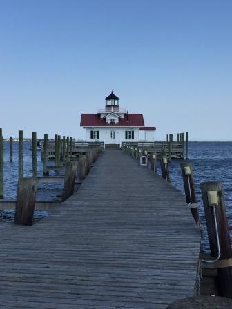
Roanoke Island Maritime Museum
US Weather storm warning tower

About the weather tower

Hurricane Irene sign
Here are some pictures from the way the town and waterfront looks now:

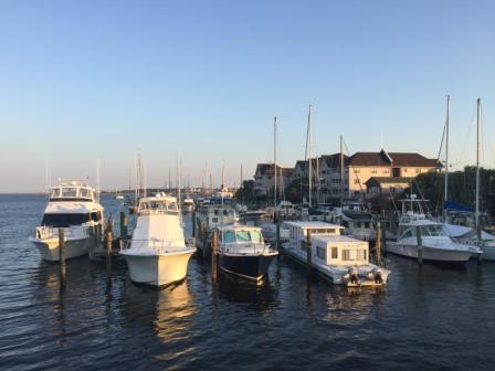
Manteo Waterfront

Manteo waterfront
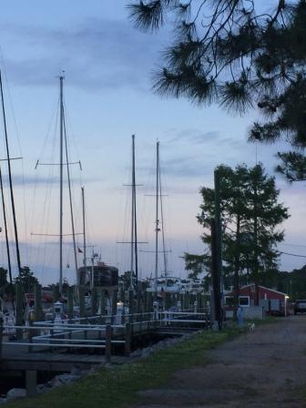
Waterfront Marina Boardwalk – older section
After our walk around the town, we went back to the boat to do emails, and to do a little more research on places to eat. We opted to try Ortega’z – A Mexican-like restaurant that had a fresh twist to it, and walked the two blocks from the marina to the restaurant.
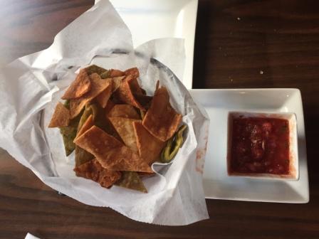
Chips & Salsa
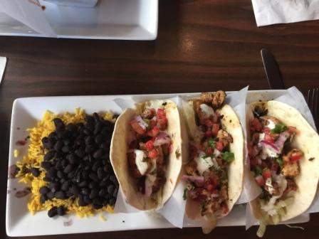
Tacos at Ortega’z

Ortega’z
After dinner we stopped and got an ice cream cone at the shop right near the marina office. All day long we watched people come out of the shop with great looking cones and happy faces. The funny thing was there must be 15 different places to get ice cream all within a 3-block radius of where we were, but only the one by the marina stayed open until 8 – thereby affording us a nice dessert.
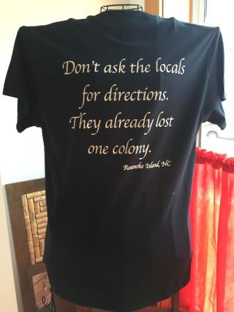
Manteo is a cute community, but another one of those typical water-based towns that have lots of “shops” to buy things we don’t really need. Other than the running store and a pottery store (both of which had just closed when we went by) there was nothing more in the historic area that interested us. Besides, most of it closes at 5:00 pm or earlier during this time of year. We are learning the season here starts just before Memorial Day, and we are just a week too early. This area is known as the Lost Colony and is represented in all kinds of souvenirs you can buy in the numerous gift shops. You can learn more about the numerous attempts to settle this place in the 1500’s (and how it came to be known as the Lost Colony) here.
The one really cool part of this area was the Roanoke Island Festival Park that was directly across the water from the marina. It houses an historical museum and grounds, including a replica of the ship that brought some of the earliest settlers to this community. We walked across the bridge into the park and explored the main building which houses the welcome center, but since it was closed for the day there was not that much more we could see.
Originally we had planned to stay two days here, but after the day’s explorations we determined it wasn’t worth staying the extra day. Tomorrow’s weather was going to be great for crossing the Albemarle Sound, and the thought of arriving in Hampton, VA a day earlier than planned (after Coinjock) was more enticing. Fortunately, we had only paid for one night of dockage when we checked in and now we readied the boat for a departure in the morning.
Here are some more pictures from Manteo:
T-shirt in store
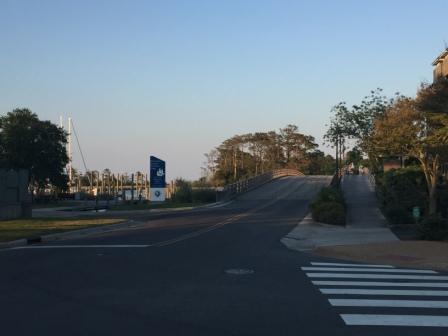
Bridge to Roanoke Is Festival Park
IO at Waterfront Marina

Selfie in Manteo
One final note about coming this way: We were so happy we had a great weather window that enabled us to spend so many hours on the very exposed Neuse River and Pamlico Sounds. They are nature at its finest and we loved being on the open water. It also meant that we did not have to go into the Alligator-Pango canal and the Alligator River, whose ugly brown water is responsible for the brow that appears on the front of so many boats once they have transited these waterways. While more protected, it is not as pretty (to us) and can be full of stumps and debris as well. Hopefully, we can return on the same route when we are headed south this fall.
Coinjock, NC (Thursday, 5/18)
We probably could have left Manteo and gone all the way to Hampton, VA in one day, except that we were going to have to go through 3 bridges and a lock – all of which had to be perfectly timed. Since the wait time before some of these was unpredictable, it did not make sense to plan to do the 90 miles in one day. So we scheduled our Thursday night stay to be at Coinjock, about 30 miles before the first (swing) bridge and a place we had so much fun at when we were on the Loop.
We left Manteo at 9:00 am and entered the Albemarle Sound under cloudy conditions. It was a bit breezy and the waves were 1 – 2’ but tolerable. This Sound is much smaller than the Pamlico Sound and so by 9:40 we had entered the North River, and by 11:45 we were in Coinjock.

ICW near Coinjock

Bridge before Coinjock
When we arrived the dockmaster put us at the extreme southern end of this 1200’ dock, with half our boat hanging off the end of the dock – even though we were the only boat that had arrived for the night’s dockage. This was the exact opposite spot we were at when we did the Loop; then they put us at the extreme North end of the dock. We soon learned that the North River Swing Bridge (30 miles north) had broken; unable to make its 9:00 am opening and they didn’t know when it was going to be fixed. As there is nothing between it and Coinjock, all the boats that had left that morning were coming back for the night’s stay. Add to it all the other boats with reservations for the night, and they were looking for every inch of space. They also advised us that there was a high likelihood that we would have to have another boat rafted to us. We were grateful we had made reservations at the dock and at the restaurant as it was going to be a full house.
We walked up to the marina office to check in and we saw that Looper David Pike, (“Journey”) whom we met in Southport had his boat (dinghy) tied up to the dock. Unfortunately, he had no reservation and they were not going to be able to accommodate even his 15’ boat. We offered to let him raft to us for the night, but he was going to go across the water to Midway Marina – a very run-down place whose restaurant had closed and for which there is no power on the docks and no marina services. We wished him luck as he took off and we did not see if he got in or not.

Journey at Coinjock dock
During the day, Denise worked on the last blog posting and cataloging all the pictures taken to date and Mark washed off the boat and did some office work. First all the power boaters, then the sailboats poured into Coinjock and the experienced dockhands had them tied up and rafting together in no time. We had put the VHF radio on so we could hear the boats coming into Coinjock as they attempted to get dockage for the night, or find alternatives (for which there are few). By the end of the day there were at least 40 boats either tied to the dock or rafted to others and everyone wanted to know the status of the North River Bridge. We too wondered if the bridge would be fixed in time for us to leave tomorrow and make it all the way to Hampton.
Fortunately, we had made previous reservations at the restaurant, as you have to if you want their prime rib. This is the dish that they are most known for, and not knowing this the last time we were there we did not get it. So we put in our request this time; splitting the 32 ounces, and leaving enough left-overs and another meal at a later point. The prime rib was good, but we both agreed we would not get it again – their fresh seafood is actually better. But their home-made potato chips are what we really love and they are great! (Sorry we ate them all before we could get a picture).
As Mark would put it, Coinjock is like the stage coach stop in the days of the Wild West; everyone here is just passing through. There is a saloon (bar), restaurant, bath house (showers) and the “usual” suspects (delivery boat captains) who come through here on their way to somewhere else. All that is missing is the “ladies of the evening” and the “can-can dancers”. But it is etched in our memories as the place we met AJ, Brian and Mike and had a great time in May 2015. (See “All Walks of Life” post from 5/6/2015 here). This time our memories are just as great and we met many other people, including new Loopers who were rafted behind us on the dock.
Rafted and stacked up at Coinjock
Rafted behind us
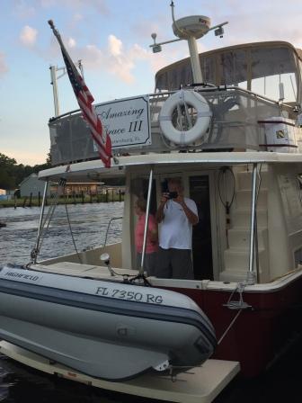
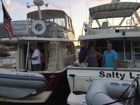
Loopers from Amazing Grace
We went to bed hopeful that tomorrow we will be able to leave as planned.
