
Manasquan, New Jersey (Thursday, 6/8)
It was a cool morning when we left Atlantic City, and fortunately there was only a slight breeze. So we moved forward with plans to go north up the New Jersey ICW, and left the docks as the tide was coming in. We wanted as much water in the narrow and shallow parts of ICW so we would have every advantage and prevent a mishap.
We had been coached on the route by Looper friends Evelyn & Clark Woodworth (“Sea Moss”/”Sunset Delight”) who live in New Jersey and knew the waters well. Their helpful hints allowed us to cruise without incident, and for that we are grateful. We found a lot of the way to be similar to parts of the Indian River in Florida where there is lots of open water, but only a small portion is navigable as the rest is too shallow for most boats.
Here are some pictures from the early part of the trip:
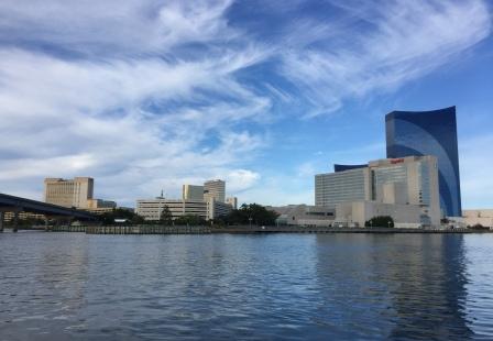
Leaving Atlantic City

Rutgers University Marine Field Station
The natural beauty of the ICW was soon replaced by numerous houses that line the eastern shore as the ICW turns close to the barrier islands. For several miles we traversed “no wake” zones and the communities of Beach Haven and Long Beach that had houses on the ICW and boardwalks or beaches on the Atlantic Ocean side. However, other than those areas, we were able to go full speed ahead at 20 knots.
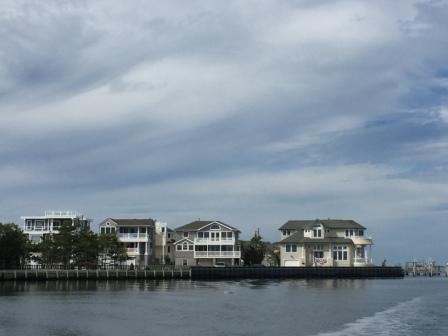
Houses at Long Beach Township
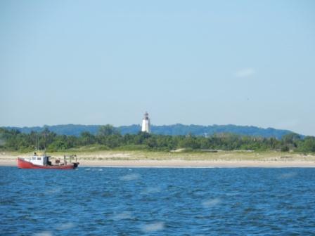
Soon we came to Barnegat Bay, a very large body of shallow water that was full of fishing boats and other cruisers – far less than we were led to believe would be there, but we attributed that to it being a weekday. It really is a beautiful body of water and it was enjoyable to experience this much-talked about cruising area.
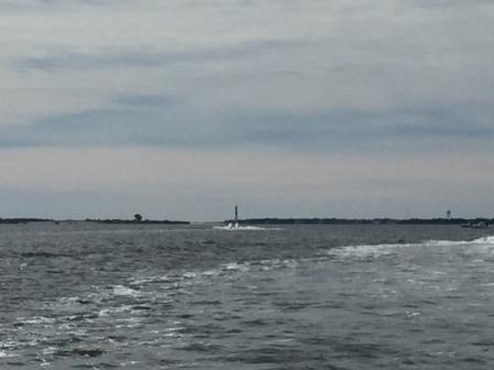
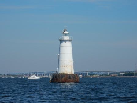
Barnegat LIght and Oyster Creek Channel
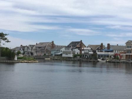
Homes in Barnegat Bay
Eventually we came through Bay Head Harbor and the Point Pleasant Canal, which is a two-mile long man-made canal that empties into the Manasquan River. In this canal you have to go under two bridges, but we could clear them without requesting an opening. The current was now running in our favor, so even though we were at “no wake”, we were picking up an additional 2 knots of speed through this narrow area.
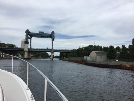
Approaching Lovelandtown Bridge
Point Pleasant Canal
Home in Manasquan River
Within no time we arrived at Hoffman’s Marina (west) where we assigned to an end-tie. Normally, we would have liked this setup, but the swift current and the numerous boats passing by (ignoring a no-wake rule), made this an uncomfortable situation. More importantly, the fixed docks were not conducive to our exiting the boat as there is a 4 foot tide and our boat was way too low to get off easily. Another contributing factor was the railway bridge about 100 yards away that would blow a loud whistle when it was ready to close or open (which happens about 2x per hour). When we checked in at the marina office, they were more than happy to accommodate us and found us a slip (with lower finger piers). At slack tide we moved the boat and were much happier to spend the night in the new location.
Here are some pictures from the marina:

Hoffman’s Marina
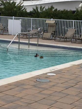
Ducks in pool – Hoffman’s Marina
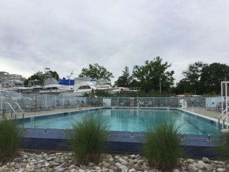
Pool at Hoffman’s Marina
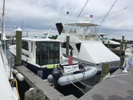
IO at Hoffman’s Marina
We were trying to decide what to do for dinner as there are several choices in the area, and we spent some time using YELP and Open Table to determine which option was the best. We opted for one of the restaurants (“Waypoint 622”), located at the marina, which allowed us to do a quick load of laundry while we ate; taking advantage of the free laundry offered by the marina.
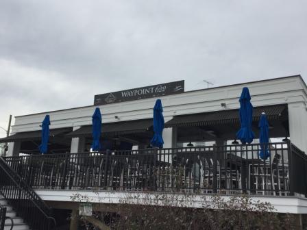
Waypoint 622 Restaurant – Facing Marina
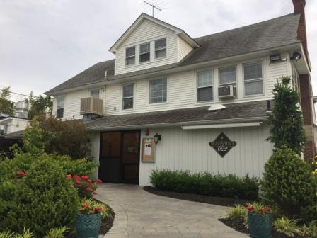
Front entry Waypoint 622
Waypoint 622 has outdoor dining and a bar area, but the weather was too windy and uncomfortable so we chose inside instead. When we walked into the place we felt like we stepped into a scene out of “Good Fellows” or “Sopranos”. The décor and atmosphere was stereotypical New Jersey restaurant, and they had a young guy singing Frank Sinatra and Dean Martin songs. The place is not that big and it filled up quickly shortly after we arrived. Our food was delicious and we couldn’t stop laughing at how art really does imitate life.
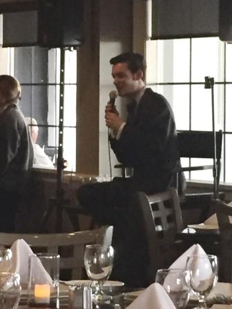
Zachary Alexander performs

Denise at Waypoint 622

Fried Calamari
After dinner we walked back to the boat, picking up our laundry along the way. We confirmed our plans to leave in the morning, cruising up the Atlantic Ocean and onward to Staten Island. The weather looked favorable and we were hopeful it would hold true.
Staten Island, NY (Friday, 6/9)
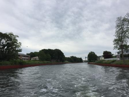
Again we woke up to a cool morning requiring long sleeves, and long pants for Denise. We left Hoffman’s marina at 8:00 and made it easily through the railway bridge and out into the harbor. There were lots of boaters heading out offshore; mostly fishermen who were anxious to finally have a good weather window.
Here are a couple pictures from the beach area around Manasquan as we left the inlet:

Manasquan Beach Lifeguard Station

Manasquan Inlet – South side
We entered the Atlantic Ocean and found very favorable conditions. There was a 1 -2 foot swell from the east, and there was little wind, making it acceptable to cruise the 20 miles up to Sandy Hook before we would face a west wind. We cruised about 3 miles offshore at our usual 20 knots, passing along beach clubs, casinos, condominiums and even Asbury Park’s convention center.
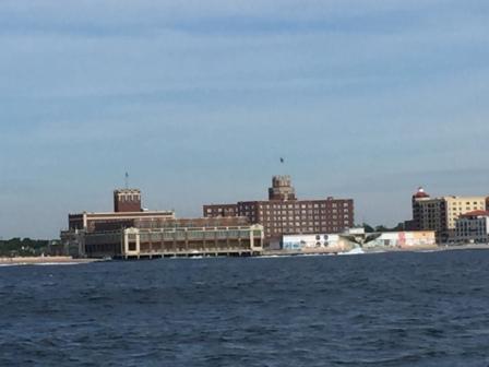
Asbury Park Convention Center
It was a pretty clear day, and very soon after leaving we could see the New York City skyline. It really is amazing to be 20 miles away and still be able to make out this very distinctive landmark. Even if you are not a fan of NYC, it does evoke emotion as being as “American” as apple pie and baseball.
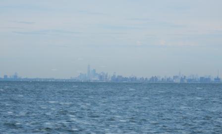
NYC from 20 miles away
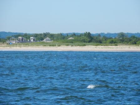
Before long we approached Sandy Hook and came up to Highlands Beach and Gateway National Recreational Area . These beaches are really pretty with white sand and no development to interfere with nature. This is just one part of the Gateway National Recreational Area which also includes parts of New Jersey and New York. You can learn more about this great National Park here.
Highlands Beach – Gateway National Rec Area
Sandy Hook Lighthouse
From there it was a short 6 miles cruise across Raritan Bay and into Great Kills Harbor on the eastern shore of Staten Island. We pulled into a slip right near where we were nearly two years ago, and we were greeted with hugs by AGLCA Harbor Host John Calascibetta. He had been awaiting our arrival and patiently rearranged things when we got delayed out of Cape May.

John Calascibetta & Mark
Also in the crowd of greeters were (now) Gold Loopers on “Conductance”, whom we had followed and eventually passed along the way in our run up to Manasquan two days prior. After we got settled in we made plans to go to dinner with John & his wife Julie. We both had work to do for clients, and Denise had two back-to-back conference calls that lasted until it was time to leave for dinner.
We traveled with John and Julie up the street to “Coles Dock Side” where we enjoyed great food and even better company. The owner (Larry) came by and said hello to Julie & John as they are regulars. He was noticeably excited as he was heading out to his house in the FL Keys for the week to do some fishing.

Coles Dock Side
After dinner we returned to GKYC where there was a bi-monthly club meeting (men only) and the women (auxiliary) were hanging out waiting on the men to return. Mark brought our dinner leftovers back to the boat, then headed to the bar at the club. Meanwhile, Denise hung out with Julie and met some of the friendly woman at GKYC. There she ran into Lars & Erja Odmark (“Ambikaart”) a Swedish couple who are doing the loop in a Mainship. We talked for a while and agreed to try and get together before the weekend was out. Denise then headed to the bar to join Mark.

Bar at GKYC
About that time the club meeting let out and the bar filled up. Drinks are known to be cheap, and the volunteer bartender was quite busy, so it took Mark a long time to get his bill. While waiting for the bill, we noticed John Scarcella (not to be confused with John Calascibetta) was at the bar and we went over to talk with him. Mark had met John when we were here in 2015 when he and his family were planning on leaving for the Loop in the coming weeks. Although we had followed their progress and we seemed to leapfrog around each other during our adventure, it wasn’t until we were in Miami Beach (and nearly home) in April 2016 that we finally connected again. They too have completed their Loop and are now Gold Loopers as well. We hung out with him until his wife and son made it clear it was time to go. As we were preparing to leave, he offered us his car for use the next day so we could run some errands and we made plans to connect in the morning.
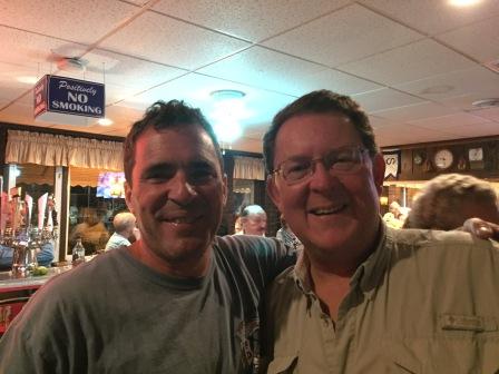
Mark and John Scarcella
Staten Island, NY (Saturday, 6/10)
It was a beautiful morning, although the temperature had risen in the last 24 hours, and a heat wave was headed our way.
Sunrise over natural area – GKYC
Denise went for a run, intending to go out to a park that forms the eastern shore of Great Kills harbor. However, the walking path was overgrown and a sign indicating the trails were under rehabilitation discouraged her further progress. Instead she ran up and down Hylan Blvd, with a few side street distractions, including one along the water that made for a great shot of Raritan Bay.

Raritan Bay – morning run
After breakfast and showers were done, we were able to connect with John S. and use his car to run several errands. We did a major provisioning of groceries, liquor and even got to hit a credit union ATM for some cash. Mark was also able to get a badly needed haircut while Denise worked on cataloging pictures.
We hung out on the boat the rest of the afternoon, constantly stopping to talk with the nicest people at GKYC. We were visited by Santiago, the guy who helped Mark with our “boat issue” in 2015, and others who remembered us from our 11-day visit here. John C. had come by and gave us some freshly caught striped bass he received from another member, and John S. came by as we compared stories of our Loop and learned more about him and his service in New York City, eventually retiring with FDNY.
Later in the afternoon, we used John’s car to attend the 5:00 mass at St. Clare’s Catholic Church. It was only about 1.5 miles away, but with the hills and having to cross Hylan Blvd, we chose to drive. It was a beautiful church located in a middle class neighborhood, and was very warm and friendly.
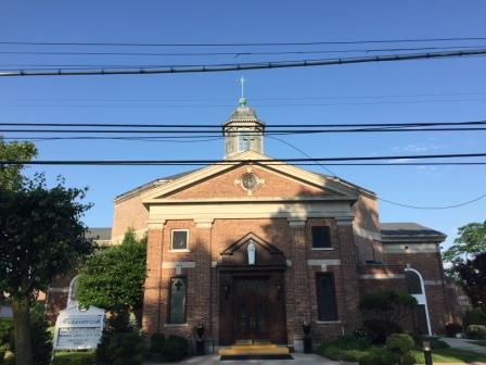
Church of St. Clare
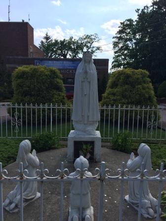
Our Lady of Fatima at St. Clare’s

Inside St. Clare’s
Although there were many dining opportunities and John S. had again offered us use of his car to go anywhere on Staten Island, we opted for eating the fresh fish John C. had shared with us instead.
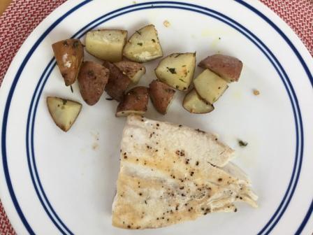
Fish dinner
Tomorrow we would leave for Long Island and we still had some planning to do.
Here are some pics from of the GKYC area:

GKYC

Arch at end of dock
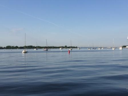
Great Kills Mooring field
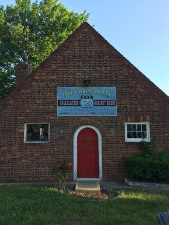
Port Washington – Long Island, NY (Sunday, 6/11)
As much as we hated to leave the family-oriented GKYC, we had places to go and left for Long Island just after 8:00 am.

Great Kills Inlet
Knowing we needed to get fuel eventually, and not wanting to pay New York prices, we headed south across Raritan Bay to Brown’s Boat Yard up the Cheesequake Creek Inlet. It is a much protected inlet with lots of nature around, but the fit into the slip to get the fuel was a bit tight.
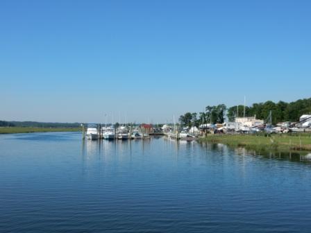
Brown’s Boatyard – Diesel Stop

Tight fit for diesel slip
After filling the tanks and getting a free (with fill-up) pump out, we headed back out onto Raritan Bay and chose to take the longer (and less scenic) west side run up Staten Island to New York Harbor.
“W” Light in Raritan Bay just before Arthur Kill Channel
The channel in this area is known as “Arthur Kill” and is heavily traveled by industrial barges and tows. Initially the coasts on both Staten Island and the New Jersey side are mostly residential, but quickly turn commercial. On the New Jersey side are numerous docks and fuel depots, and on the Staten Island side there is a power plant (or two) other industrial areas.

Looking towards Perth Amboy – West side of channel

Western shore of Staten Island

Perth Amboy – NJ Eastern Shore
Eventually, we came up to the former landfill on Staten Island that is now being converted into a park. Because it is so large in height, you can see it for miles coming up the Arthur Kill channel.

Landfill on western shore
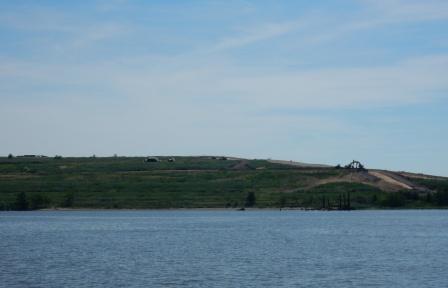
Landfill on Staten Island – future park site
At the foot of the landfill is a refuse off-loading plant where household trash is collected and put on barges to be shipped to “who-knows-where”.

Refuse Center on Staten Island
John C. (at GKYC) had given us all the information about this area as well as the stories about two of the bridges that are under construction along this route. One such bridge is the Bayonne Bridge, which is being raised from 150 feet to 215 feet. They are literally building the new bridge above old one and this marks the transition into the Kill Van Kull channel that eventually dumped us into New York Harbor.
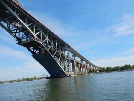
Goethals Bridge (I-278) Building the new over the old.
And then we entered New York Harbor. The last time we passed by here it was windy and cool, but not much boat traffic. Today was the complete opposite; it was hot, no wind and there were so many pleasure boats, ferries, sightseeing vessels, container ships and tugs churning up the waters. Mark was able to slow the boat down for a few classic pictures of the NYC Skyline and Lady Liberty, before turning into the East River.

Bayonne Golf Club, New Jersey side of harbor
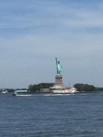
Lady Liberty

NYC Skyline
We passed along Governor’s Island and headed up the East River going under the BMW bridges (Brooklyn, Manhattan, and Williamsburg). This was new territory and we have never been here before on our boat. We then cruised the route that took us west of Roosevelt Island and gave us ample opportunity to take some very cool pictures of the area:

Governor’s Island
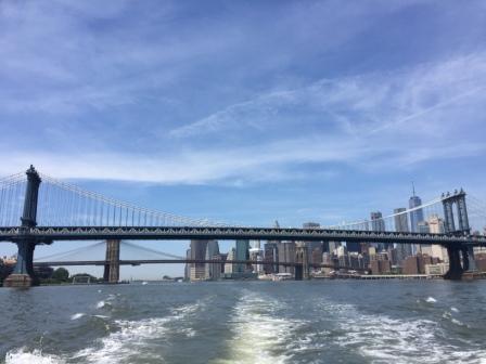
Through the Brooklyn & Manhattan Bridges
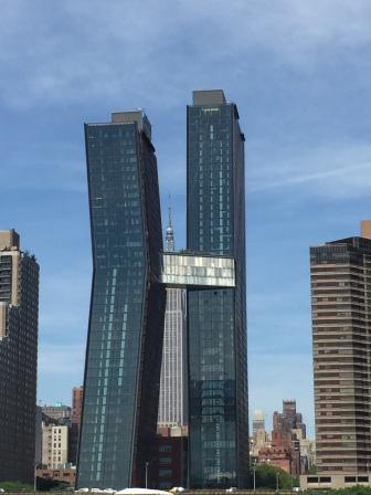
Funny Building on East River
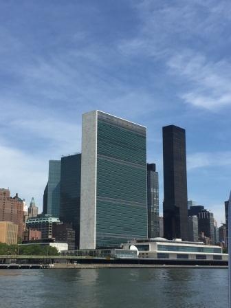
UN Building
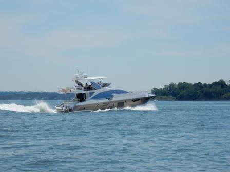
And as we were cruising along who should pass us in the opposite direction was the motor yacht “Magic Days”, whom we last saw in Atlantic City.

“Magic Days”
About the time that we approached the Hell’s Gate area and Riker’s Island, we were infested with millions of tiny bugs that attached to the ceiling inside the boat. We had been running with the back door open which was fine when we had open water, but now that we were in the confines of the East River, it got hot…and now we had bugs. The Captain ordered the door closed, and the generator and air conditioners on. For the next 15 minutes Denise vacuumed until all the bugs were eliminated and everything was put back to normal. Then it was time to make lunch and there was little time for pictures.
Eventually, we passed LaGuardia airport where the planes were landing overhead and there were lots of recreational boats on the water.

LaGuardia Airport
Although the waterway opens up and is quite wide, there is still a channel and many of the power boaters go full throttle, creating a huge wake. It is the equivalent to a 4’ wave in the ocean and really rocks our boat.
Power boater kicking up huge waves
Shortly thereafter went under the Throgs Neck Bridge (I-275), passing the State University of New York Maritime College on our port side, and the US Merchant Marine Academy at Great Neck on our starboard side. This is the dividing line where the East River officially becomes the famous Long Island Sound; a new body of water for our Island Office to experience.
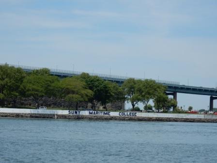
Throgs Neck Bridge & SUNY Maritime College
We cruised past City Island and made a right hand turn into the Manhasset Bay where we were instantly aware of the very large mansions lining the edges of the bay. These houses are the largest we have seen on this trip, and are reminiscent of those on Lake Skaneateles that Denise experienced on the Loop adventure. We are in “Great Gatsby” country and these homes look the part.
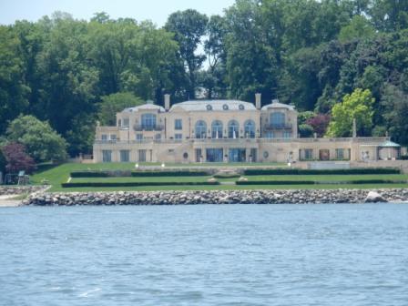
Home on Manhasset Bay

Home on Manhasset Bay

Home on Manhasset Bay
As we approached the Brewer Capri Marina West where we had reservations, we attempted to contact them regarding our slip assignment. However, after numerous attempts via phone and VHF radio, we were unsuccessful and this became frustrating. Instead of motoring in the harbor we pulled up to the fuel dock and got the attention of the dockhand, who contacted the marina manager via VHF and he directed us to our slip. Of course all of this after he told us his VHF radio did not work. Go figure!
We pulled into the slip and looked around to find we were the smallest boat in the “yacht” section of this marina. The next smallest boat was the Hinckley Sedan next to us and was at least 45’ (and probably worth $2.5 million). We were definitely playing with the “fat cats” now. We chose a marina, and specifically this place, as Mark has to leave to go see a client and we needed to be able to get off the boat and into shore easily. A mooring ball for the week was just not going to cut it.

IO at Brewers Capri Marina West
Once we got the boat settled we were able to discover more about the marina and were really happy we chose this place. The floating docks are wide (they drive golf carts on it) and the finger piers are long and in great shape. There is a pool, laundry, restrooms and showers all just a short walk away, and an on-site casual restaurant (Butler’s Flat Clam Shack).

Butler’s Flat Clam House – at Marina

Tables at Butler’s Flat and Marina office
Not long afterwards, the manager rode by in a golf cart and welcomed us. When we told him of our attempts to make contact earlier, he apologized for the lack of response. He also advised that a package for us had arrived and he would have one of the dockhands bring it by.
We then went to work cleaning the salt off the boat. Usually Mark likes to do this by himself, but today he allowed Denise to come behind him and squeegee the windows and dry the stainless. He was definitely hot and a bit tired.
Later over cocktails, we contemplated what to do about dinner. In addition to the on-site restaurant there are a few restaurants in walking distance (1/2 mile away), and we could always take the water taxi across the bay where there were more options. By this time fatigue (or alcohol) had set in and we opted to eat leftovers on board. A few other yachts pulled into the marina, and a dockhand brought our package down to us.
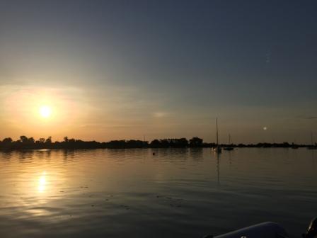
We did manage to get in a walk around the docks before calling it a night, and captured a great sunset on which to end the day.

Sunset over Sands Point
Port Washington – Long Island, NY (Monday, 6/12)
Sunrise continues to get earlier and earlier, so Denise expected to be wide awake the minute the sky started to turn daylight (around 4:45). However, since no alarm was set she actually slept in until 5:30, and then headed out for a run. As we are docked on the northern part of Manhasset Bay and the town of Port Washington is on the southern end, she thought it would be a good to run the 2 miles there and then back, and it was.
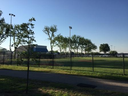
Initially the route was a residential area, but quickly changed to the main street in the village of Manorhaven where there is park that runs along the water. The park has tennis courts, a swimming pool, baseball fields and an outdoor hockey rink (open in winter). Here you can also rent paddle boards and kayaks, when the park is open – which will not officially begin the summer season until this coming weekend.
Manorhaven Beach park pool & tennis courts
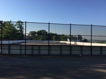
Hockey Rink
Just past the park, the road intersects with Shore Road where she picked up the “Bay Walk” – a paver-laid pathway that runs most of the shoreline around into the town of Port Washington. Along the path there are plaques describing the local birds, fish, and flowers, as well as some art depicting the history of this area.
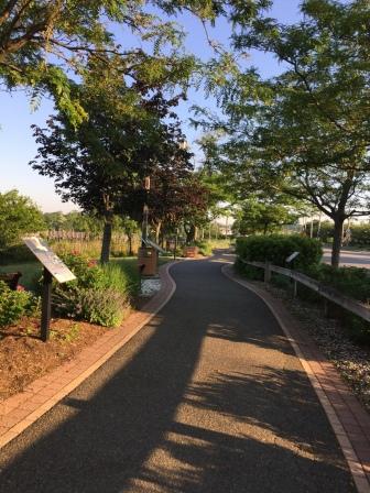
“Bay Walk” along harbor

Mosaic art on Bay Walk trail
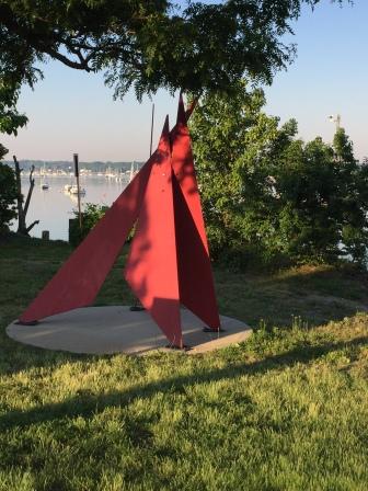
Sculpture along Bay Walk
There is also sculptured art and a nautical bench the result of a 5th grade art project from the local school – Sousa Elementary.
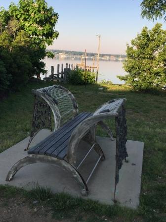
Sousa Nautical Bench
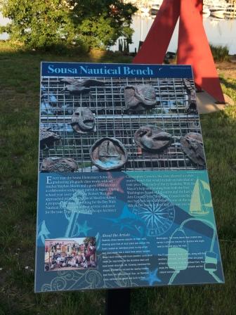
About Sousa Nautical Bench

Village Clock

Bay Walk Park
Continuing into town there is a baseball field, amphitheater and “town dock” where you can pick up a water taxi to take you out to your boat on any of the numerous moorings.
Baseball Field Building
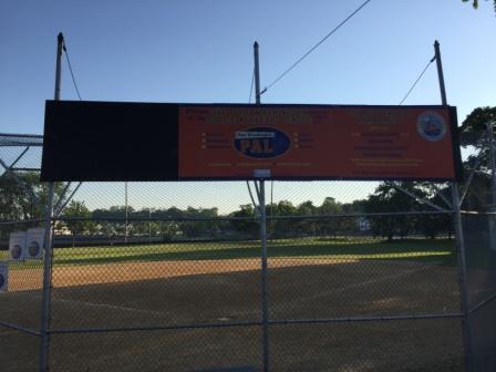
Port Washington Baseball field
Here there is also Louie’s Grill; a popular restaurant that overlooks the bay and has a large dock you can dinghy to or take a water taxi to for dinner. It has been around since 1905 and is known for being a great venue to see spectacular sunsets, but more recently was made famous as it was used in the movie “Meet the Parents”.
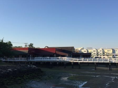
Louie’s Restaurant

Dock at Louie’s
Realizing she had gotten distracted by the sights and that it was getting late, Denise had to quickly run back to the boat as she didn’t want to miss Mark’s departure. He had arranged for a cab to pick him up at 7:30 and take him to LaGuardia airport – at least a 90 minute drive at this hour, even though it was only 17 miles away. She did made it in time to say goodbye and see him off, and he successfully arrived at his client.
For the rest of the day Denise stayed close to the boat, doing work for clients and working on cataloging pictures. Occasionally, she would step outside and talk with the crews who worked the yachts in the nearby slips, but for the most part stayed on the boat. Part of the reason was the desire for some quiet personal time, but also because it was really hot outside, with temperatures in the mid 90’s. Before long it was time for bed and the end of another day.
Port Washington – Long Island, NY (Tuesday, 6/13)
Today was household chore day. First was a trip to the dockmaster to buy quarters, then the laundry, and finally the boat cleaning. The guest quarters needed to be prepared for Claire’s visit (Denise’s sister), which included finding a place for all the stuff currently stored on the bed. Then the bed had to be made up, and the rest of the boat got a good vacuuming and some much-needed TLC.
Add to this was the fact that it was another blistering hot day, with the high temperature reaching 95°. Denise put up the canvas on the back of the boat to try and keep it a little cooler inside and keep the AC’s from having to work so hard. It was HOT!
Canvas up – Sun protection
Also during the day, Denise did some research about places to stay in Maine, connected with friends who have a house in Gloucester, Mass, and another business associate who spends summers on Penobscot Bay in Castine, Maine. All of which adds to the excitement to finally reach our planned destinations for the months of July and August.
Later in the evening the 3-masted sailing vessel “Sound Waters” pulled into the marina and tied up across the dock from our boat. Apparently they are a charter boat from Connecticut and had just the working crew aboard. It is a beautiful vessel and in mint condition, but did look a little funny parked next to a big yacht.

“Sound Waters”
It had been a physically exhausting day, and Denise had all she could do to stay awake until 9:30 pm – not long after the sun went down. Tomorrow Claire was coming and who knows what kind of adventures that would bring. One thing was for sure; the weather was going to change and thunderstorms were predicted during the night. The skyline at sunset gave a hint of what was to come.

Bad weather approaching
