

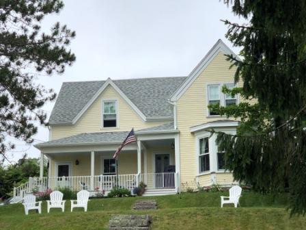
Tuesday (7/13) – Hurricane Island, Maine (near Vinalhaven Island)
We were hoping for clear skies today, but none were to be found, and the forecast was for rain in the afternoon. We left Potts Harbor and the Dolphin Marina just after 8:00 am hoping we would not also hit fog, which looked possible. Our travels today would take us into the Gulf of Maine, at least until we go around Cape Small, then we would be able to take channels that ran inside between the numerous rock islands that line the coast.
We exited Potts Harbor around Haskell Island, passing Little Mark Island to our right, and Bailey’s Island to our left. It was a fairly calm day and the biggest challenge was dodging the numerous lobster pots that were everywhere in our path. In no time at all we rounded Small Point, and passed to the north of Sequin Island. From there we had a direct shot through well-marked channels crossing the Sheepscot River and passing Squirrel Island to our left and the Hypocrites Islands (including Ram Island Lighthouse) to our right. All through this area the water was tame and we continued without encountering any rain or fog.
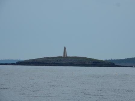
Little Mark Island Monument Light 
Seguin Light on Seguin Island


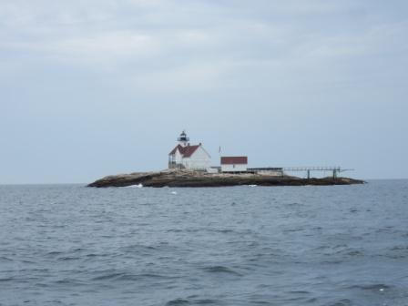
the Cuckolds Lighthouse 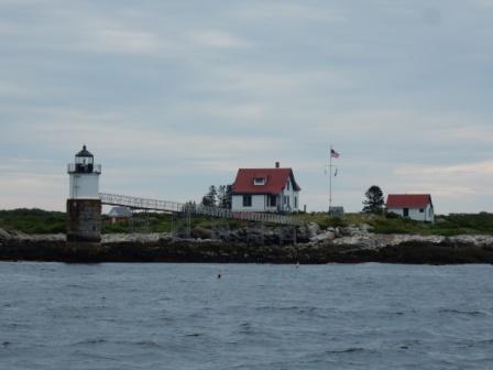
Ram Island Lighthouse


As we approached and rounded Pemaquid Point there was less protection from barrier islands and things were more bumpy, but very tolerable. The wind from the Gulf of Maine combined with the inflowing tide and river currents made for some short waves, but fortunately no whitecaps.
Pemaquid Point Light 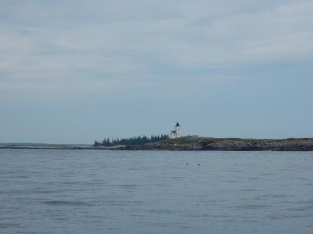
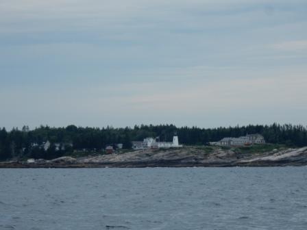
Two Bush Island Light?

Our path was mostly a straight shot across the Muscongus Bay passing Easter Egg Rock Island. We wanted to pass by this small rock island as this is one of only 3 islands in Maine where Puffins come to nest and hatch. Eggs are laid in March and April, and by June and July they have hatched and the young birds are learning to fly. By Mid-August they are all gone to parts further north, but will return next spring. At one time these birds were nearly extinct here due to hunting, but with the efforts of certain Audubon groups, they once again have a thriving population. Today we got lucky and were able to spot a whole group of these very small birds from our boat. It took us a bunch of pictures to even get one to come out as the bumping wave action and distance from the rocks required careful navigation and challenged our basic photography skills.

Puffins
Soon we were back cruising around other rock islands and had a smooth ride until we entered West Penobscot Bay. Then things got bumpy again in the deep shipping channel, but then really calm as we approached Vinalhaven Island. The large island mass truly was a shelter for the eastern side of the bay.
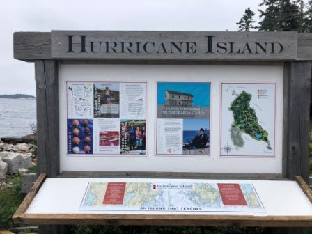
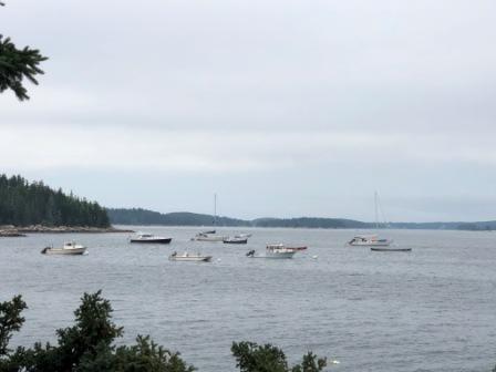
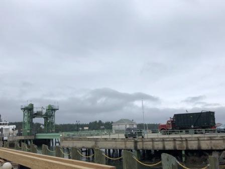
We entered the channel that took us to Hurricane Sound with White Island to our left. Turning south we then entered the area east of Hurricane Island, where we picked up a mooring in the harbor. Here there are several moorings that are available on a first-come, first-serve basis (FCFS). They are courtesy of the Hurricane Island Center for Science and Leadership (HICSL), located on the Island in what used to be an Outward Bound location. The HICSL ask for a fee ($25) to help maintain the moorings and the fee is collected by putting the money in the jar attached to the pennant on the mooring. It is based on the honor system, and we did our part to comply. We had traveled 58 miles in 3 hours and we were ready for lunch.

Approaching Hurricane Island moorings

We were anxious to get off the boat as it was getting tossed about a bit, due to wakes caused by passing lobster boats, the ferry to Vinalhaven Island, and a little bit of current. We launched the dinghy and went onto the island, signing the requisite guest book and reading the “rules” for guests. The HICSL is conducting studies on scallops (farm raised vs. wild) and were using middle-school students in a summer camp to teach and help with some of the research. “Nate” on staff with the center shared with us about the organization and what they are doing, including the building of a future research lab where the old Outward Bound building used to be. It had just been raised last week and groundbreaking of the new facility starts next week.

Scallop research 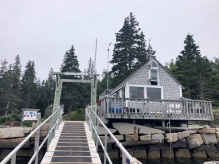
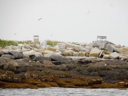
Hurricane Island


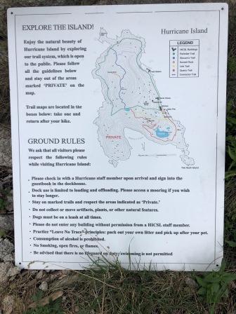
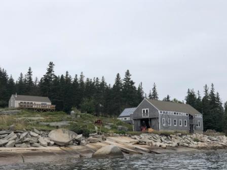
We took a trail map and headed to the south side of the island, passing tent and cabins for the HICSL. The rocky shoreline provided a great view onto the pristine blue green waters Gulf of Maine. Also in this part of the island there is a quarry. This island was originally mined for its granite, and the remaining fresh water quarry it created is now the source of water for the island. We walked up a bit (but not to the top) of the quarry before returning back to the welcome area. From there, we walked the trail north that follows the edge of Hurricane Sound and the mooring area. If we wanted to, we could have continued walking all the way around the island (2.5 miles in total) or on inland trails that would have taken us to an overlook of the Penobscot Bay. However, rain was coming and we didn’t want to get caught in it on slippery paths, so we headed back to the boat.

At Hurricane Island – south shore


Quarry on Hurricane Island 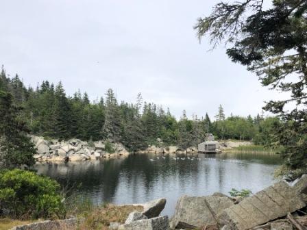
Birds swimming in Hurricane Island quarry


But bird bathing is ok 
Old quarry equipment


Tents for HICSL 
New Research Center dock 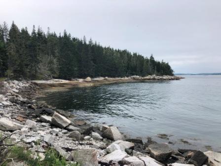
Cove near new research center


Hurricane Island Moorings – IO in top left

For the rest of the day we worked on the boat and prepared and published the last blog update. We were grateful that as the evening wore on, the boat traffic and wave action subsided, and things were much more settled (although not totally calm). We were happy we had leftover clam chowder from Erica’s Seafood as that was our dinner, and it seemed to hit the spot. We just didn’t feel like cooking, and the light rain was such a deterrent that we didn’t barbeque as planned.
Usually this part of Maine is great for seeing millions of stars in the sky at night. However, tonight’s cloud cover kept us from this, and when coupled with almost no light pollution, it was really dark when the sun set. Unable to keep our eyes on our reading, we both feel asleep very early.
Wednesday (7/14) – Perry Creek, Maine (near North Haven)

A southerly wind blew through the rocks at the end of the sound and all through the night the boat rocked and rolled. The water slapping the hull was very loud and because we went to bed early, Denise woke up at 1:30, unable to get back to sleep. At one point (probably as the incoming tide changed to ebb), she thought she was going to get seasick from the motion. Eventually, she fell back to sleep, but woke again at 4:30, and was ready for warm coffee. It was 57° and we needed heat. But she did not want to wake up the other boaters (or Mark) at such an early hour. Finally, at 6:00 am she turned on the generator, put on the heat and a strong pot of coffee.
Mark too was up a bit earlier than usual, and although we were going to leave at 9:00, after breakfast we headed out to go to Perry Creek, near North Haven – another one of the islands that are part of Vinalhaven. By 8:15 we were on our way and we didn’t have very far to go. Our trip to this anchorage/mooring area was less than 10 miles.

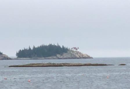
Heron Neck Lighthouse – from Hurricane Island 
Hurricane Island Morning fog

We headed north through Hurricane Sound, then made our way through the narrow but well-marked channel north of Leadbetter Island (called Leadbetter Narrows). It was here that we had a beautiful bald eagle fly right in front of our boat and up around behind us before landing on the rocky shore. We could not get the camera ready fast enough and missed the picture, but witnessed its mate join him. It was a spectacular site in a spectacular setting.

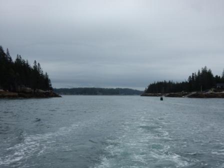
Leaving Leadbetter Narrows
We then entered West Penobscot Bay and in one continuous right hand turned entered the Fox Islands Thoroughfare. From past cruises we knew the shoreline of this area to be lined with beautiful homes and lots of boats.

Browns Head Light – entrance to Fox Islands Thoroughfare 
Entrance to Fox Islands from Penobscot Bay


On North shore of FI Thoroughfare

We cruised past the small village of North Haven, spotting another Back Cove 37 on one of the moorings in the harbor. We turned right into Seal Cove, rounding Hopkins Point and entered Perry Creek, a nice long and narrow creek that is lined with trees. There are mooring here filling the cove, making anchoring next to impossible, but 4 of the moorings are free (FCFS again) with a request to make a donation to the Vinalhaven Land Trust, owner of the lands surrounding the creek. We secured one of the free moorings and found the pristine location to be exactly what we needed. It was incredibly calm and peaceful, and the wildlife was amazing. The only drawback was low-to-nonexistent cell phone (or internet) service.
Rain was forecasted for later in the afternoon, so we launched the dinghy and took it back to the village of North Haven. But before going to shore, we stopped by the Back Cove we had seen when coming through the Thoroughfare. We met Jeff (“The Dawn Treader”) and spoke with him for a while. He and his wife recently bought their 2019 model and he is still getting used to it. They are from Virginia Beach, with property and a business here in North Haven, and will be taking their boat back to VA in the fall. We exchanged boat cards and other information, and then we headed towards shore.
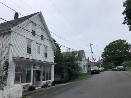
Once on shore we walked through the only town gift shop, walked through an art gallery, and visited a very small market. In the process we learned the only real market on the island is more than 4 miles away and is more accessible via Pulpit Harbor. Although we knew of this, we were hoping to pick up some milk and ice at something that might be closer to a 7-11, but alas no such establishment exists here.
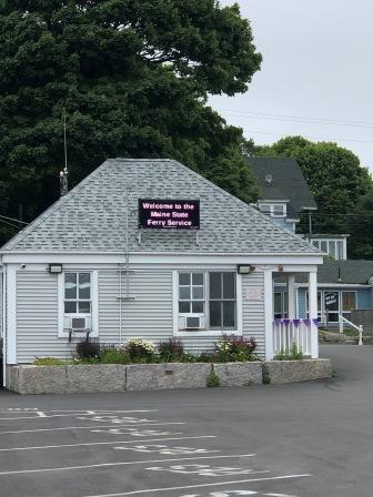
North Haven Ferry dock welcome center 
In North Haven


In North Haven 
shops in North Haven
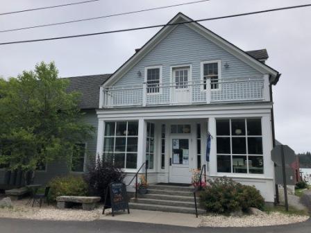
Watermans Community Center – North Haven 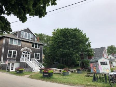
At North Haven Brewing


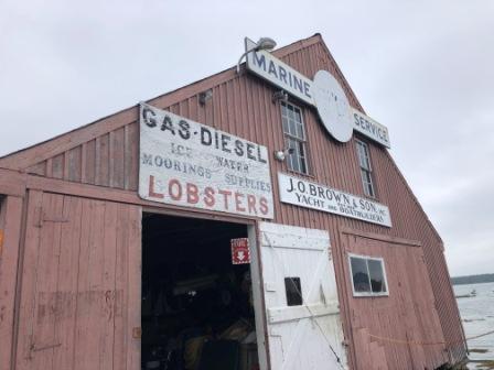
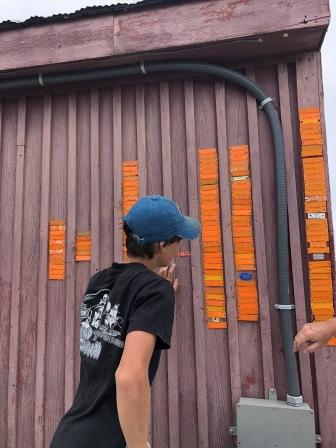
We then went to Browns Boatyard to see about maybe getting some ice, but they too did not have any. It was here that a young boy explained his great, great, grandfather established the business in 1898, and it has been in the family ever since. He showed us the “Wall of Shame”; a place on the outside of their boathouse of lobsterman’s tags with their license numbers. These tags are on all the pots that allow for the return of lost lobster pots to their rightful owners. Their boathouse reminded us of Kenny Eaton’s (Eaton’s Boatyard) in Castine, and in fact they had one of Kenny’s tags on the Wall of Shame.

Once we had seen all there was to see in North Haven, we got back into the dinghy and headed back to the boat. The return trip was heading into the wind, and the waves were short and frequent. It only took about 5 minutes, but it was a bit bumpy, until we turned into Perry Creek. Then it was peaceful and calm again.
During our trip this morning, Mark noticed the dinghy had water in the bottom, despite his bailing the remnants of recent rain water. It appears the seam where the inflatable is attached to the aluminum bottom is once again coming apart. We had this issue in 2018 in (we think) the same spot, so now we need to have that looked at before we take the dinghy on any long journeys. So after lunch, and with limited cell phone service, Mark managed to make some calls to inquire where we might get this fixed.
Today we also made a decision to leave Vinalhaven a day earlier than planned to get closer to the Mount Desert Island area. We already have reservations at Southwest Harbor, but have moved that up a day so we can beat the incoming weather front (strong wind).
While writing today’s blog, we were entertained by a set of beautiful birds, who perched on the bow of the boat to do their preening. It was fun to watch until they pooped all over the deck. Captain Mark was not too happy about that. We also got see a seal swim around one of the empty mooring balls near us, and we watched the tide rise (some 10’) covering the ledges along the shoreline. And the fog, of course the fog appeared midafternoon and we were grateful we were not out in it.


Fog rolling into Perry Creek 
IO at Perry Creek

Over the last two days we have been challenged with very low cell phone coverage and no internet, even with a hotspot. However, the remoteness and beauty of the area is good for the soul and that is what it should be all about. We have seen an amazing amount of spectacular wildlife including: puffins, bald eagles, small dolphins (porpoises), numerous unique bird types, and seals. What a wonderful world!
