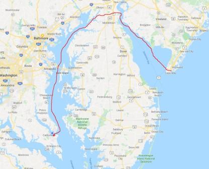
We have made big progress and covered many miles since our last update, including passing through 5 states. Here is what we have been up to.
Wickford, RI – Friday 10/11
We spent the morning publishing our last blog update and doing some work for our business. Then we looked at the weather and made some inquiries for possible stops hopeful to be able to make it to NYC or NJ this weekend.
Since the weather was going to remain bad for Friday and Saturday, we picked up a rental car for the weekend so we could go “adventuring” on land. In the afternoon we went to the movies to see “Judy” (the Judy Garland story). While the acting was good, the storyline seemed to drag and could have been a little faster moving.
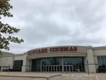
Movie theater for “Judy”
Not wanting to go back to the boat right away, we drove to a shopping area. Here they had an LL Bean store and across the highway a huge plaza with many stores. We went into a few, but ended up not buying anything and decided it was time to head back to the boat. On the way we once again stopped back at Dave’s Market and picked up a few things for dinner.

Dinner from Dave’s Market
The weather was improving, but it was still rainy and the wind blowing so we hunkered down for the night watching tv and grateful our boat was in a very protected marina.
Wickford, RI – Saturday 10/12
After our breakfast this morning we took a look at the weather forecast and saw that it had improved for the weekend. With this in mind, we revised our future plans to leave on Monday and shifted to leave tomorrow (Sunday) instead. We mapped out several stops and bailout locations (if necessary), and determined where we could get fuel along the way. Additionally, Mark added some oil to the boat and now it was ready to go.
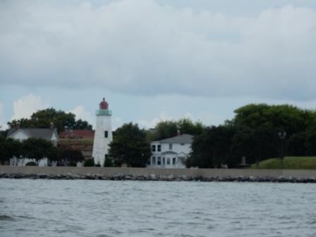
We then set out on our adventure for the day. We took the rental car over the Jamestown Verrazano Bridge to Conanicut Island. This is the island that is in the middle of Narragansett Bay between mainland Rhode Island and Newport (on its eastern shore). Here lies the town of Jamestown and Fort Wetherill State Park, where Beavertail lighthouse & museum is located on the southernmost point. This is the lighthouse we passed on the way up to Wickford last week.

At Beavertail Lighthouse

Beavertail Lighthouse Museum Signage

Beavertail Lighthouse & Museum

Beavertail Acquarium

Jamestown Verrazano
We had hoped to go into the museum and the small aquarium there, but because of Columbus Day Weekend, the museum closed at 3:00 pm and we arrived around 3:10. However, the site is really interesting and we walked around the grounds and took pictures of the Narragansett River and Newport Harbor.
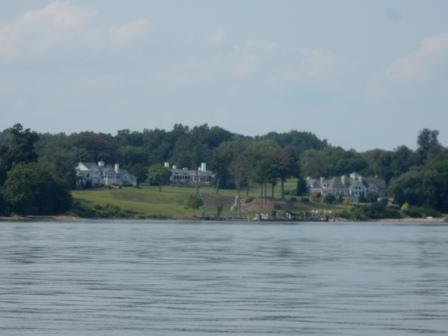
It was a bit cool so we did not hang out at the park long. We got back into our car and drove through the village of Jamestown. Here there is a marina that we have considered staying at as it directly across from Newport and is a bit cheaper. There is a small downtown in walking distance to the marina and some pretty nice houses that overlook the harbor as well.

Jamestown

Bridge to Newport

Homes at Shorbey Hill – Jamestown
From there we went back out onto the highway and took the Pell Bridge to Newport for an evening of fun.
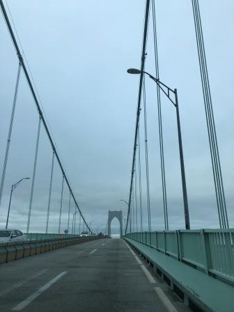
Clairborne Pell Bridge – To Newport
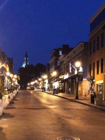
But first we had to find the UPS Store as we wanted to mail a package home; it was full of clothes (mostly) that we won’t use on the boat and wanted to free up the space. It took us longer to get to the place with all the traffic in town, then it did to conduct the transaction, which went quickly. From there we drove to St. Mary’s Catholic Church for their mass at 5:15. This was the church that JFK and Jackie Beauvoir were married in and they are celebrating the event with an upcoming fundraiser called “Return to Camelot”. You can read more about on their website here. Denise had been here with her sisters in 2015 and got to sit in the Kennedy pew at that time.

Pipe Organ St Mary’s – Newport

St Mary’s – Newport

Inside St Mary’s – Newport
This evening however, we met up with our friends from home Wendy & Tom Willhoite. They attend our church back home, and Wendy runs in Marathonfest with Denise. In fact, she was running in the Newport Marathon tomorrow (Sunday) and we were hoping to be able to cheer her on. However, since we were leaving Wickford in the morning that would no longer be possible. Instead, we shared mass and then went to dinner at Busker’s Irish Pub. This was not our first choice, but with a 1 – 1.5 hour wait for all the other restaurants and it was getting late, it was our choice. It actually turned out pretty good and we enjoyed a good meal at the bar and some fun times with friends.

Cottage Pie

Pulled Pork Sliders

With Wendy & Tom Willhoite
We left Newport and made the drive back to the Wickford area to return the rental car. Shortly thereafter we got an Uber cab back to the marina and readied our boat for the departure in the morning.
Staten Island, NY – Sunday 10/13
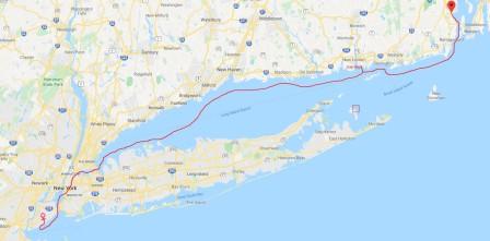
Wickford to Staten Island
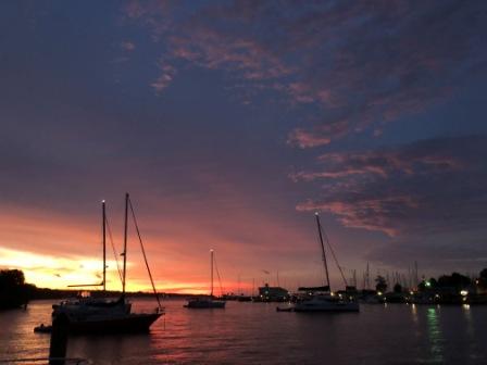
We both were up early and did one last check of the weather. It was beautiful in Wickford Harbor and ideal conditions as we left the dock at 7:00 am and headed out through the Inlet.

Sunrise over harbor

Leaving Wickford
Denise was a little nervous with the predicted seas, especially on the Long Island Sound some 2.5 hours away. For this reason we had identified a few bailout locations as well as a few places to stop for fuel. One of these was the Shennecossett Yacht Club (SYC) at the southern end of the Fishers Island Sound and just before entering LI Sound. So our plan was to at least try to get to this spot today, and continue further if conditions allowed.
With this in mind, we cruised down the Narragansett hugging the western shore and passing along homes, the University of Rhode Island Bay Campus, and the town of Narragansett. It was a calm morning and there was little wind and waves making our trip enjoyable.

University of Rhode Island Bay Campus

Birds flying south like us
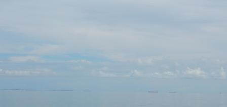
We were making good time as we rounded Point Judith and Point Judith Light. We had been expecting the wind and waves to pick up here, but found a nice day on the water. It was sunny and clear enough that we could see Block Island off our port side.

Point Judith Lighthouse

Block Island
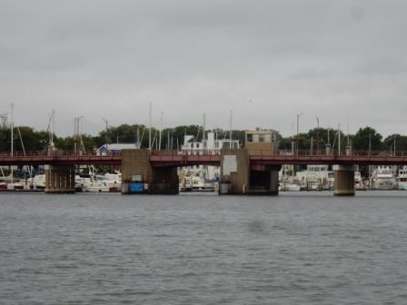
We cruised uneventful until we came up to Watch Hill and the entrance into Fishers Island Sound. Here there were numerous fishing boats and the waters were churned up quite a bit.

Watch Hill Lighthouse

West Harbor – Fishers Island
We were starting to wonder if we had made the wrong decision to go between Fishers Island and the Connecticut coast instead of taking the outside route that would take us through Block Island Sound. We persevered for the next 20 minutes passing the river entrances for Stonington and Mystic, CT and then made our way to the Poquonnock River Inlet and the SYC. This is right near Groton, CT and here we found a nice protective harbor near the University of Connecticut Avery Point campus.

Approaching Shennecossett Yacht Club
We pulled into the fuel dock and found a very welcoming dockmaster (Charlie) who helped us fuel up. In no time we were on our way and pulled out of the inlet and back into the sound.

UCONN Avery Point Campus – Marine Sciences

Fuel stop at Shennecosette Yacht Club
Here we passed by New London Harbor Lighthouse and then the New London Ledge Lighthouse and entered into Long Island Sound.

New London Ledge Lighthouse

Falkner Island Lighthouse – LI Sound
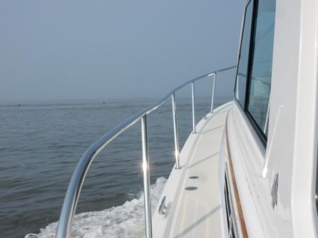
Once on LI Sound we found things a little bumpy. We were getting some of the winds from the north meeting with the waves from the east and the swirls of currents; there was a bit of chop. We were conflicted about which side of the sound we should run down to get to NYC, but eventually stuck with the CT-side and found the land did block the wind. Eventually even what little wind there was died down and we had a pretty smooth cruise. It turned out to be one of the nicest trips we have had on LI Sound.
Just after lunch we were already seeing the outlines of the NYC skyline. Now we knew we would make it all the way to New York and started identifying our options for places to stay. We would love to stay at Liberty Landing in Jersey City, overlooking the NYC Skyline. Here are friends on “Argento” had been waiting out the weather. This a great marina with a great view of NYC, but expensive. However, staying on Staten Island would give us a better position for running down the New Jersey shore tomorrow (Monday). After calculating our arrival time and making contact with the respective locations, we chose to push on to Staten Island.

Calm on LI Sound

NYC Skyline 30 miles out
By early afternoon we were approaching the Port Washington area, and soon thereafter we passed the Stepping Stones Light with the backdrop of the US Merchant Marine Academy at Great Neck. From there it seemed liked no time we were passing the SUNY Maritime College, the Long Neck Bridge, and then Rikers Island.

Stepping Stones Light

Execution Rocks Light

US Merchant Marine Academy

Throngs Neck Bridge

SUNY Maritime College

Rikers Island
We then entered the East River and passed through the navigational area known as Hell’s Gate, where we had a favorable current and picked up 4 knots of speed. It didn’t last, but we enjoyed the ride and the help on fuel consumption. We moved through the west side of Roosevelt Island and by then our speed had diminished back to 20 knots, until we began encountering the wakes of passing ferries, barges and tour boats. We went under the Queensboro Bridge (one of several Denise ran over in last year’s NYC Marathon) and encountered 3’ – 4’ waves due to the turbulence and the confluence of the tides, current and boat wakes. It was the roughest water we encountered all day.

IO on the East River

Queensboro Bridge
We cruised past the Manhattan skyline to our right and then entered NYC Harbor. We headed toward the Statue of Liberty and slowed the boat for picture taking. Denise went on the bow to take pictures with our burgee and the gray lady in the backdrop as we celebrated the crossing of our wake (once again); this time for the completion of Down East Circle Loop (DECL).

Freedom Tower

Good Bye NYC

Ellis Island

DE Loop – Crossing our wake
With no time to waste, we headed east out of NYC Harbor and went under the Verrazano Narrows Bridge; another one that Denise ran over last November at the marathon.

Verrazano Narrows Bridge
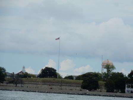
We turned right and headed into Raritan Bay. Before long we were entering into the Great Kills Harbor, and to the Great Kills Yacht Club where we were greeted by our friend (and dockmaster) John Calascibetta. He and some other cruisers on the dock helped us tie up the boat, and then we got a big hug from our friend John. He (like all the others at GKYC) always make us feel so welcome.

Familiar marker – entrance to GKills, SI
Once the boat was settled, Mark washed it down to get off all the salt while Denise prepared a dinner on Board. We were not going out anywhere tonight as we were tired. It had been a very long day completing 158 miles and we had made a lot of progress heading south. We did a quick check of the weather and with mostly favorable conditions, we decided that tomorrow we would continue heading south and try to make it to Cape May, NJ. We sent a text to “Argento” and they too confirmed they would leave in the morning. Finally we would have someone to buddy-boat with on this journey.

At GKYC

At GKYC
Cape May, NJ – Monday 10/14 – Columbus Day!
 As much as we would have liked to stay at GKYC for a few days, we knew we had to take advantage of the good weather and make headway on these days when we have to cover big waters. Today it would take us out into the Atlantic Ocean and down the New Jersey shore.
We left GKYC and exited the harbor to a nice sunny day on Raritan Bay.

Leaving GK Harbor
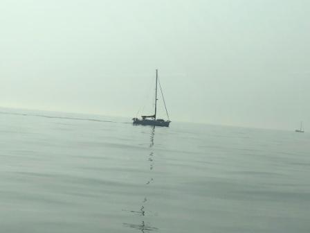
In 20 minutes we arrived at Sandy Hook Point and to the numerous boats all trying to go offshore for a nice day of fishing. We rounded Sandy Hook and stayed close to land, hoping what little wind there was would be blocked by the land and make the ride smooth. We were mostly correct on this, but the waves from the east and were crashing on the bow, and there was a bit of a chop. Things were a bit bumpy. We had been in communication with “Argento” who had left 30 minutes before us from Liberty Landing, but we could not see them anywhere. Eventually, we were able to make contact with them and learned they were a little ways behind us, but closing the distance. There were so many boats on the water today, and most all were heading south. There were sailboats, fishing boats, cruising yachts and commercial fisherman. We saw more today than in any other single day since April.
We passed Asbury Park and continued south for a short time, but the waves started making things a bit uncomfortable. As we approached Manasquan Inlet, we knew we had a decision to make. Denise was not feeling great (a bit of seasickness from the chop) and did not feel comfortable continuing like this for the next 2 hours before we would get to Atlantic City. Although Barnegat Inlet (another hour south) was a possible bailout, it is not recommended when seas are from the east. With this in mind, Captain Mark suggested we go in at Manasquan and take the NJ ICW south to Atlantic City. This would definitely take us longer (by about an hour – best case) as there are several “no wake” zones and always lots of fisherman in the middle of the channel. This is the exact opposite course we took when heading north on Memorial weekend.
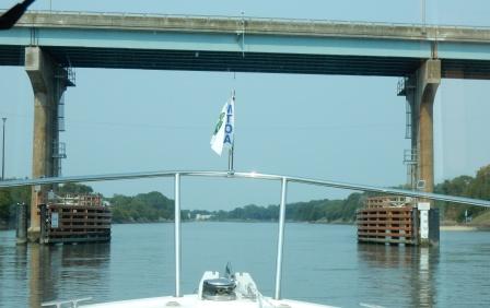
So we turned into the inlet and made our way through the harbor, past the open railway bridge, and went under the RT 35 Bridge on the Manasquan River. We turned into the Point Pleasant Canal and experienced a bit of turbulence from the conflicting tides and currents. It is a short distance and in no time were out of the canal and passing the beautiful homes of Bay Head Harbor.

turbulance in Point Pleasant Canal

Exiting the Point Pleasant Canal
As we cruised south through the rest of the ICW towards Atlantic City, we encountered almost no fishing boats. Even in Barnegat Bay we found it was peaceful and there were few boats on the water; a big surprise on a holiday Monday. This made Captain Mark happy and made our trip even faster than expected.

Barnegat Bay – NJ ICW

Reeds Bay on NJ ICW
But it was also here that we saw the screw holding our US Flag had backed out and was nowhere to be found. The flag was wobbling and when Denise went to check it out, we discovered it missing. She took the flagpole & flag down and now we would have to order a new one.
We had been in communication with “Argento” who remained offshore and were now ahead of us. They reported that the wins had smoothed the seas and things were improved after Atlantic City. So when we came up to AC we headed through the inlet (an e-ticket ride) and once again cruised south in the Atlantic Ocean. We only had 35 more miles to go and it was just after 1:00 pm. We knew we would make it to Cape May today and put one more body of water behind us.
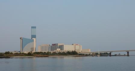
We ran down the Jersey shore passing familiar Atlantic City sites. As we approached the inlet around Ocean City the water got really choppy and rough, but it didn’t last. Soon we could see the roller coasters from the amusement parks along the shores of Wildwood, and eventually we could see the Cape May inlet. Here are some pictures from this part of our trip:

Atlantic City

Leaving Atlantic City

Wildwood

Heading South
We entered the Cape May Harbor, radioed the South Jersey Marina (where we had reservations) for our slip assignment and pulled into the side-tie on the fuel dock. As usual at this marina we had expert help with the tie up and were able to settle the boat in no time. The place was packed as so many boaters have been hung up waiting out bad weather, and finally got to move today. We felt pretty good as we had accomplished another big day at 120+ miles.

Cape May Harbor

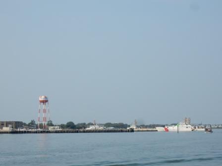
USCG Boats

USCG Station Cape May

Approaching So Jersey Marina

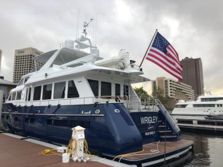
IO at So Jersey Marina
We checked in at the marina and then made contact with Chuck & Victoria (“Argento”) who were on another dock in the marina. We made plans for dinner and went back to the boat to get cleaned up.
Along the way we noticed a handful of other Sabre and Back Cove’s in the marina, including “FLYKT”, a Sabre 48 we last saw in NE Harbor, in August, but no one was aboard. Mark preceded to wash down the boat while Denise took care of things below deck. After a while she could not hear any water on the boat and poked her head out to see Mark talking to Sven, (owner of “FLYKT”). Mark mentioned seeing the boat in NE Harbor, but reminded him we originally met in Naples, FL in 2015. He did recall our previous meeting and we had a chance to talk and get caught up. We also discussed plans to head south; us through the Delaware River and him taking the offshore Route down the Delaware coast. He had to leave so we cut our conversation short and bid him safe travels.

“Flykt”
In the meantime, a Trumpy Yacht (“America”) pulled alongside the dock across from us. We had seen it leave NYC Harbor the day we went to GKYC and now here it was pulling in right near us. Denise is a fan of these old yachts and has done a little research on them. You may recall we have encountered the Trumpy Yacht “Lady Catherine” in the past, and have made friends with owners Richard and Catherine (see post from 4-12-2019). “America” is also a charter like “Lady Catherine”, but the owner is not the captain. You can learn more about these beautiful boats here.

Trumpy yacht “America”

Trumpy Yacht “America”
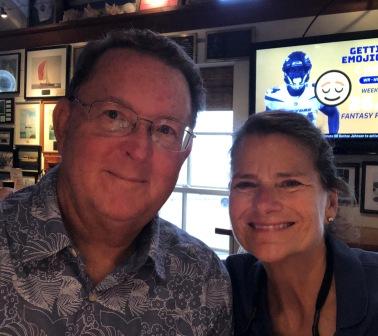
That evening we met Chuck & Victoria at the Lobster House Restaurant, located near the marina. They had also invited another couple they know from their homeport marina in Boston, who are also headed south for the winter. Linda & David (“Happy Our”) were new to the cruising life and this is their first big trip. Their 45’ Azimuth was on a mooring ball in Cape May and they expect to stay another day before heading south. We all enjoyed a good meal and a chance to get to know each other better, and now have new cruising friends.

Lobster House restaurant
 and Victoria & Chuck (\"Argento\")")
With Linda & David (“Happy Our”) and Victoria & Chuck (“Argento”)
After dinner we walked back to the marina with Chuck & Victoria and discussed plans to leave tomorrow. It looked like we would have a good window to get up the Delaware River and then on to the Chesapeake Bay. How far we were going to go would depend on the weather; they were hoping for Annapolis and we were hoping for something a little further south. The weather towards the end of the week was forecasted to be bad and we did not want to get stuck in a Cape May, Delaware City or Chesapeake City. So, tomorrow was the day to go.
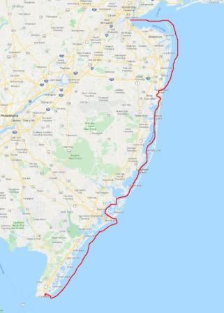
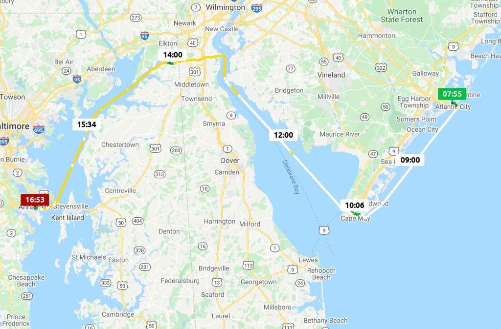
Solomons Island, MD – Tuesday 10/15
Cape May to Solomons Island
It was a beautiful morning in Cape May and we were anxious to get under way. However, on our way out of town we had to get fuel and we had to wait for them to open. So, Denise went for a run, but her leg and hip kept her to 2 miles and she was back on the boat earlier than expected. She had a chance to talk briefly with the Captain on “America” and learn a little bit about this particular Trumpy before he cast off lines and left the marina. After getting breakfast we decided to leave and wait at the fuel stop for them to open if they were not when we arrived.
We left the South Jersey Marina and headed through the Cape May Harbor. We went under the highway bridge and into the Cape May Canal, taking our first left and up the short canal to Miss Chris Marina. There are several charter fishing boats who leave from here, and one was loading up to head out, with all the fisherman watching us dock. There is a saying “you are either watching the show, or you ARE the show”. In this case, we were the show. Fortunately, Captain Mark does a great job docking our beautiful Island Office and made it look easy. The dockmaster had already arrived and helped us tie up. Twenty minutes later we were full of fuel and headed back into the Cape May Canal.

NJ 109 bridge – Entrance to Cape May Canal
In the meantime “Argento” had left and they were slightly ahead of us; we were buddy-boating again today. When they left the Cape May Canal the hailed us on the VHF radio and told us things were a little rough on the Delaware River and they were going slow. We knew a northwest wind with the opposing incoming tide would be an issue, but the wind was supposed to be light and therefore small waves. Mark’s strategy was to run as close to the north shore line with the anticipation that it will eventually settle down as the land will block the wind.
We passed by the Cape May ferry dock and entered the Delaware ourselves and found it a bit choppy, but not too bad.

Leaving the Cape May Canal

Cape May ferry dock
We continued along for about 20 minutes and we debated if we should turn around and go tomorrow. But we also know from past experience that this is usually the roughest part of the bay. We then talked with “Argento” who confirmed it was not getting any rougher where they were at, but they had slowed down to allow us to catch up to them.

Rough seas on Delaware Bay
Normally we can get up the river into the C&D Canal in 2.5 hours, so we knew we only had to endure the rough part for about an hour longer. We pressed on and eventually caught up to “Argento”, who then followed in our wake so they would have a smoother ride. We were getting pummeled with seas over the bow, and Mark would have to rinse off the boat again when we arrived at our destination.
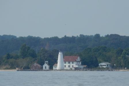
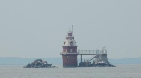
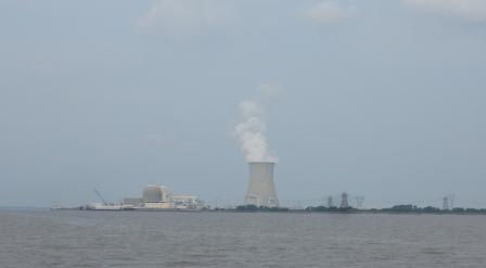
But as expected, as the river narrowed and we got closer to land, the curving shoreline blocked more of the wind and the seas settled down so it became more tolerable. Eventually, we were able to speed back up to 20 knots and make progress. By the time we started to see the Hope Creek & Salem Nuclear Power plants up ahead, we could actually relax. We passed the Ship John Lighthouse and a tug-pushing barge and finally, made a left turn into the protected waters of the C&D Canal.

IO on Delaware
 Lighthouse")
Ship John (“Jack”) Lighthouse

Hope Creek & Salem Nuclear Generating Stations

IO on C&D from “Argento”

“Argento” following on C&D
We continued cruising the 12 miles of the C&D Canal at 20 knots, until we had to slow down for passing other boats. Here we encountered “America”, the Trumpy who left Cape May 2 hours before us. We also had to slow down when we came to Chesapeake City and the docks of the marinas, as well as the docks for Dann Marine Towing, a familiar landmark near the western end of the canal.

US1 & US13 bridges – C&D Canal

Dann Marine Towing
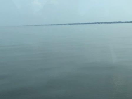
We exited the Cape May canal just after noon, and now were calculating how far we could get by the end of the day. We needed to see if the Chesapeake would be as calm as was forecasted and we were happy that in fact it was. Originally we had thought we could get to just south of Annapolis, but now we were pretty sure we could go all the way to Solomons, MD; eighty more miles south of where we were.

Calm day on Chesapeake Bay
We also had been calculating our fuel consumption and trying to determine if we had enough fuel to get to Top Rack marina in Norfolk (known for having very inexpensive prices). There was also another place we would pass south of Annapolis (Herrington Harbor), and which we were considering stopping for the night. However, it was only competitive if we would be taking on more than 150 gallons and we didn’t need that much yet. Since schedule was our overriding concern for the day, we opted to bypass this option and head for Solomons. We could pick up an incremental amount if needed.
In the meantime we had been looking at options for dockage and where we could stay for a few days to wait out the impending bad weather. There are several locations to choose from in Solomons, but we knew there was a harbor host with AGLCA at the Solomon Island Yacht Club (SIYC) and they had transient slips available. A few phone calls later and we secured dockage at the Yacht Club, as did “Argento” who had been following us all afternoon. Now all we had to do was get down the Chesapeake Bay.
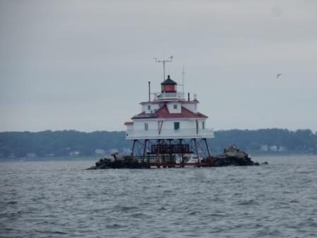
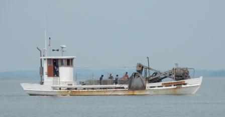
The day continued to delight us with spectacular sunny skies, clear visibility and mostly flat seas. It doesn’t get any better than this on the Chesapeake Bay in the fall. We cruised under the Chesapeake Bay Bridge, passed Annapolis, and then passed the famous Thomas Point Shoal Light. Along the way we had to dodge many pieces of debris, including some big logs and trees. The rain and high water has contributed to flooding and the run-off from the creeks into the Bays has created all these hazards; some of which could sink our vessel. Captain Mark does a great job at avoiding the big ones, but a few smaller ones have clunked the bottom of our boat. Here are some pictures from this:

Approaching Chesapeake Bay Bridge

Debris everywhere

Passing container ship

Thomas Point Shoal Light
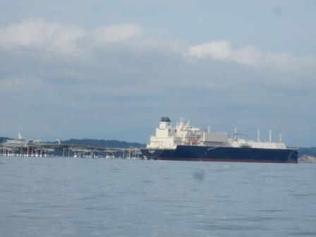
Finally, we approached Dominion’s Liquid Nitrogen Gas (LNG) depot at Cove Point. This is always a landmark for us and as we head into Solomons Island we know we are almost half-way through the Chesapeake Bay.

Cove Point LNG Facility
We rounded Drum Point and entered the Patuxent (PAX) River with the Naval Air Station to our left and Solomons directly in front of us.

Entering Pax River

NAS PAX
We entered the harbor behind the research vessel associated with the University of Maryland – Center for Environmental Science, who then docked at their facility on our port side.
Mark had been on the phone with the SIYC dockmaster (also named Mark) and he gave us step by step directions into our slip. He was there to grab our dock lines and help secure our vessel. Meanwhile, “Argento” went to get fuel at a nearby marina, and then came in right behind us to the dock. After we got them tied up, we went up to the Yacht Club, registered and took the free drink tokens to the bar for a much-deserved cocktail. Once again we had a big day, completing 150 miles total and a 3-day total of more than 420 miles. But now we will sit until at least Sunday, waiting out weather and hoping to connect with our friends Betsy & Dave (“Fryedaze”) who live here.
Once “Argento” got tied up and registered, they too joined us in the bar. Together we agreed to a shared pizza dinner courtesy of Papa John’s and hosted on our Island Office. Although they were originally going to leave in the morning, they are now reconsidering due to the expected rain and winds.

Solomons Island Yacht Club

Sunset over Solomons Island
While we were finishing dinner, Doug, the AGLCA Harbor Host came by our boat to introduce himself. He was very gracious and gave us lots of information about the club and the area.

Doug Smith – AGLCA Harbor Host
After Doug left we finished our dinner, said good night to “Argento” and then turned in for the night, totally exhausted.
Solomons Island, MD – Wednesday 10/16
The morning started off with a beautiful sunrise, but the sky was foretelling of the terrible weather to come. “Red sky in morning…..sailors take warning”.
Morning before the bad weather
We spent a good part of the morning trying to put together a plan for the coming days, with many things to consider. We are planning to go to Washington DC the weekend of 10/26, but not by boat. We will need to the leave the boat where we intent to be as Denise is meeting her running “Sole Sisters” in Washington DC that weekend for the Marine Corp Marathon. While she is not running the marathon, two of the women are, and others are doing the 10k (as is Denise) or they are cheering on the rest of the “Sisters”.
We also were planning for our time in Poquoson, VA to visit Denise’s brother and family as we did on our way north this spring. We are awaiting confirmation on the availability of a slip at Whitehouse Cove Marina, where we have stayed in the past. Not long after our stay there this spring, they had a fire at the Surf Rider restaurant located at the marina and we are not sure if there is room for us. If not then our location will change and we need to secure Plan B.
Also during the morning we met several of the members at SIYC. One member was John (“Longshadow”) who came down to the dock to talk to us and “Argento”. He told us he has been looking at Back Coves and is seriously considering buying one, although he likes the 41 foot model the best. He also advised that he lived in the house next to the marina and told us his car was available if we needed one. We thanked him for his offer and when he left we went back inside our boat, grateful for such southern hospitality. This once again proved to us that life is better south of the Mason-Dixon Line.

Johns House

“Longshadow”
We weren’t back in the boat 15 minutes when the sky opened up and the rain started. We had watched several boats come into the anchorage and get their boats situated just in the nick of time. It rained for the rest of the morning and into the late afternoon, sometimes with harsh winds. We hunkered down in the boat, doing work, catching up on emails, and finally getting to download all the pictures from the last three days of travel. Mark was able to get Back Cove to send us a replacement screw for the flagpole and it will be sent ahead for pickup in Poquoson.

Rainy day at SIYC
In the evening, the SIYC was having “taco night”, and we were invited to join them. So at 5:30 we went with “Argento” and arrived in time to secure the last few seats at the bar. The place was packed and all the tables inside were taken. Due to the weather, the tables on the patio were not a viable option and we felt lucky to be able to sit while eating. The members in the club were very warm and welcoming, and Mark (dockmaster), his wife Lucy, and Doug (AGLCA Harbor Host) made it a point to come over make sure we were well taken care of. Denise was able to sign the AGLCA Guest Book and put our boat card in their “album” where we saw cards for many of our Looper friends that have also been here. It was great to feel so welcome and we had a fun time.

Taco night at SIYC with Victoria & Chuck (“Argento”)
We retired back to our boat and watched another episode of “Victoria & Albert” before calling it a day.
Solomons Island, MD – Thursday 10/17
While the rains of yesterday stopped, the winds picked up as predicted and were already blowing pretty good when Denise went out for a morning run. She ran along the Patuxent Riverwalk and through the neighborhood that overlooks the harbor entrance. The University of Maryland’s Center for Environmental Science the Solomons House & Visitors Center is also located here, and she was able to see the sunrise over the already choppy water. Here are some pictures from her run:

Sunrise over the Chesapeake

UofM – Center for Environmental Science

Solomons House & Visitors Center

Thomas Johnson Bridge over PAX River

Fisherman & Boatbuilder Memorial

The Pier on the PAX River
She cut the run short after 2 miles due to the pain in her right leg/hip, frustrated that she can’t run any further distance.
During the day we took advantage of the windy day and hunkered down once again on the boat to get some work done. Mark had a series of conference calls, and helped Chuck (“Argento”) on his boat with a few technical items. Denise began cataloging the downloaded pictures and working on this blog post. Meanwhile we also finalized our plans for the weekend in DC, including Mark staying behind on the boat and Denise going to visit with her Sole Sisters. We also received confirmation that we can go into the Whitehouse Cove Marina in Poquoson and could stay there through Tuesday 10/29.
In the afternoon John (“Longshadow”) came by to tell us he put in his order for the Back Cove 41, and that his daughter is buying his current boat (Hinkley) from him. He also offered his car for us if necessary tomorrow, and we might take him up on this.
In the evening Denise made a fish dinner that was a new recipe and was from some fresh fish we picked up in Rhode Island. We had put it in the freezer and defrosted it just before prepping for dinner. It turned out really good, but we figure it will be even better at home when we can use a “real” oven.
We finished the evening watching another episode of “Victoria & Albert” and are close to being ready to start watching the last season that was just released.
Solomons Island, MD – Friday 10/18
It was a cold 48 degrees when we woke up this morning and almost had us thinking we were still in Maine. The wind was still blowing a good bit, but it had settled down since yesterday. Mark spent almost all morning on telephone with clients and Denise continued to work on this blog update. We also took advantage of the free laundry at SIYC to get that chore behind us.
In the afternoon we looked at the weather for Sunday (our planned departure date) and decided to leave for Poquoson tomorrow (Saturday) instead. Rain and some wind is expected for Sunday and we have a beautiful day planned for Saturday, so why wouldn’t we? Also, tropical storm Nestor is forecasted to hit the FL and Gulf Coast states and then move through GA, SC and NC over the weekend. We weren’t planning to go further south for a week, so this will be work out fine for us.
Later in the day Chuck came over to the boat to discuss their southbound travel plans. He and Victoria are highly frustrated with the weather delays (welcome to our world) this year as last year they were further south in their journey to Delray Beach. Since we know this route quite well, we discussed possibilities for routes (offshore or ICW) and where to wait out weather. Mark and Chuck then made plans for the four of us to go out to dinner as this would be one of our last times together. Although we intend to buddy boat tomorrow down the Chesapeake Bay, they are going on to Norfolk and we will stop in Poquoson.
After wrapping up our day of work, we went to the Yacht Club and had a before dinner drink with Victoria & Chuck. The club’s drinks are very inexpensive, and we always enjoy patronizing establishments that have been gracious to us. Afterwards we walked down the street to a restaurant called the “Island Hideaway” for dinner. As they do not take reservations on a Friday night, we thought we might have to wait a while for a table. However, right after we walked in four seats at the bar became available and we chose to eat there instead of wait on a table. The food and service was terrific and we all had delicious meals. The place was all decorated for Halloween and it had quite the festive feel.

Island Hideaway Signage

At Island Hideaway

At Island Hideaway

At Island Hideaway

At Island Hideaway

At Island Hideaway
As we were walking back through the SIYC parking lot to our boats, we ran into Doug (AGLCA Harbor Host) who was taking out the trash. He invited us to come into the club and meet his wife, Susan. We stayed and chatted for a bit and then said goodnight. They were closing up the club and we didn’t want to hold them back. We left Chuck & Victoria talking to them and we turned in for the night.

Susan & Doug (AGLCA Harbor Host)
A few notes about Solomons Island Yacht Club: This is our 4th stay in Solomons and we like coming here as it is about halfway up/down the Chesapeake. However, this was our first time staying at this club, but it our favorite location. The people are the nicest, the location in town is great, and the club is not snobby or pretentious. In some ways it reminds us of Great Kills Yacht Club in Staten Island. If we get to come back to Solomons again, this would be on the top of our list for places to stay. Here are some pictures of the SIYC and some other boats.

SIYC Front Entrance

SIYC facilities & barbeque pit

SIYC overlooking harbor

Lounge at SIYC

Chesapeake Buy Boat “Half Shell”

Bar at SIYC

Argento & IO at SIYC
Stay tuned for more of our adventures on Island Office


 and Victoria & Chuck (\"Argento\")")


 Lighthouse")


