Daily Archives: November 8, 2017

Home Sweet Home!

Harbortown Marina – Merritt Island, FL (Saturday, 11/4)
Before leaving, Denise wanted to get a run in along the beach. But she had a hard time getting up due to insomnia during the night (excited to finally being home?).  When she finally woke up at 6:15, there was not really time to run, and Mark had woken up a bit earlier than usual. We had targeted a 7:00 – 7:15 departure and when we left NSB City Marina at 7:15, we were right on schedule.

Just before we left we had a chance to see the awesome moon from last night set over the western sky, and shortly thereafter we were graced with an awesome sunrise. Surely we will miss this after today.

Full moon setting over NSB

Sunrise on the ICW – God’s Handiwork

We headed south along the ICW and here again we found houses to have damaged docks and sunk boats.

“Red Sky” aground near Edgewater

Wrecked piers from Irma

We cruised past the Boston Whaler Plant in Edgewater and through Mosquito Lagoon where we finally got to glimpse the Vehicle Assembly Building (VAB) at Kennedy Space Center.  This is our landmark to tell us we are almost home.

Boston Whaler Plant in Edgewater

VAB from Mosquito Lagoon

Almost the entire time we were underway, Denise began packing up things on the boat.  All the clothes, linens, food, medicines & cosmetics, books and other personal items had to come off the boat.  On Tuesday the boat will be hauled out for some annual maintenance as well as cleaning and polishing of the hull. While she was doing this, Mark steered our Island Office around the fishing boats, slower cruisers and around the bridges.

We cruised through the Haulover Canal and by the city of Titusville passing boats along the way.  It was a beautiful day and there were lots of watercraft on the water. Then soon afterwards we turned east into the barge canal and towards Harbortown Marina.

Barge Canal – almost home

The usual dolphins were frolicking about, almost as if to say “welcome back”.  And then we turned into the marina and parked our Island Office into its newest slip. We were safely home sweet home!

Harbor Town Marina – HOME!

Advertisement

Floridays Finally!

St. Augustine, FL (Thursday, 11/2)
Again we woke up to a nice morning, but the cool evening air after a warm day yesterday brought in the fog. Not something you want when trying to navigate the narrow area of the ICW through Georgia.  At 7:20 we left the dock as the fog was pretty light at this point in the ICW.  We made our way under the Jekyll Island Bridge and once again passed the Jekyll Wharf Marina.  We cruised easily through the shoaling area of the ICW and out into St. Simons Sound, but then fog got really thick. But it didn’t last long and within minutes the sun rose and it burned off enough that we could see the St. Simons lighthouse behind us and Jekyll Island to the west.

Fog when leaving SS Sound

Sunrise over SS Island

St Simons Island Lighthouse

Jekyll Island from SSI Sound

The wind was calm and the waves were very small, but had a bit of a chop to them.  For the next 90 minutes this is the way we cruised down the Georgia coast, and Mark was loving it. Unfortunately, Denise was not as the chop was just enough to allow her to read or do too much without getting seasick. These were not difficult conditions and although they were very tolerable, she was bored.  So we made the decision to go back to the ICW once we hit Jacksonville, by way of the St. Johns River. After all we had plenty of time to get to St. Augustine, and it would only add another hour to the trip at this point; we had avoided the curving ICW through the rest of GA.  And, we had crossed the state line and were now back in our home state.

Once inside the St. Johns River inlet we passed Mayport Naval Base where there were at least 3 ships in port and where we were treated to dolphin welcoming committee.  We cruised passed the Morningstar Marina where we had stayed in April with friends Tim & Karen (TiKa2) on their boat, and then navigated around an inbound barge, crossing way in front of it to turn south on the ICW.

Approaching Entrance to Mayport

Dolphins near Mayport Morningstar Marina

Approaching freighter in St. John’s River

Now in calmer waters, Denise was able to do a few things on the boat while Mark drove under the familiar bridges and around the slower boats.  There were two north-bound boats that we passed that looked familiar to a boat we had seen in the marina in Poquoson; the “Linda Carol”.  The “Thomas J” and “Samuel M. Bailey” are part of a class of boats known as “buyboats”. They are so named as they were originally the boats used by those who would buy oysters from the waterman on and around the Chesapeake Bay.  There is an association of those who currently own these very unique looking vessels and you can learn more about them here and here.

Oyster Buyboat “Thomas J”

Oyster Buyboat “Samuel M. Bailey”

We continued cruising south through the gorgeous homes of Ponte Vedra, negotiating around a barge that was in the middle of the channel dredging. Fortunately, the channel was a bit wider here than it is further south.  In no time we were in Palm Valley and then at the edge of Guana River Wildlife Reserve which is bordered by the Tolomoto River (ICW) on the west, and the Guana River to the east.  Here we saw a few women on paddleboards enjoying the beauty of this great park.

Ponte Vedra House

Paddleboarders at Guana Wildlife Management area

It is also in this nearly 7 miles of the ICW that lies one of our favorite anchorages.  It is near Pine Island (not to be confused with the Pine Island on FL’s Gulf Coast), and where we have anchored several times.  Unfortunately, tonight we had reservations at Camachee Cove in St. Augustine where we needed a good internet connection. Mark had a planned 2-hour web conference with a client and we needed to be where there was technology.

So, we continued past Pine Island and headed to Camachee Cove where we had to wait on the dredge to dock before we could proceed into the marina.  The wind was really blowing and the current at the entrance was really strong, but Mark did a great job of getting us into the slip.  We tied up successfully and then went and checked into the marina office.  Here they gave us all the usual information, including menus for the two restaurants located on the grounds near the marina.  After looking at the one for “Vinny’s” we decided that was the place we would walk to once the call was done; they had garlic knots!

Camachee Cove Marina east facilities

Mark’s call ended a little earlier than planned and it was still daylight when we walked to the restaurant.  They have a few tables inside and a handful of picnic tables outside, but these overlooked the Vilano Bridge and highway so we opted for inside dining.  Denise ordered a Greek salad and Mark got the chicken parmesan sub (no surprise there) and we both devoured the garlic knots. They were good, but still not as good as Antonella’s in Winter Park.

Vinny’s for dinner


New Smyrna Beach, FL (Friday, 11/3)
A few charter fishing boats several slips away in the marina decided to leave early and woke us up with their wakes and noise. However, we did not leave the dock until 8:15 when the tide was more favorable for us to leave the marina entrance and get through St. Augustine Inlet.  Here you have to go way outside the inlet, almost to the ocean due to the shoaling and it was a bit choppy.  The wind had really picked up compared to yesterday and we were happy to be heading south in the ICW today.

Leaving Camachee Cove

We passed through the downtown area of St. Augustine and from here south really witnessed the devastating impact of hurricane Irma in this area. We had seen some of the damage here from Matthew when we headed north in the spring, but this was so much worse. The city marina was badly damaged and is slowly recovering. They can only handle a handful of boats at the docks, with more availability in the mooring fields north and south of the Bridge of Lions.  There still are several sunken or partially sunken vessels along the shoreline or just outside of the channel and many hazards are reported.

St. Augustine

And this is how it continued south on the ICW all day.  We were amazed at how many private docks were totally destroyed and how many homes had waterfront damage, despite the protection of the barrier island to the east.  Storm surge is the culprit here the amount of water can be very destructive.

Especially hard hit was the Daytona area, with two marinas (Caribbean Jacks and Loggerhead Marinas) totally destroyed and closed for transients.

Caribbean Jacks – Destroyed

Caribbean Jacks – Destroyed

Loggerhead Marina – Destroyed

Destroyed boats near Loggerhead

We continued south through the Ponce De Leon Cut (rather than through Ponce Inlet) and were pleased that the dredging they did had held through the storms and we had plenty of water.  From there we made our way passed the eastern shore homes that all had docks that were destroyed or partially destroyed; not one was without impact.

We passed under the North Causeway Bridge (Flagler Ave) in New Smyrna Beach (NSB) and just after 1:00 pulled into the New Smyrna Beach City Marina.  Although we could have continued on and easily made it to our home marina in Merritt Island, we wanted to spend some time with long-time friends in the area.  Pat & Milan Skrtic were friends of Denise’s parents and we had plans to meet them for dinner.

As we tied up to the dock, the dockmaster informed us that there was no power or water to our slip but that they were actively working on its repair. In fact, the whole marina was out as they were replacing several pedestals at the slips. It was promised to be back up by 4:00 and it was so there was no real issue for us.  We were able to work on a few things on the boat that did not require power. When the power came up we were able to get our showers and enjoy a drink before dinner.

IO at NSB City Marina

Moonrise over NSB

The Skrtics picked us up in front of the marina and took us to “Riverview Terrace”, a nearby restaurant that has beautiful garden dining and inside seating in this old house converted to a unique dining experience.  The food was really good and we shared some great wine, not to mention terrific company. We talked way past the end of our meal and finally when all of us were yawning, they returned us to our marina and we said good night.

Outdoor dining at Riverplace Terrace Menu

Riverplace Terrace Menu

The NSB City Marina is the best place to stay in the area. You are within walking distance to the town of New Smyrna and there are lots of restaurants and shops to explore, and the marina is well-run.  We have stayed here several times in the past and will always choose it over the more expensive (albeit more esthetic) New Smyrna Marina located to its north. While it is not close to the beach, it is not a far walk and you can always use Uber to get you the 1+ mile to see the Atlantic Ocean.

NSB Marina Dockmasters Office

Just for fun Jekyll!

Jekyll Island, GA (Tuesday, 10/31 – Halloween)
Before we left Brunswick we decided to take advantage of the free laundry and wash our boat towels.  Denise got up early and had this all accomplished before Mark had finished his breakfast. We left the dock at 9:30, even though it was a short distance (8 miles), but mainly because we did not have any reason to hang around Brunswick.  We wanted to get to Jekyll Island so we could utilize their internet and get some work done.

We cruised back down the East River, passing the shrimp boats docked at the commercial docks just south of the freighters we passed yesterday.

Fishing boats in Brunswick

We turned east and went under the Lanier Bridge, headed out on the Brunswick River, and then reconnected with the ICW at the Jekyll Creek Inlet.  We knew this stretch of the ICW was notorious for shoaling, and although the tide was going out, we were passing through 2 hours before low tide.  However, we encountered a few spots that were really shallow; at one point our depth gauge showed 2’ 2” – WOW!  This was scary, but Captain Mark managed to get us back into deeper (8’) water and continue on without incident.  We passed the Jekyll Wharf Marina which is near the Jekyll Island Club, and is so shoaled up now that it is closed to transients.  We witnessed one of the commercial boats trying to dock with much difficulty due to the shallow water near the dock.

Jekyll Wharf Marina – shrimp boat trying to dock

We cruised under the JI Bridge and pulled into the Jekyll Harbor Marina where the dockmaster Terri and Manager Bill were there with helping hands for the tie-up.

IO at Jekyll Island

This is a terrific marina right on the ICW (in a no-wake zone) with lots of fun things to do.  We first stopped here in 1998 when we had our sailboat, and also stopped on our way north this spring.  In addition to great transient rates, they have loaner bicycles, free cable tv, and golf carts, not to mention an on-site pool and restaurant that is really good.

We spent the whole day working on the boat, either doing work, conference calls or working on blog posts. During that time we watched several boats negotiate the shoaling north of the marina, and even saw one get stuck for a while.  We also saw boats we had passed earlier in the week go down the ICW and continue south.  Yes, during this time of year all the boats leapfrog each other as there are many different marinas and anchorages and each boat has their own plans for where to stop for a day or two.

Denise had a planned conference call in the early evening, so we opted for a quick and easy dinner beforehand. We borrowed the golf cart and went to the “Love Shack BBQ Shrimp & Yardbird” – a walk-up place in the Jekyll Island Marketplace that we had “discovered” on our trip north in April. Usually there is a line out the door to get into this place, but because we were early there was no one in front of us. However, by the time we got our to-go order of pulled pork sandwiches, there were people already queuing up.  We golf-carted it back to the marina in time to enjoy it before Denise’s call.

Another event that we watched during the day were the repairs taking place at the marina.  Hurricane Irma felled two large oak trees on the property, and they had been partially cut up, but several large stumps were still laid up on the ground. The marina had also detected a fuel line leak and they were near completion of its repairs. Because of these activities there were several contractors in the area and the grounds were a bit torn up. However, they did get the fuel pumping by the end of the day, and we could see the progress that had already been made on the rest of the property.

Fixing the fuel line at JI Marina

After Denise’s call, we were greeted by two “reverse” trick-or-treaters who were walking the docks and handing out candy to all the boaters.  This marina has a handful of live-aboard boaters and this is how they celebrate Halloween.  It was fun and we actually shared some of our candy with them as well.

Halloween Pumpkin on dock

Skeleton on boat bow

Also in the evening we were able to watch cable tv for the first time in weeks.  We really hadn’t missed it all that much as we found nature far more interesting and pleasurable, especially with sunsets like this:

Halloween Sunset

Jekyll Island, GA (Wednesday, 11/1)
It was a beautiful and calm morning, so Denise went for a run. It was nice to be in familiar territory and with no constraints on miles as there are lots of paths and places to adventure on this island.  She left the marina and headed to the beach downtown, and then along the paved pathway opting for the backdrop of the Atlantic Ocean.  The ocean was flat and many boaters were taking advantage of such seas and making their passage south instead of going on the ICW.

Morning on the Atlantic Ocean

Running path along the Atlantic

During the day, we did a few boat chores and then got busy with work and all that was required to update the blog (cataloging pictures, writing posts, etc.).  Mark spoke with a few clients and Denise had a chance to speak with friends in New Smyrna Beach, making plans for Friday night dinner when we are there.

We also made a change to our itinerary deciding to go further south tomorrow to St. Augustine, once again bypassing Fernandina Beach. This will allow us to split up the distance to New Smyrna Beach and be positioned for a short cruise to Harbor Town marina in Merritt Island (our home port) on Saturday morning.

In the evening we had Debra & Larry (“Dabadoo”) over for drinks as they wanted to see our boat.  They were in the Kadey Krogen motor yacht in front of us at the marina, and we had spent some time over the past two days talking with them. Larry was familiar with the Sabre line but had never been inside the Back Cove.  We spent some time getting to know each other a bit and invited them to go to dinner with us, but they had plans of their own.

Debra & Larry (“Dabadoo”)

Sunset on Day 2 – JI Marina

Once they left we walked up to Zachry’s Riverhouse, the restaurant at the marina. We had dined here before and again had a terrific meal.  We recommend you stopping at this place if you are ever on Jekyll Island as their food is good and their view at sunset is outstanding.  You can learn more about the place here.

Sunset from restaurant

Back on the boat, we made plans to leave in the morning before the tide started to run out. The weather forecast looked favorable for us to go offshore down to St. Augustine and allow us to avoid the shoals in the ICW all the way down to Jacksonville.

Back to Brunswick!

Hilton Head, SC to Brunswick, GA (Monday, 10/30)
Even if we wanted to leave early, we could not as we were dependent on the dockmaster to operate the lock. They don’t come in until 8:00, but that didn’t stop us from pulling out of the slip and queuing near the opening.  As soon as the dockmaster arrived Mark drove us into the lock without incident, and within 10 minutes we were through it and on our way.

Leaving Windmill Harbor Lock

We headed south on the ICW and the meandering course it takes in this part of the state.  We crossed the Savannah River and entered the state of Georgia.  Soon thereafter we passed the marinas that line the town of Thunderbolt to its South, and bypassed the slow (no wake) zone around Skidaway Island and Isle of Hope, where we stayed on our way north in April.

Causton Bluff-Sam Varnedoe Bridge – near Thunderbolt

Boats at Thunderbolt

Then, we approached an area known as Hells Gate near Raccoon Key that is aptly named for the extreme shoaling.  Of course we hit this ¾ mile stretch of the ICW at low tide and it was not good.  Even though we were in the dead center of the channel, at one point our depth gauge reported less than 3’ and we draw 3’ 3”, but we managed to stay afloat. Perhaps the mud here was soft enough that it kept us from a hard stop grounding and our motion pushed us through. This area is in desperate need of dredging as hurricane Irma has made it far worse than it was when we went through here on the way north.

Once through that area, the rest of the trip was uneventful; cruising through the serpentine of rivers and inlets that connect that make up this part of the ICW.  The most exciting part was coming into view of the bridge that crosses the Brunswick River as it is clearly visible when we were about halfway down the coast of St. Simon’s Island to our east.

GA Low Country – Near North Newport River

Passing Dredge barges on Mackay River

Lanier Bridge from ICW

Soon, we turned up the Brunswick River, went under the Lanier bridge and headed north up the East River passing the freighters being loaded along the eastern shore.  We pulled into the Brunswick Landing Marina where we had reservations for the night. The primary reason for stopping here was that they had the best fuel prices and we were in need of a fill-up.  Otherwise we would have continued on to Jekyll Island where we were spending the next two days and is only 30 minutes further south. But after 108 miles we figured we had gone enough and we liked the discount on fuel that the marina offers its transient guests.

In addition to the inexpensive fuel, this is a great marina with reasonable rates and great perks.  These include:  good internet, loaner bicycles, free laundry, free beer & wine at their nightly happy hours, and free back scratchers – of which we now have a few.  We also like the Thai restaurant in town (Basil Thai), but alas we discovered they are closed on Monday evenings.

Once we finished fueling, we moved into our assigned slip, settled the boat, and then opted for our own cocktails aboard (skipping the ones offered by the marina).  We then used the bikes to go to Tipsy McSway’s for an early dinner.  We had eaten here before and last time the place was packed. As the marina was very full and there were only 2 restaurants in town open today, we were concerned that we might have a wait for a table.  However, when we arrived and the place was mostly empty and it never filled up while we were there.  Unfortunately, this is a sign that this downtown is really struggling to stay afloat.  If it wasn’t for the seasonal boaters it probably would not be sustainable at all.  All the growth is near the airport and the businesses there are thriving.

After dinner we rode the bikes back to the marina, getting in just before dark. We spent the rest of the evening relaxing and talking to neighbor boaters along the dock, and then mapping out our plan for leaving in the morning.


Heavenly Hilton Head!

Hilton Head, SC (Sunday, 10/29)
Knowing the wind was going to really start to blow around 1pm, we knew we had to leave early to Hilton Head, SC. Of greatest concern was the area around Port Royal where we would be very exposed from the west wind as we transited south from Parris Island to the northern tip of Hilton Head.  Although it was only 4 miles, we knew from past experiences this could be miserable.

So, we left Bristol Marina as soon as the sky got light, even though the sun was not up. We cruised through the US 17 Bridge without incident and then made our way down the Ashley River until it joined the ICW.  Here we turned and headed south, slowing for the every small fishing boat who should be seeking safe shelter.  The wind was blowing, but we had the protection of the land and so it was not an issue for us.

The first part of the ICW south from Charleston is very slow going as there are lots of homes and boat traffic. Eventually we made our way to more rural areas and we were able to accelerate to our normal cruising speed of 20 kts. Through the winding waterway we passed along John’s Island, then Wadmalaw Island then Lady’s Island, and several inlets with open waterways and a bit of wind. Much of this area is unspoiled and natural low country as it is in national or state wildlife protected areas.  It is rural and quite beautiful.

Whitecaps on the Coosaw River

Soon we came to the town of Beaufort (pronounced Byuu Ford) – and not to be confused with Beaufort, NC (pronounced Boe fort).  From the Lady’s Island Bridge to the McTeer Bridge near the Port Royal Marina it is a no-wake zone and was slow going. We creeped past the Beaufort Marina (which was full) and the boats in their mooring field.  We passed the Beaufort Yacht and Sailing Club to the east and eventually the Port Royal Marina and the Navy hospital to the west.

Beaufort, SC City Marina

In the meantime the wind had started to build and we could see there was hardly anyone else on the water now.  As we headed south we came to Parris Island, home of the Marines and their famous Recruit Depot – a facility where Denise’s dad went to when he became a marine.

MC Recruiting Depot – Parris Island

The wind was blowing about 20 knots now, but it was behind us so it wasn’t too bad. However as soon as we rounded the point of Parris Island and headed toward Hilton Head we were in the crosswinds of the incoming tide and the western wind that had blown all the way down the Broad River.  It was really rocking and we had to slow the boat down a bit, but it was nowhere near as bad as our day on the Chesapeake crossing the Potomac River.  The journey here was short and we encountered one other smaller boat making the crossing ahead of us.

Finally, we entered the ICW Channel that runs along Hilton Head Island and the waves settled down almost immediately.  From there we only had a short ride to get to Windmill Harbor Marina, which has a lock you must go through to get into this well-protected area.  As we approached the marina (lock) entrance, there was a small boat sailing race going on that we had to negotiate around. We could not believe such small boats were out in these high winds.

Sailboat race outside Windmill Harbor Lock

About this time we were lining up for the lock and in communication with the lockmaster who informed us we are dragging a line under our boat. Our dinghy bow line had come loose and was now dangerously close to our prop.  Denise went back to pull it up, but it was fouled on something and she was not strong enough to break it free. At one point it sounded as if it had caught on the prop and the cutter was able to keep it from stalling the boat. Switching places (Denise driving), Mark was able to pull it free, and when he did it appeared to have been cut and about 1/3 of it remained.

Once this crisis had been averted, we were able to pull into the lock, get locked up, and dock the boat in the assigned slip at the marina. It was before 1 pm and that is when Gale Force winds (34–47 knots) were expected to kick in.  We were happy to be settled and out of harm’s way.

Inside lock at Windmill Harbor

The location of the slip was very convenient as it was very close to the pool, restroom facilities, and laundry. It was only a short walk to the South Carolina Yacht Club (SCYC) clubhouse, or across the footbridge to the dockmaster’s office. But best of all it was much protected on all sides.

Marina at Windmill Harbor

Once the boat was settled we intended to do some laundry as there is no charge at this marina. Unfortunately, another boater was ahead of us and had taken both washers, so we knew it would be at least one hour before it became available.  We walked over to the dockmaster’s office to check in and learned the SCYC was closed for dinner on Sundays; they are only open for lunch. This was a disappointment as we were looking forward to a good meal there. We had dined there when we were here in August of 2014 with our nephew Johnny and the food was really good.

Still waiting for the washers to be freed up, we decided to walk to the other side of the marina and check out the Sabre 45 that Craig gave us permission to go into.  As we approached the dock, we noticed a familiar boat we knew from our Great Loop adventure.  We walked up to and knocked on “Sum Escape” and found Julie & Tom Van Hall to be home! They invited us on board where we had a chance to talk and get caught up. We had met them at Hoppies on the Mississippi River and saw them several other times along the Loop, including in Marathon in February 2016.  We had stayed connected off and on via Facebook, but had lost touch with them when we headed to Maine. We talked for a long time and discussed our future plans.  While we are headed home, they are headed to South Florida again for the winter and we hope to maybe catch up with them.

Julie & Tom Van Hall (“Sum Escape”)

We then went to the check out the Sabre 45, docked right next to “Sum Escape”, taking Tom & Julie aboard for the look-see. It is a very nice boat and we like a lot of the features, but it is not something we intend to buy for a while.

Checking out the Sabre 45

Afterwards, we went back to check on the laundry and it was here that we met Bob Sherer (aka “Bob423”) who is on the sailboat “Feetwing”.  Bob is famous to those who cruise up and down the ICW as he is a frequent poster in ActiveCaptain® about potential hazards. Everyone wants to be behind him when transiting the ICW so they can get the latest updates.  We had a chance to take a picture with him and learn he is headed south tomorrow as well as us. Unfortunately, we are faster than him and this means we will no longer have the benefit of his sage knowledge as we navigate the very shoaled up ICW through SC and GA.

With “Bob423” – Bob Sherer

Since the yacht club was closed and we didn’t feel like spending money on an Uber we decided to eat dinner on board. Plus, the wind was really ripping at 30+ knots and we just didn’t feel like going out in it.  But also, staying in allowed us time to get the laundry done and finally get some of the blog updates staged (online) for publication; we finally had a decent internet connection!

Here are some other pictures from the marina:

Pool at Windmill Harbor

Tennis Courts at Windmill Harbor

Dockmasters Office at Windmill Harbor

Windy day at Windmill Harbor

Sunset over ICW from top of lock

Charming Charleston Revisited!

Charleston, SC (Friday, 10/27)
We left the Wacca Wache Marina just after 8:00, with no wind and a little fog in the low lying areas. There was no one else yet on the water to disturb the pristine beauty we got to experience.  We cruised through the rest of the Waccamaw River, passing the “School Bus Ferry” and “Paaty’s General Store”.

Leaving in morning fog

Paaty’s General Store

Soon the ICW leaves the Waccamaw River and took us into the low country of South Carolina.  It was a beautiful day and we could see so far on the water.

South Carolina Low Country

Along the way, we once again passed the unique motor vessel “Oceanis” whom we first saw on the Alligator-Pungo Canal in North Carolina.  They are just one of hundreds of boats heading south for the winter, although this one is quite unlike any others we have seen.

“Oceanis”

Another interesting thing we saw today was the boat “Storymaker”.  We have heard of people riding stationary bikes on their boats, but never witnessed one doing so while under way until today.

Exercising while underway

Our travels also took us past Georgetown; a place we have stopped at before and actually spent 2 nights on our trip north.  But for this trip we would not be stopping and instead we had reservations to go to the Isle of Palms (IOP) marina just north of Charleston and right on the ICW. Our plans were to then stay at the Bristol Marina in Charleston on Saturday & Sunday evenings; allowing us to get to church and to see our friends at Coastal Carolina Yacht Sales (CCYS). They are the one who sold us our boat.

We were making such great time and the IOP is so close to Charleston we wondered if we were doing the right thing staying there. We also saw that there were high winds forecasted for Sunday night and we needed to consider this in our future travel plans.  So we revamped our itinerary and called to see if we could get into Bristol Marina a day early.  We had to wait for a response, and in so doing we pulled off the ICW just before IOP and anchored in Seven Reaches Creek to await the call-back.  If we could go into Bristol we would press on as it was less than 10 more miles and only 1:00 in the afternoon.  If we couldn’t, then we would go to IOP as planned.

At Anchorage – Seven Reaches Creek – near Isle of Palms

Shortly after we pulled into the anchorage a boat from Barrier Island EcoTours” pulled up and it was full of young students.  The guide stopped near our boat and pulled up a crab trap. He was close enough that we could hear his lecture about the life of a crab, how they shed their shell and what they eat.  He went on to other areas of the creek and to explain other parts of the ecosystems that make up this area and the salt life.

Ecotour with students – Near Isle of Palms

About the time the guide left, we received a call-back to let us know it was ok to come into Bristol Marina in Charleston. So we pulled up the anchor and headed that way.  As we were approaching the IOP marina we noticed a familiar motor yacht on the outside dock; “Corporate Approved”. We know this boat from our Great Loop adventure when we met the owner (Brian Donovan) at Coinjock, NC in 2015. We later saw him at the AGLCA Rendezvous in Norfolk, and thereafter went to his marina (Shady Harbor) in New Baltimore, NY on the Hudson River.  We attempted to hail him on the VHF radio but the IOP dockmaster came on and let us know he was not on the boat for a few days. We took a picture of his boat, emailed him and he instantly responded to us, informing of his plans to keep the boat at IOP for a month, then moving it to Marathon for the winter.  In the meantime, we called the IOP to cancel our reservation for the night.  What a small world this cruising life is.

“Corporate Approved” at IOP

So we headed through the area around Sullivan’s Island and into Charleston Harbor and passing the downtown area to our right (starboard).  AS the ICW turns left and heads south, we continued on up the Ashley River to Bristol Marine. We were delayed briefly at the US 17 Bridge before realizing we could make it under the stated 14’ clearance (it was more like 16’).   It’s a good thing as they require a 24 hour notice before they will open.  We later learned that all the Back Cove and Sabre boats at CCYS can clear the bridge without require an opening.

Charleston Waterfront

After tying up and settling the boat we went to check in and visit our friends at CCYS. Craig and his daughter Maria (pronounced Ma Rye AH) are great people and we really enjoy seeing them.  Of course Mark talked with Craig about the Sabre 45 we saw at the Newport Boat Show and Craig is willing to find one for him. He suggested we go to Hilton Head and look at the one he has being prepped for delivery at Windmill Harbor Marina, one of our favorite marinas.

That evening we decided to order a pizza from D’Alessandro’s – a place we used in the past.  They would deliver to the marina which is not convenient to any restaurants, and would require a short Uber ride to get to those in the downtown area.  It was a Friday evening and this was a perfect ending to our perfect day.

IO at Bristol Marina

Sunset over the Ashley River

Charleston, SC (Saturday, 10/28)
Denise started the day with a run to downtown Charleston. Knowing there is a half marathon now 4 weeks out and she had not run very long at all this summer, she managed to get in 6 miles. Not near enough, but fine for now.  Her run took her along the Ashley River Waterfront, through neighborhood streets and then to White Point Gardens and The Battery.  She turned around and headed back towards the marina, but diverted to the area around Colonial Lake where she did a loop around the small lake (pond?) and headed back to the marina.  Here are some of her pictures from the run:

Construction across from Bristol Marina

Sundial at The Battery

Sculpture in White Point Gardens

Sculpture in White Point Gardens

ICW from The Battery

Signage Colonial Lake

Colonial Lake

Once Denise was back on the boat, we made plans for the day.  Our internet connection was poor and therefore we were unable to spend any time updating the blog. Instead we took time to lay out an itinerary for the coming days and made marina reservations.  One of the changes we made was to stop in Hilton Head at Windmill Harbor so Mark could see the Sabre 45 Craig had mentioned. But if we were going to go to Hilton Head we had to leave on Sunday, not Monday as gale-force winds were expected for Sunday afternoon and evening. This meant we had to leave Charleston early Sunday morning.

With this in mind, we took an Uber to Saturday evening mass at Cathedral of St. John the Baptist, where we have been before.

Cathedral at St. John the Baptist

From there we walked to Poogan’s Porch for a dinner, and as the wait for a table in the dining room was long we opted for seating in their bar area at a community-type table. We met a couple from Montreal who were vacationing and who took a picture of us.

Dinner at Poogan’s Porch

After an Uber cab back to the marina, we prepared the boat for an early morning departure and went to bed.

Meet up in Murrells Inlet!

Southport, NC to Murrells Inlet, SC (Thursday, 10/26)
It was a glorious morning and Mark was still asleep when Denise went for a run around the town of Southport.  Here are some of the pictures from things she saw on her run that are different from her last time running here:

Old Smithville Burial Ground

New home in Southport

ICW at sunrise

Sunrise over the ICW

Running path at Southport waterfront

The Christmas House – store in Southport

Library

IO at Southport Marina

When Denise returned from the run we made preparations to leave, shoving off the dock at 9:00 am.  By this time several yachts in the marina had already left, including Lady Catherine.  It was cool outside (55°) and we were concerned that we might have to run the generator to keep us warm while underway. However, we did not have to do this and it ended up being a nice day to be on the water.

We cruise past a few marinas just outside of Southport, making a note that they are possible substitutes if we come back this way and cannot stay in the Southport Marina.  From there the ICW turns southwesterly (again) and we headed through areas with houses lining both sides and lots of docks with boats up on lifts. Occasionally we would come across boats in the water and would have to slow for them as well as the many small fishing boats out to get their catch of the day.

We went past St. James Plantation, a planned development with condos and a large protected marina that has received good reviews from other cruisers.  We may have to plan to come visit this place sometime.

St. James Plantation Marina

About 45 minutes later, we passed “Lady Catherine” who had left Southport earlier and was cruising at about 8 knots.  We made a slow pass around them and were able to radio back to them about the shoaling we found as we transited the shallow area near the Shallotte Inlet.  With all this distraction we passed the Inlet View Bar & Grill recommended by Mack (of Dowry Creek) and forgot to check it out; remembering too late as it was out of view.

Passing Lady Catherine

We continued our way winding through the ICW and the Little River Inlet area that was being dredged when we came through here in the spring.  Fortunately, the dredging was done, the channel was wide open and the water was deep.  But more importantly, we now transited into South Carolina.  Yippee!  We were finally done with the ICW in North Carolina.

Soon we came to North Myrtle Beach and the Little River Swing Bridge. Fortunately this bridge opens on demand and there was no real wait.  There were not many boats on the water at this point and it was a good thing as the channel is very narrow through this section.  Here the ICW is lined with nice homes and sometimes condominiums and a few marinas.

Myrtle Beach house with manikins

Myrtle Beach house with manikins

Not long after we passed under the Barefoot Landing Bridge and by the Barefoot Marina where we stayed for a week in the spring. Here we saw our friend’s boat “Bee Haven” – a Fleming 55 and their new boat, a Fleming 65, right beside each other.  We met them in Vero Beach on our very first week-long adventure, right after we bought Island Office.

We also saw where the planned redevelopment project of Dockside Village on the eastern shore was well underway. This is the area located on the hill above Barefoot Landing Marina where Denise rode her bike when we stayed here in April. The redevelopment plans call for a total reconstruction of this touristy shopping area, closing in a large man-made pond and opening a “Lulu’s” – the third of this themed restaurant by Lucy Buffett; singer Jimmy Buffet’s sister. As we were preoccupied with fixing and eating lunch while underway, and seeing all that was going on, we did not take any pictures of this area.

Sometime during the day yesterday when we were pushing to get to Southport, we learned that the planned shutdown of the ICW south of the Socastee Bridge in Myrtle Beach had been postponed, and we no longer had to be concerned about it affecting our schedule on Friday (10/27). However, even as exhausting as it was, we were still happy we had gotten through all those NC miles yesterday and were now able to pass by the area today without any encumbrances.  When we came to the area, we could see where the new highway bridge was being constructed and the infrastructure they built to hold the cranes used in constructing the bridge.

New Highway Bridge south of Socastee Bridge

We were not far from our intended marina for the evening, but we had been “shopping fuel” all afternoon for the best prices.  As was the case when we were heading north, the Osprey Marina had everyone beat when you include sales taxes and (BoatUS) discounts. So, we turned down the narrow channel off the ICW and pulled in for a “fill-up”.  We had considered staying her for the night, but we wanted to push on a little further south and meet up with some Looper friends in Murrells Inlet.  It took a short while to fill the tank, and then we were back on the ICW in no time.

Osprey Marina for the fuel-up

We continued on the ICW and finally our compass actually showed us heading south (not southwest)., We passed by the Bucksport Marina (another fuel and potential stopover) and entered the Waccamaw River – one of the prettiest parts of the SC ICW.  On both sides of the river cypress trees line the waterway and most all the development is inland or on the barrier islands to the east. This means few docks with boats that will slow us down.  It is wildlife at its finest.

Finally we pulled into the Wacca Wache Marina, where we were put in a long slip in front of the building that faces the ICW.  The larger part of the marina is behind a spit of land on which the building sits, but our guess is this is for seasonal or permanent boats; transients are assigned the slips up front, and we were the only ones there for the night.  There was a 3-masted sailboat across the ICW in a secluded anchorage, but no one else was there as well.

IO at Wacca Wache Marina

Wacca Wache Marina & restaurant

Anchored across ICW at Wacca Wache

Denise checked us in at the marina office and got the requisite information (bathroom key, WiFi Password, etc.) while Mark hosed the salt off the boat.  We had several people walking the docks stop and admire our boat; something we have become quite used to now.

The marina has very nice facilities and an on-site restaurant that we would have eaten at if we did not have plans. However, we were dining with Looper friends Ann & Jeff Timmons (“Harvest Moon”) and they were coming to pick us up.  We first met them at Hoppies on the Mississippi River, and later rafted together at an anchorage before heading up the Ohio River. Originally from Syracuse, they now live the nomad lifestyle; they spend winters in Cape Coral, FL near Jeff’s mom, and summers in their “cottage” in the thousand Islands of Canada. They have sold their Looper boat (“Harvest Moon”) but are missing being on the water and traveling with others.

The Timmons met us on the boat for drinks onboard first, and then took us to eat at a local favorite called “Prosser’s Bar B Que Buffet”; Mark was in hog heaven.  Some of the food was only ok, but the fried chicken and shrimp were good and the company was outstanding.  We talked for so long that we were nearly the last people in the place when they were closing (8:00 pm).   Afterwards, they dropped us off at the marina and we promised to keep in touch. If we get to Southwest Florida this winter we will be sure to look them up.

With Ann & Jeff Timmons at Prosser’s Bar B Que

Prosser’s Bar B Que buffet

Once back on the boat we took in the beauty of this place. During the day the marina is busy with boats pulling in to go to the restaurant or to get fuel. But at night there is no traffic on the ICW and it is very peaceful, albeit the cries of the osprey or hoots of the owls.  There is little to no light pollution as well, so you can see a million stars.  Truly this is God’s work and we felt so blessed to be able to see it.

Southport – Exhausted!

Southport, NC (Wednesday, 10/25)
Today was a very long day!  We left New Bern before light and entered the Neuse River where there was no hint of the storm from Monday and the high winds from yesterday. While there was a slight breeze, it was from behind us, so the cruising was pretty smooth.

Neuse River Bridge – at dawn

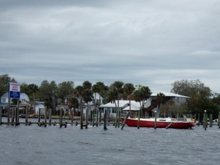
We cruised the 20 miles east until we rejoined the ICW route, turning south down Adams Creek.  Here we cruised past homes that were snuggled amongst the trees offering us beautiful scenery.  Occasionally we came across another small fishing boat, but mostly it was peaceful and quiet.

Adams Creek homes on NC ICW

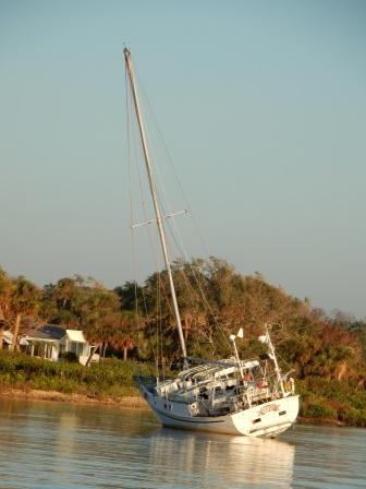
About half way up the creek we came to Jarrett’s Bay Boatworks and took on some fuel; a fill-up that should get us to South Carolina and then some.

At Jarrett Bay Boatworks

Within 20 minutes we were back on the water and headed south towards the Beaufort, NC area where we had reservations for the night.  We were making good time and the windy weather was staying to the southeast of us, so we decided to bypass Beaufort and continue on as far as we could as we had several issues that we were going to encounter further south.

The first was getting through Camp Lejeune, as they have planned “live fire” exercises and the ICW was only scheduled to be opened from 1:00 pm to 2:00 pm.  This had to be coordinated with the Onslow Swing Bridge which only opens on the hour and half hour. We also had to get through the Surf City Swing Bridge some 20 miles further south that only opens on the hour (and it will take about 1 hour to get to it). Adding to this was our concerned about getting past Myrtle Beach by Friday 10/27 as the ICW was closing due to new bridge construction and this could really delay our return home by 11/4.  And then there were all those other boats heading south, all using the ICW because the weather did not warrant going off-shore from Morehead City as we would have liked.

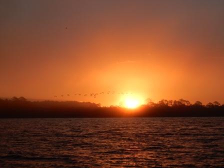
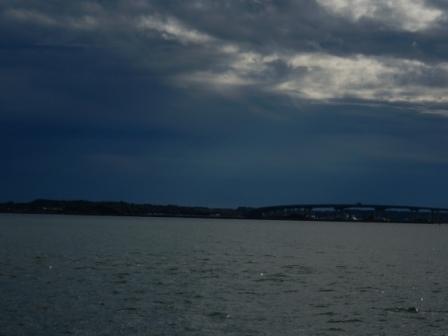
So, we pressed on, cancelling our reservation at the Beaufort, NC marina and thankful that all the bad weather stayed behind us in Morehead City. It looked like it would be a nice day in the ICW, but not offshore.

Storms on the Atlantic North of Beaufort NC and Morehead City

We cruised through the tedious parts of Bogue Sound having to slow down for the numerous fishing boats along the way. Then we made our way through Swansboro, where we had purchased shrimp in 2015 when we came through on our Great Loop adventure.

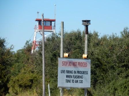
Around 12:15 we arrived at the North Range at Camp Lejeune thinking that we were in clear as the tower had no red flags and signs did not show warning lights.

North range firing signal

However, we arrived at the Onslow Bridge at 12:25 thinking they would open at 12:30 and we would cruise through.  We didn’t realize the live-fire exercises were taking place off shore and the south range was the part closed. Therefore, we had to wait on the 1:00 opening of the Onslow Bridge, along with the 15 or so boats in front of us and a barge, all motoring in place.  Once again we had flashbacks to our looping days on the western rivers waiting 4 hours for the locks.

Boats queued for the Onslow Bridge

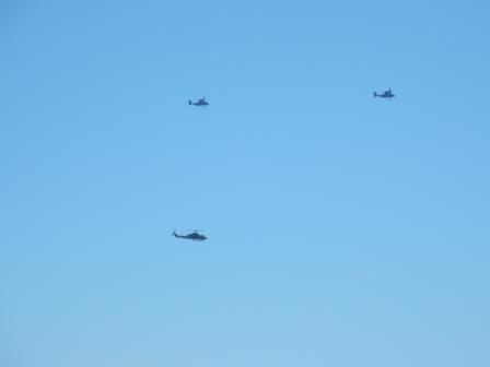
At least while we were waiting we got to watch the Osprey and Blackhawk helicopters in action as they buzzed around us.

Helos used in practice

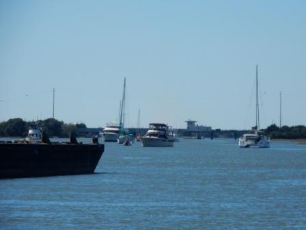
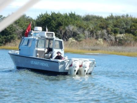
Finally at 1:00 the bridge opened and the first boats cruised through.  Next came the barge, and then us and the 10 or so boats that had now queued up behind us.  Once through the bridge we saw the soldiers on their “lunch break” on the western shore and the Navy Patrol Boat making sure we all kept to the required boundaries.

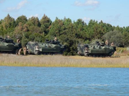
Targets used at firing range

Troops on break from firing practice

Boats behind us at the Onslow Bridge

Navy Patrol – keeping us all out of firing range

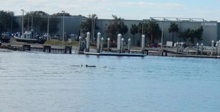
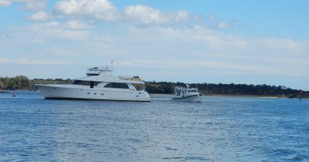
We were able to pass a few of the slower boats and finally make some headway.  However, when we came to Snead’s Ferry there is an area where there is significant shoaling on the ICW caused by the currents from the New River Inlet.  Here we watched a yacht run aground. We were able to take the deeper channel (thank you ActiveCaptain® community) and cruise past them and another boat without incident.  Once through this area we were treated to a few dolphins who danced around the waves created by our wake.

Yacht running aground near New River Inlet and Sneads Ferry

Dolphins in water near New River Inlet

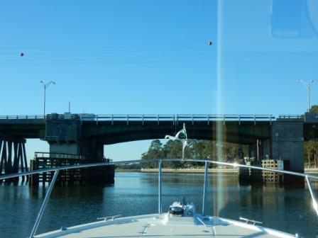
We continued south now moving as fast as we could in order to make the 2:00 pm opening of the Surf City Swing Bridge.  We were hoping we might be able to get under this bridge (published height of 12’) if the tide was low. But it was just too close to chance it and once through we were glad we waited as the high water level made it too low a clearance for our 14 feet.

Surf City Swing Bridge

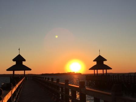
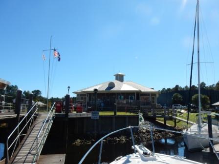
Now there was nothing stopping us from continuing on to Southport except daylight. We had called ahead to make sure they had space at Southport Marina, which they did.  We still had a long way to go, but it looked like we were going to be able to make it before the sun kissed the horizon.

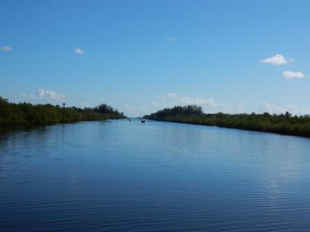
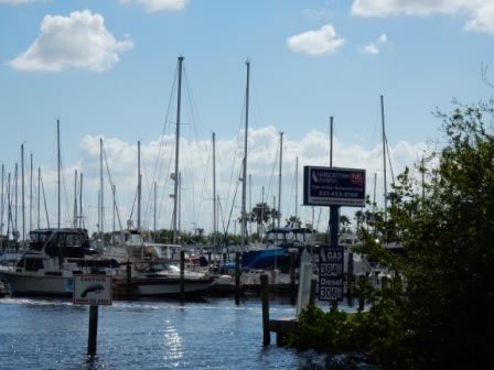
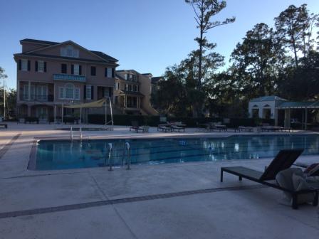
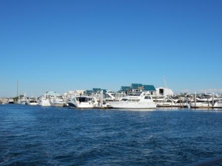
After Surf City we cruised through Topsail and Wrightsville Beaches; places you should never transit on the weekend as it is just too crazy.  Here is what this area looks like on a calm day:

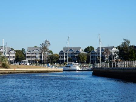
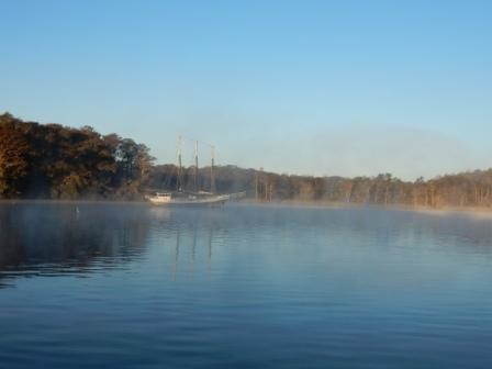
Wrightsville Beach Marina – lots of boats in this area

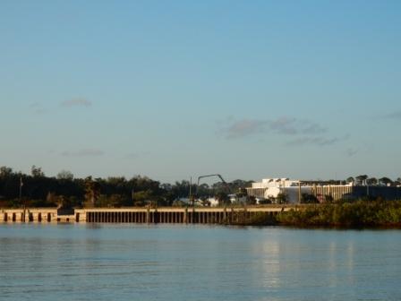
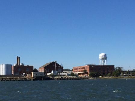
We then cruised southwest through Snow’s Cut (a passage that takes you further inland) and into the Cape Fear River.  We called the marina to let them know we would be there late, and they confirmed someone would be there until 6 pm; our planned arrival time.   Next we passed Sunny Point Military Ocean Terminal to our west, and Fort Fisher to our east.  All of this vast land is military and a restricted zone until you come into the Southport area.

At Sunny Point Military Ocean Terminal

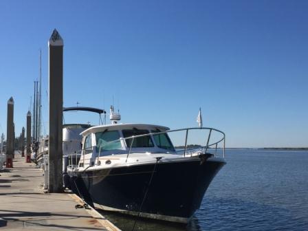
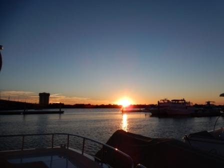
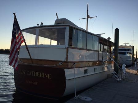
We arrived at Southport Marina and were instructed to tie to the inside fuel dock slip. As we approached the entrance to the marina and the fuel dock we noticed the boat on the outside was none other than “Lady Catherine”; our favorite Trumpy yacht.  Mark navigated the boat into a starboard side-tie and in front of another boat, while Denise got the dock lines tied off with the assistance of the marina dockmaster.  It was 5:45 pm and we had traveled 129 very tedious nautical miles and we were exhausted.

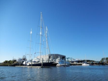
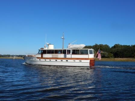
We had an opportunity to speak first with Catherine on “Lady Catherine”, and eventually her husband Captain Richard. We talked with them about our previous encounters at Pine Island (FL) and then on the Chesapeake Bay.  We discussed our mutual adventures over the summer and their plans for wintering in FL West Coast. They could not talk long as they had chartered guests aboard and had to take care of them.  Denise loves this boat and is intrigued with the eloquence of its design and beautiful lines. You can learn more about chartering with “Lady Catherine” here.

Catherine of “Lady Catherine”

Lady Catherine

By the time we settled the boat and checked in at the marina it was just after 6:00 pm.  We were hungry and had contemplated going to dinner at Mr. P’s Bistro, a place we tried to get into in the spring but the wait was way too long.  However, we were so tired we opted for a quick meal on the boat and by 8:30 Mark had climbed into bed where he slept soundly for 8 hours.

We were happy to be nearly done with North Carolina and this part of the ICW. It is a pretty area, but full of challenges and most of the time you are heading west – which can be frustrating when you want to head east.  However, we liked the town of Southport and were happy we made it the entire way here today.

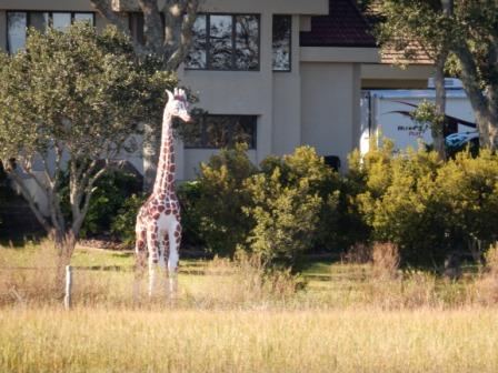
Here are some other pictures of crazy things we saw along the North Carolina ICW:

What about Women?

Swan Statue at ICW house – Topsail Beach

Statue we have seen 3 times now – House on ICW Topsail Beach

Giraffe Statue at ICW house – Topsail Beach

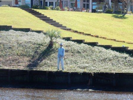
Fake palm on ICW sandbar – near Wrightsville Beach